I woke up just before 8 AM, had a quick shower, then started making breakfast for everyone. We had decided to cook at the AirBnB because the town of Arnarstapi didn’t really have any restaurants or grocery stores to get supplies at, so we had stocked up the night before. I made scrambled eggs and toast, while some of us also had little yogurt cups we’d picked up in Grundarfjörður. We ate, cleaned up, packed up the car, and were on the road a bit earlier than planned, 9:45 AM. We were going to be touring the western region today, and most of the sites were fairly close together so there would be less driving than yesterday.
Our first stop was actually in Arnarstapi so we didn’t go very far. There was a small stone structure built on a mound by the ocean that we quickly visited, however the far more impressive sight was a full rainbow that appeared over the hill beside the town. We didn’t stay long before getting into the car and continuing on.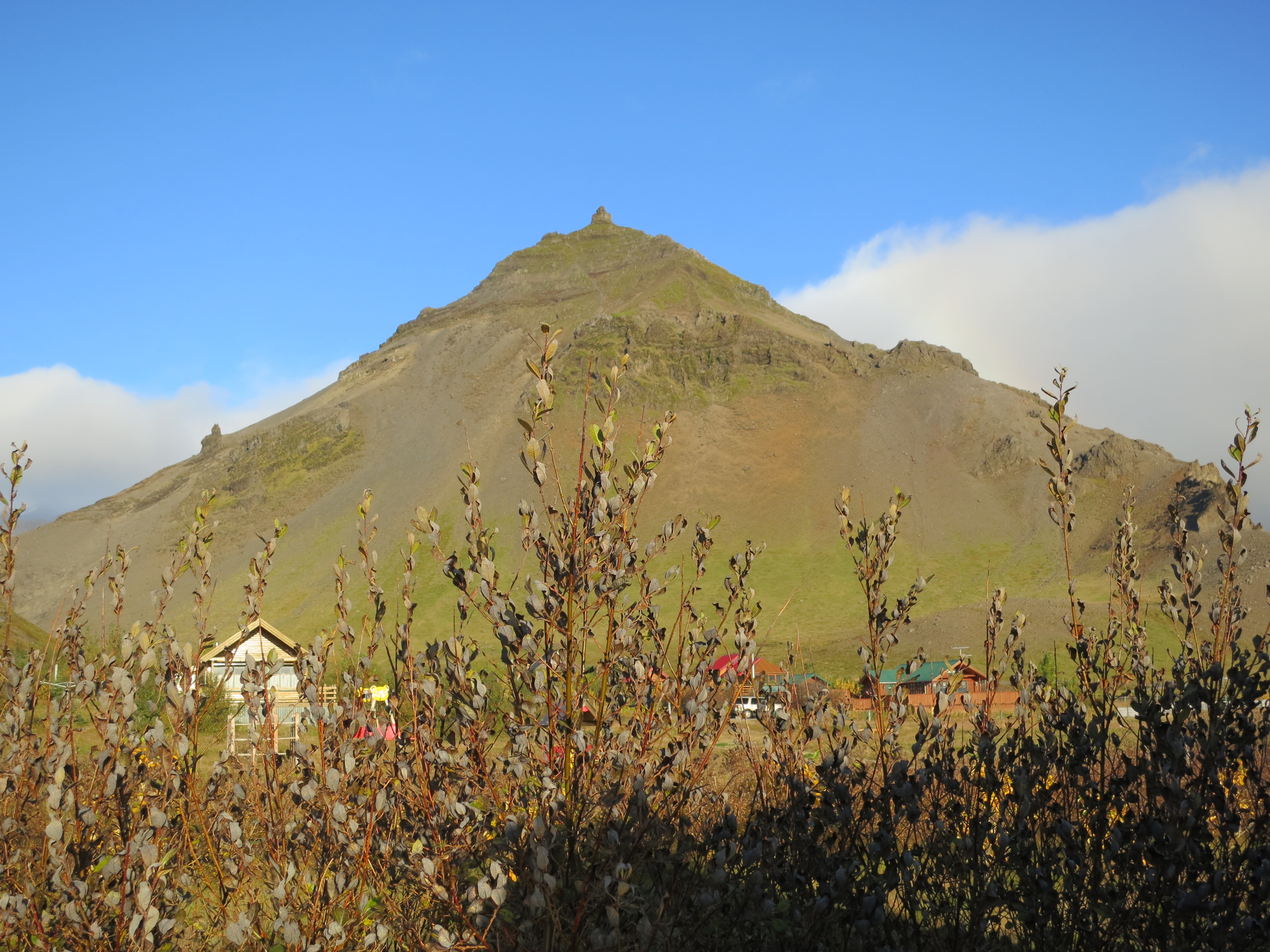
The view from our AirBnB
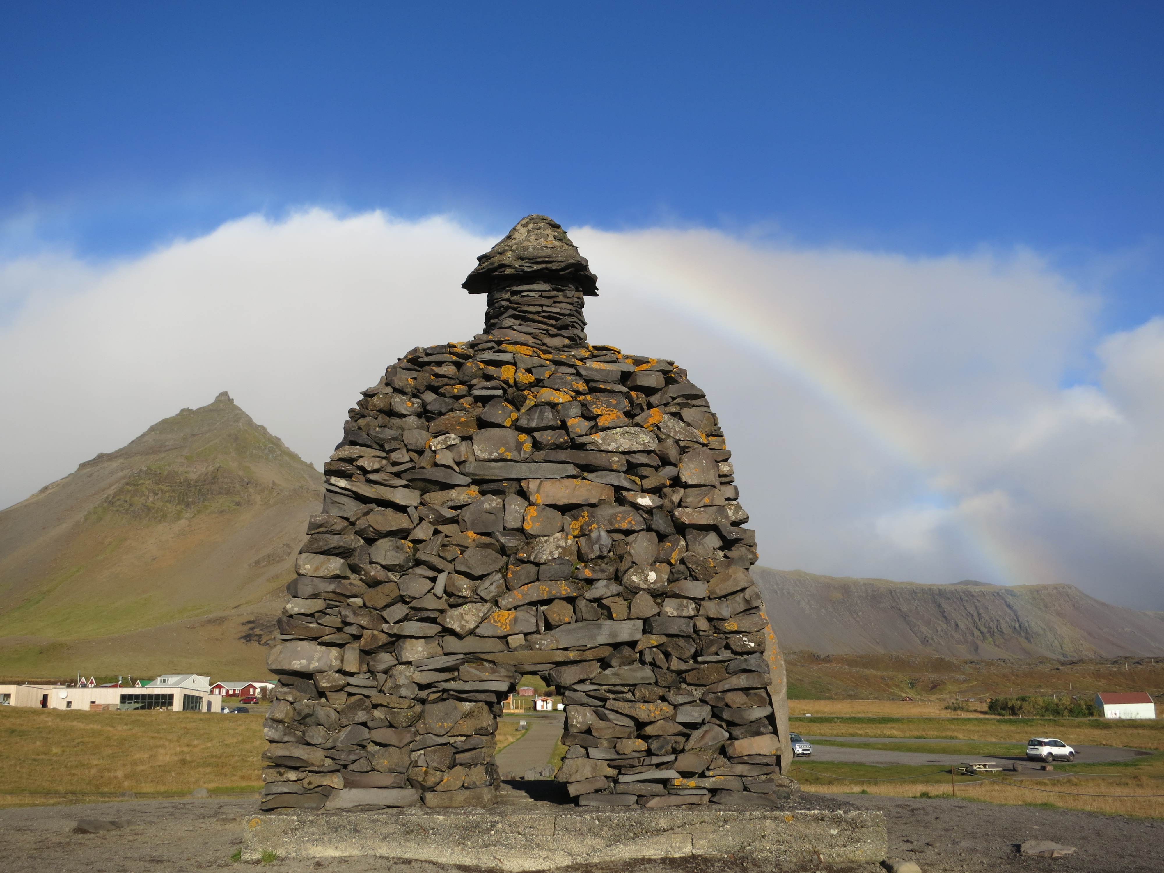
The stone structure in Arnarstapi
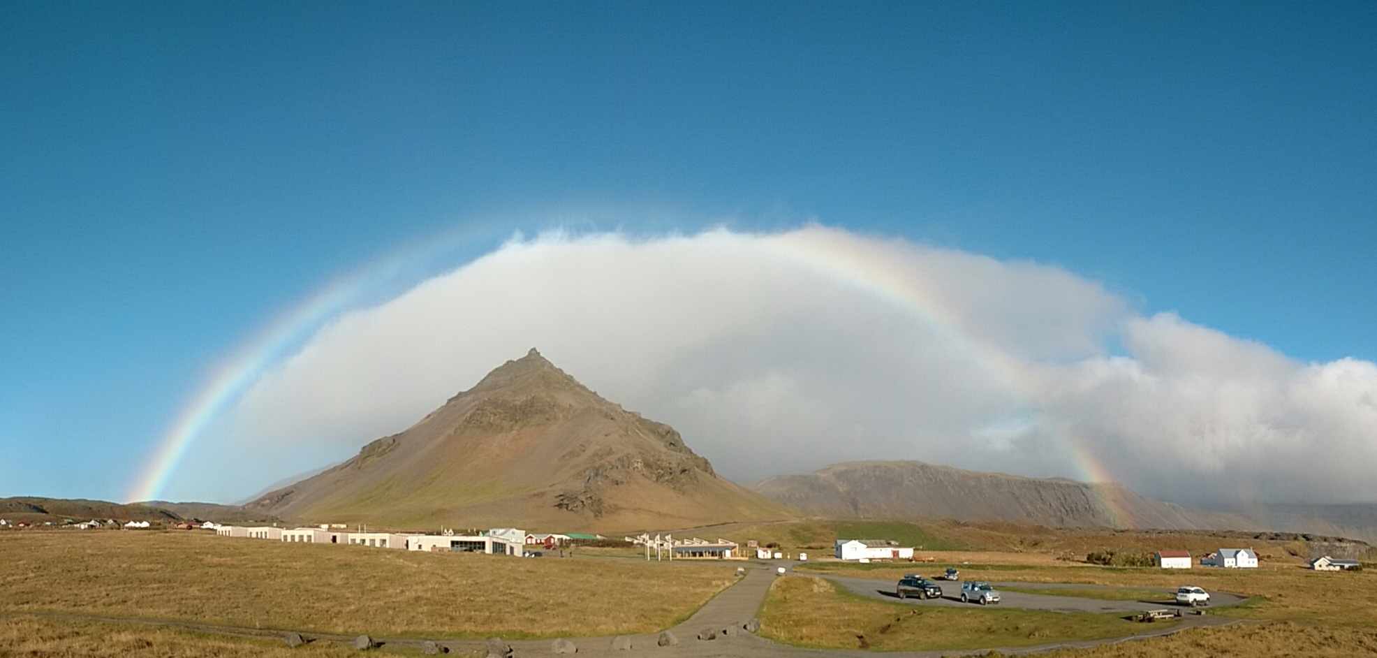
A full rainbow (required panorama mode to capture)
Our next stop was actually a recommendation from our AirBnB host, the Rauðfeldsgjá Gorge. It was only a 5 minute drive from Arnarstapi, and once we arrived we started the short hike up from the parking lot to the gorge. The gorge itself was super interesting; the entrance-way is a narrow river with high rock walls on either side, after getting through it opens up into a small atrium-like space. Here we took some photos. I continued hiking up the river a bit, being careful not to get too wet, but after 30 m or so the river narrowed so I returned back to the start. We then returned to the car.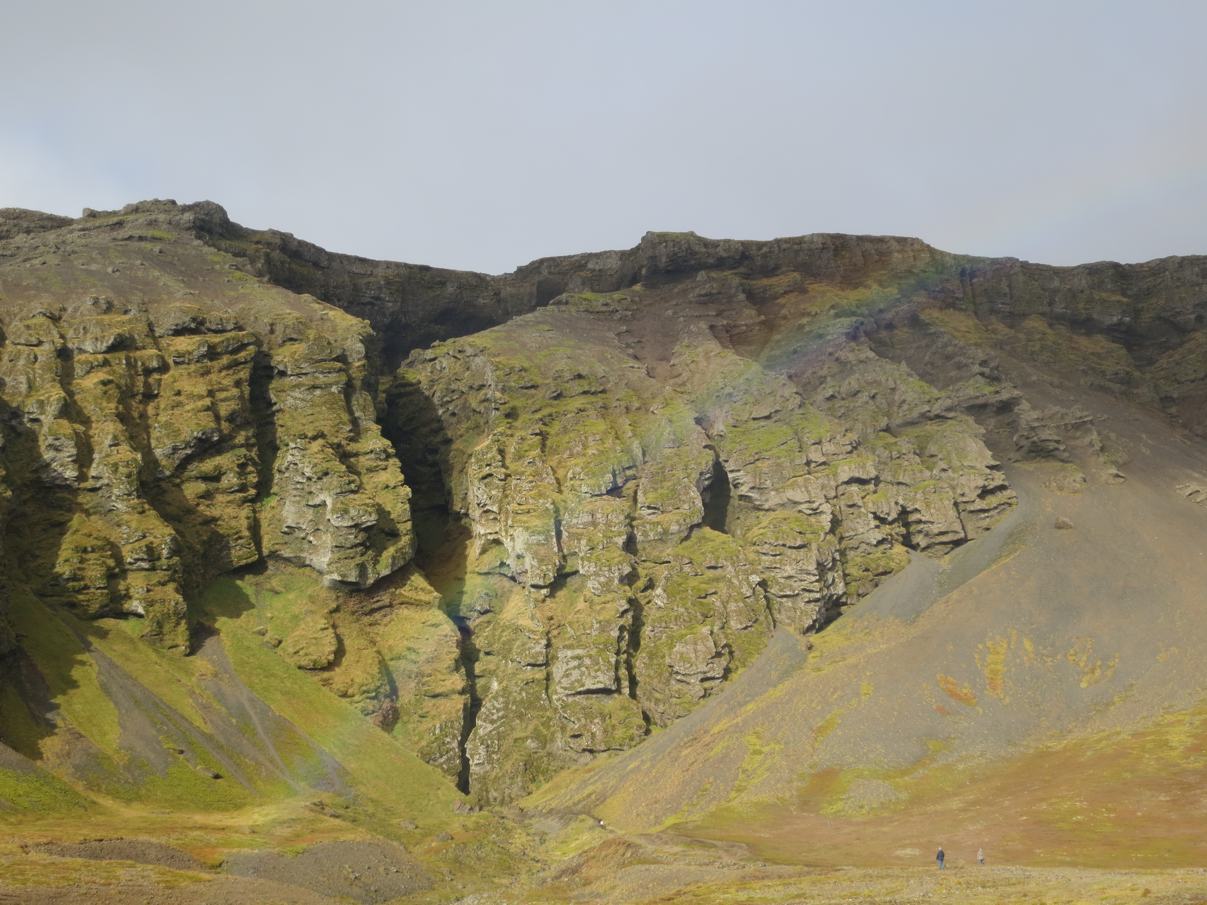
A rainbow with the Rauðfeldsgjá gorge in the background
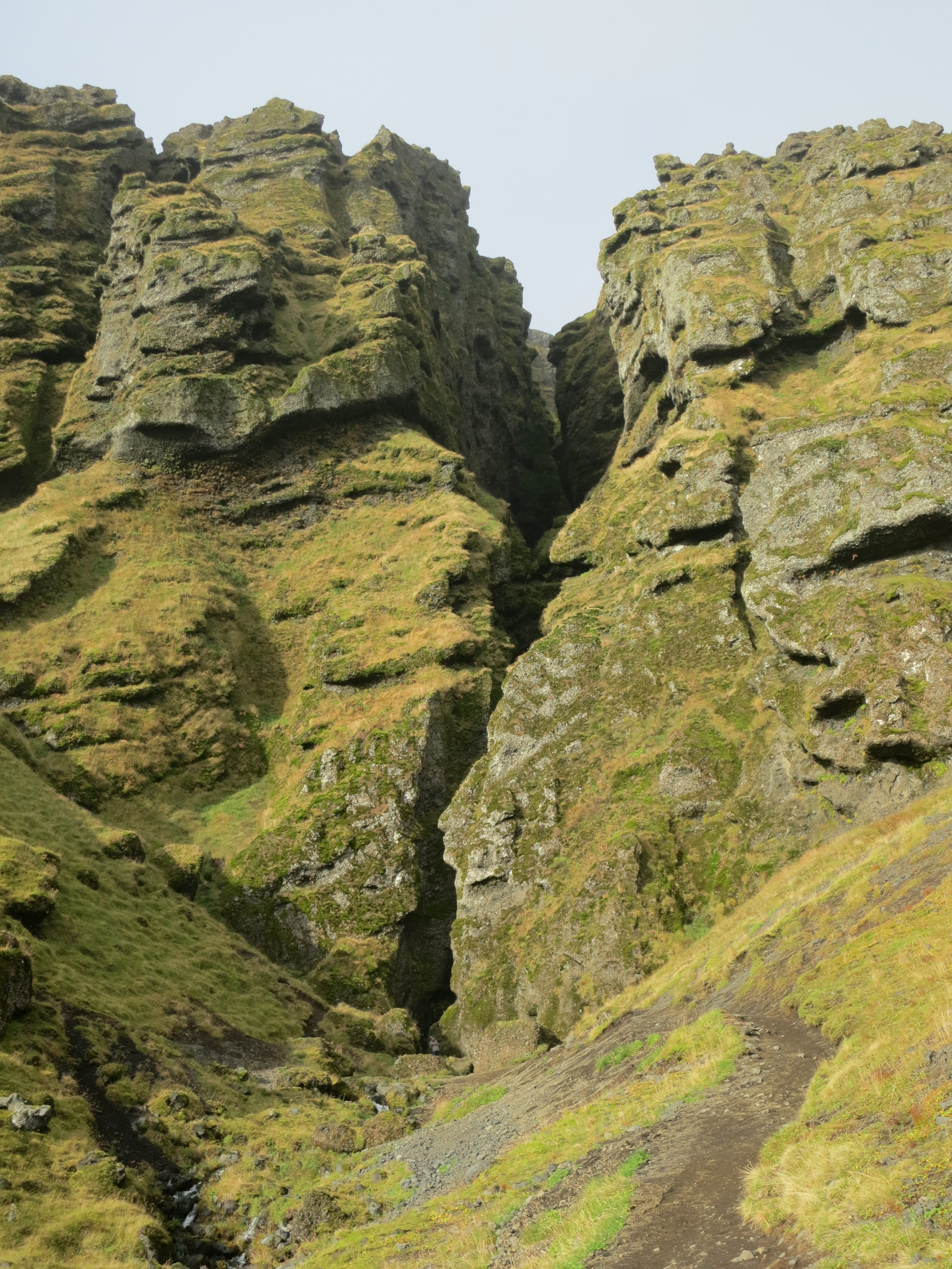
The Rauðfeldsgjá gorge
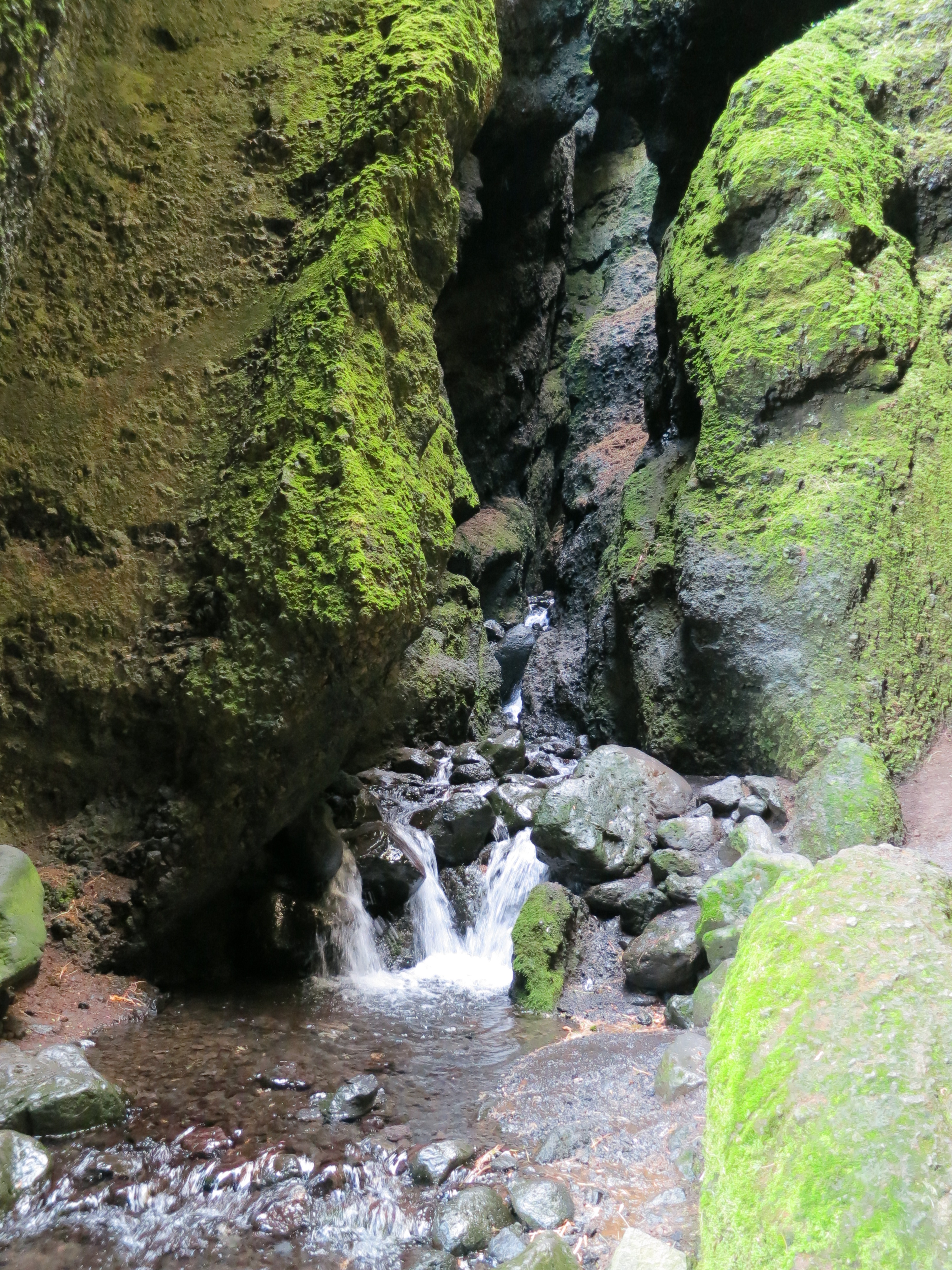
The river in the atrium
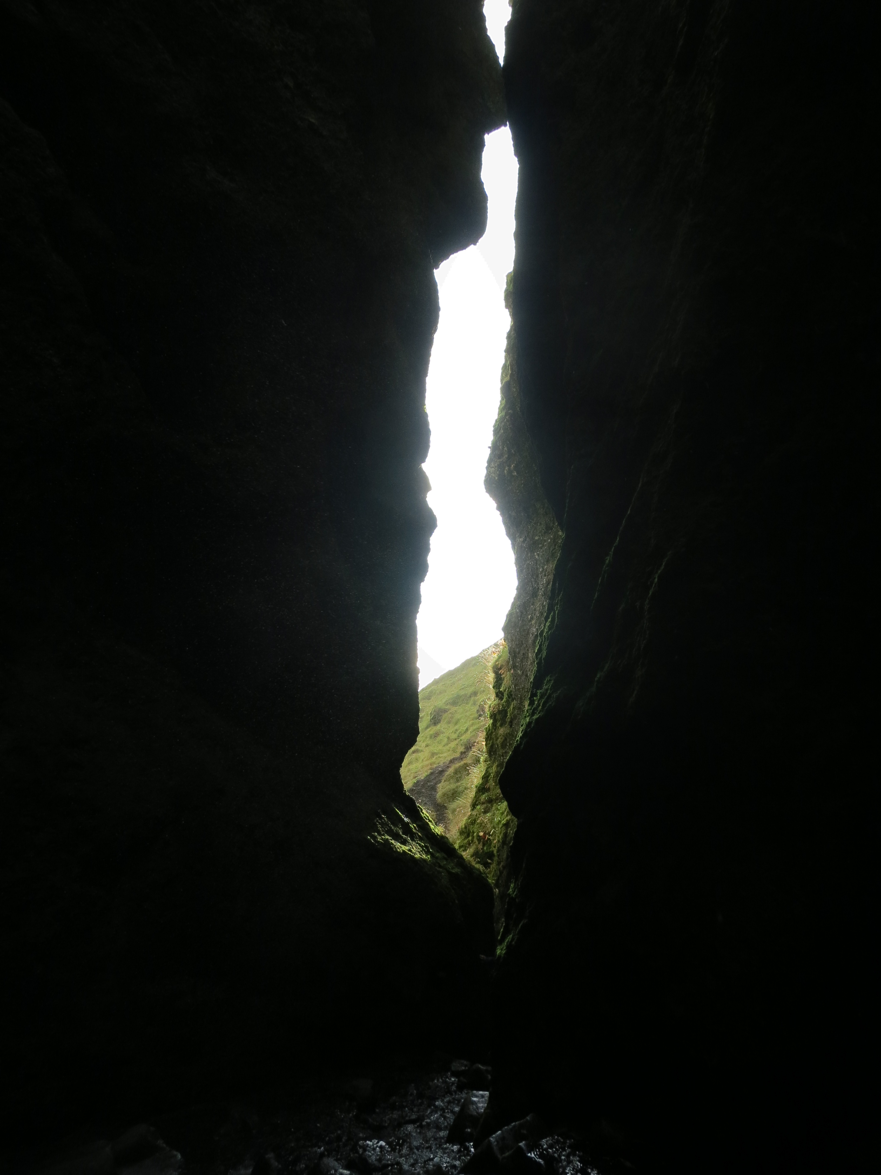
Looking back towards the gorge entrance
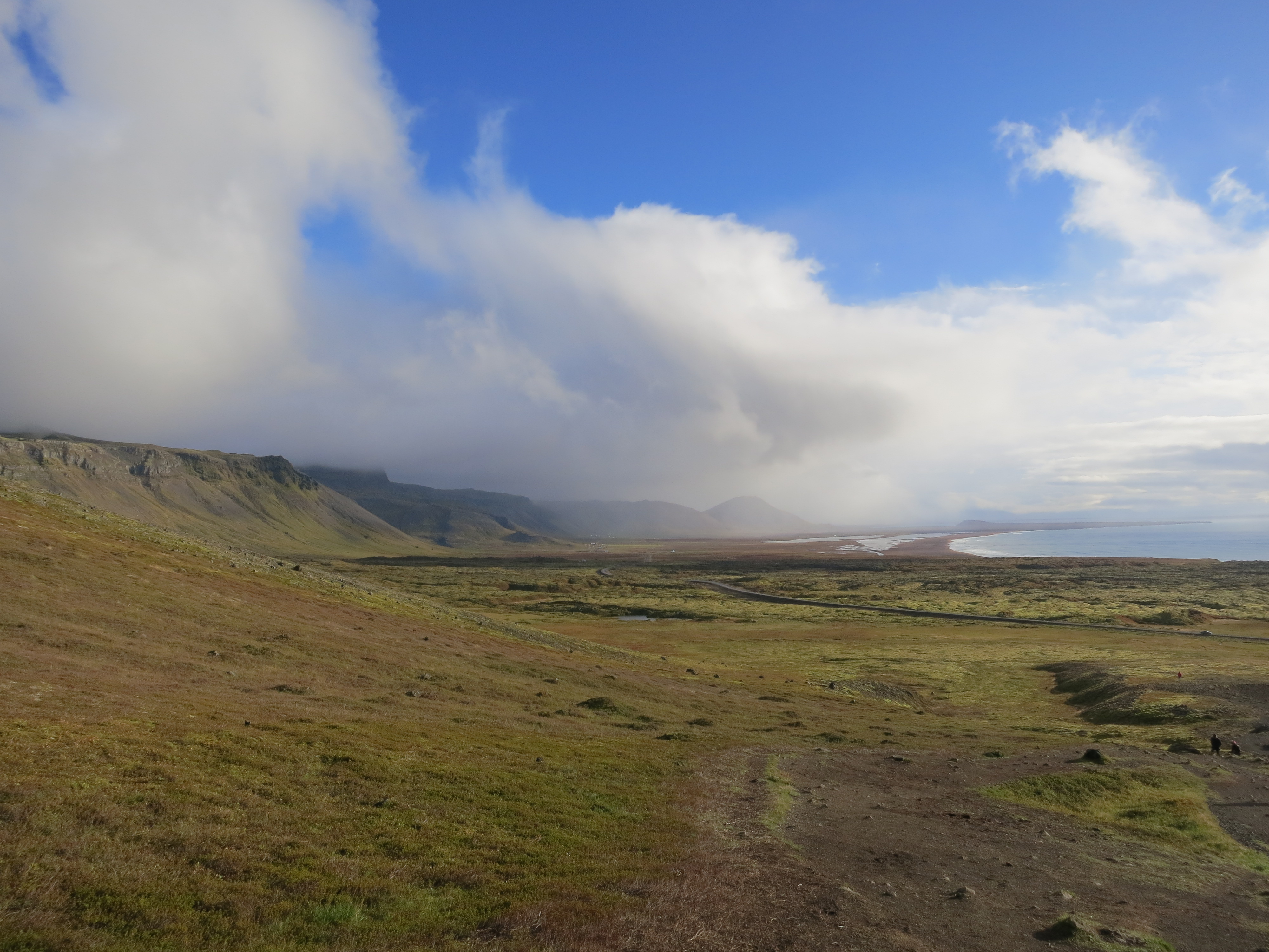
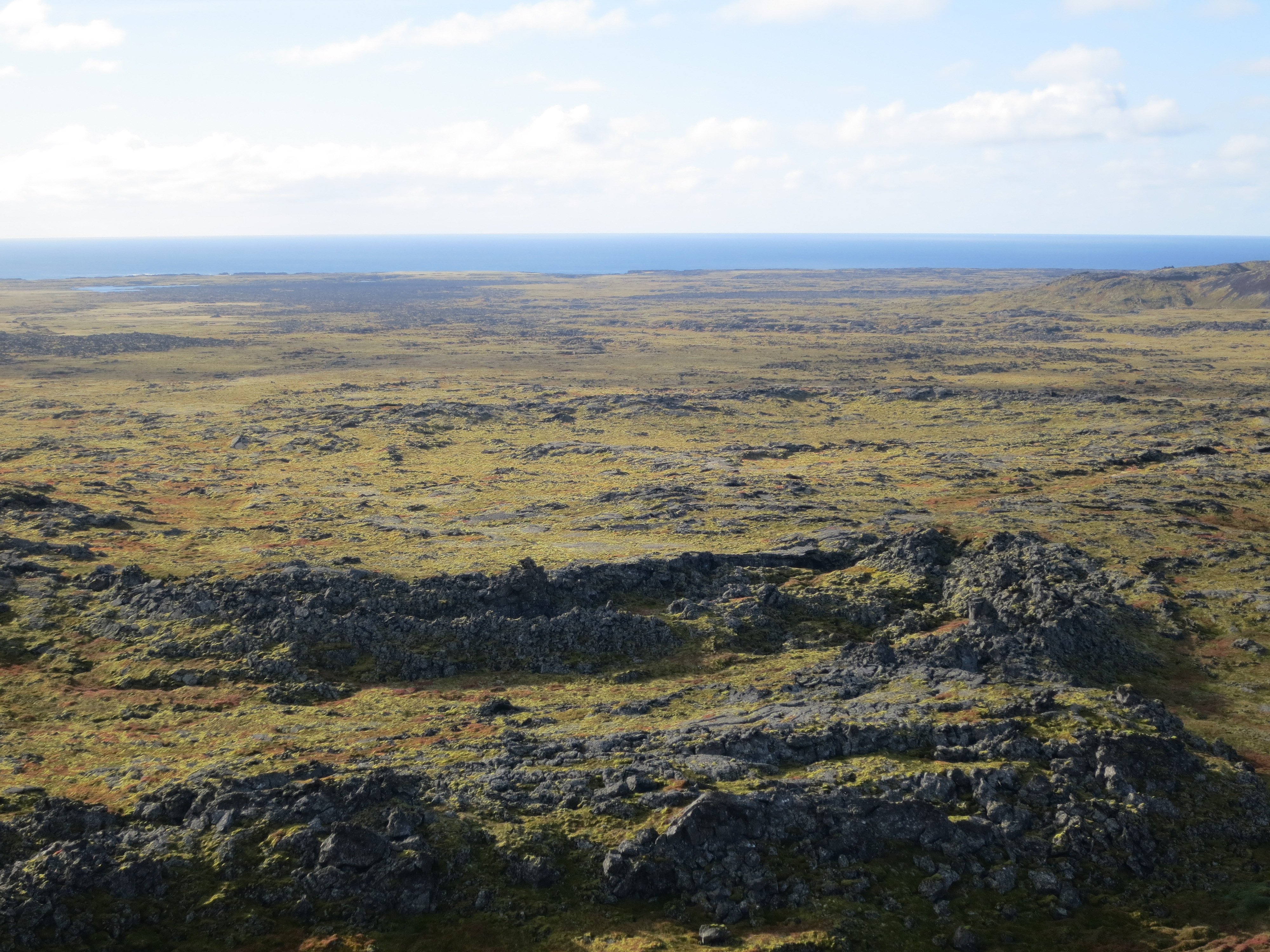
The western coast of Iceland
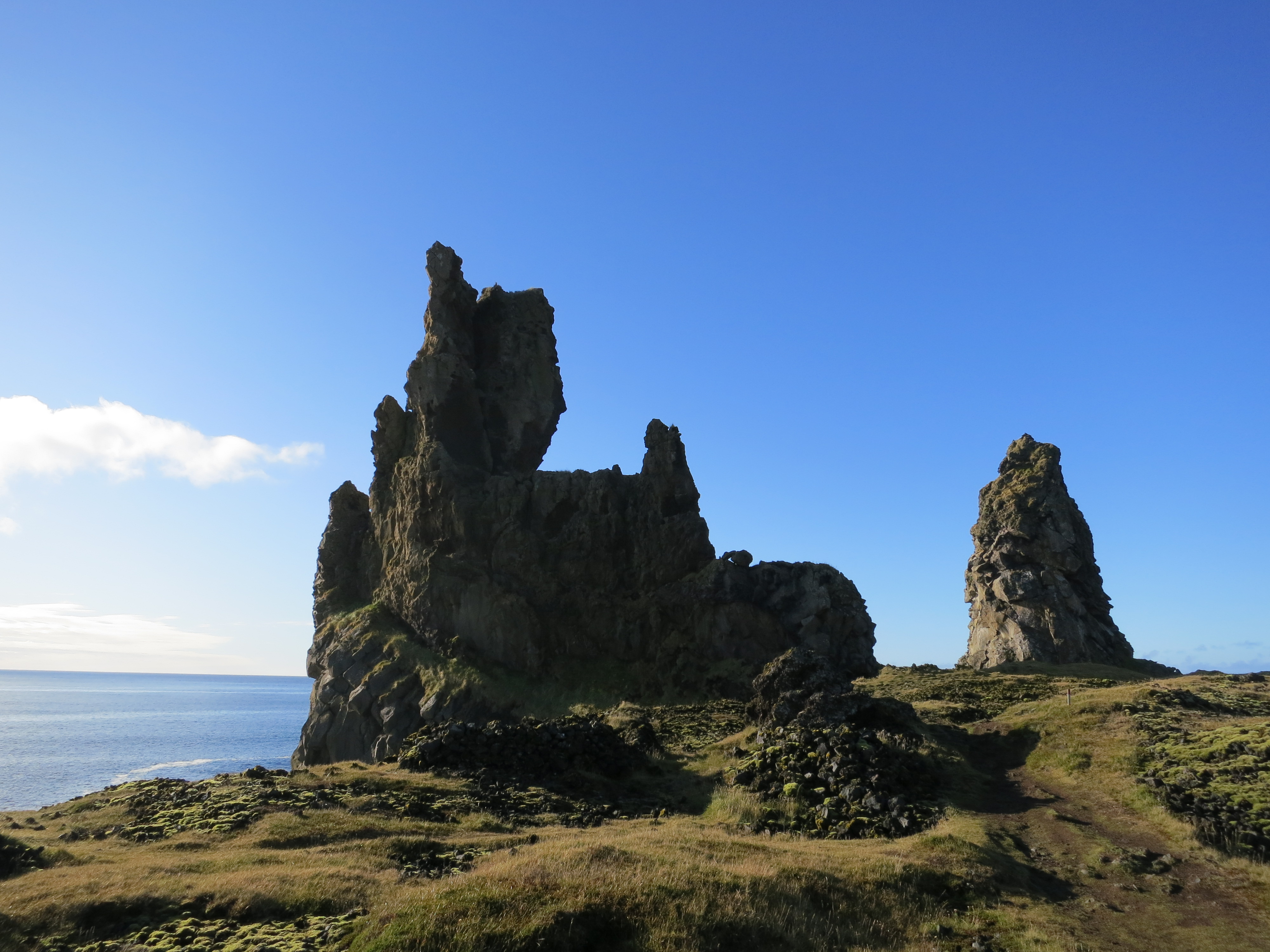
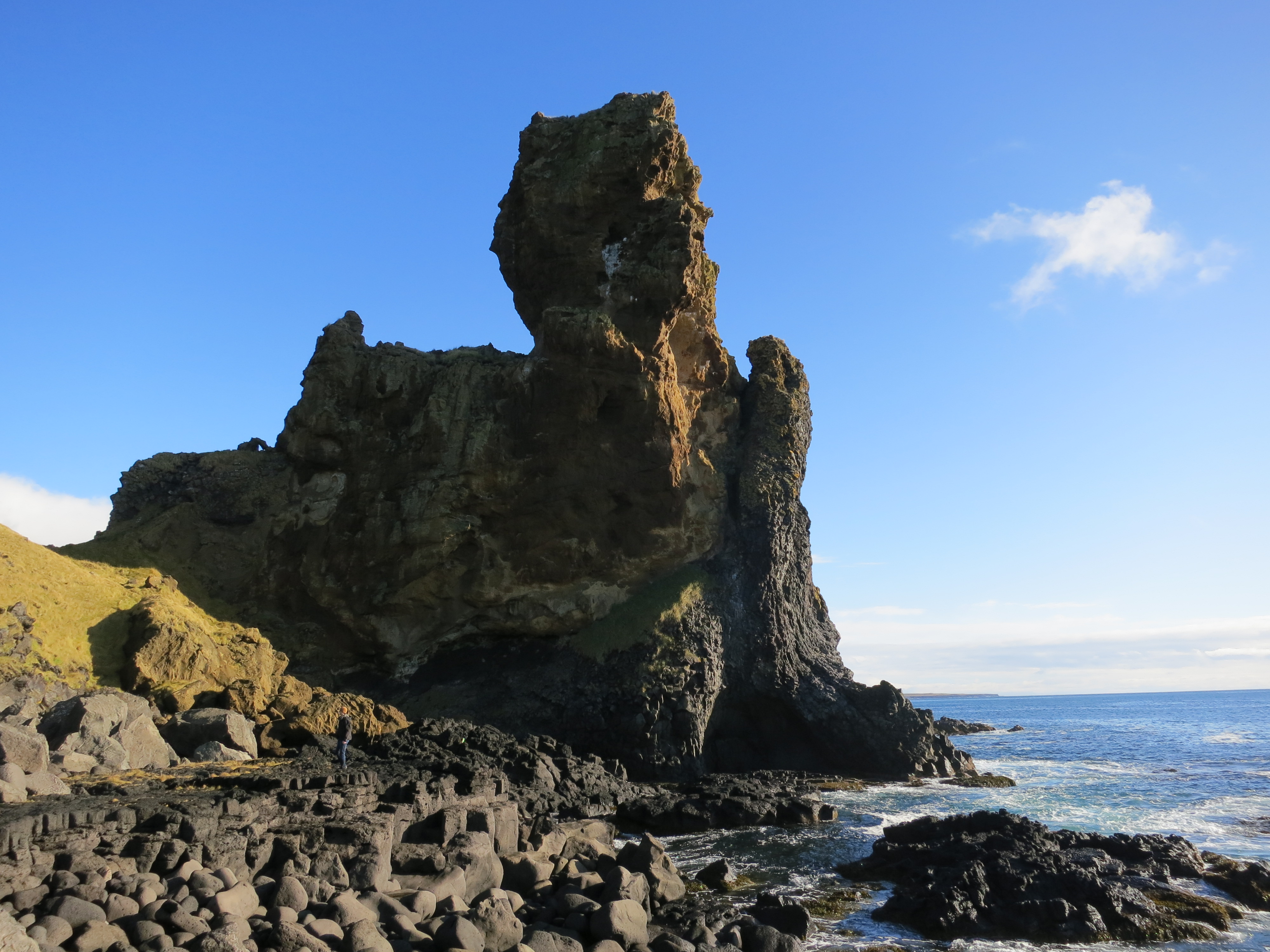
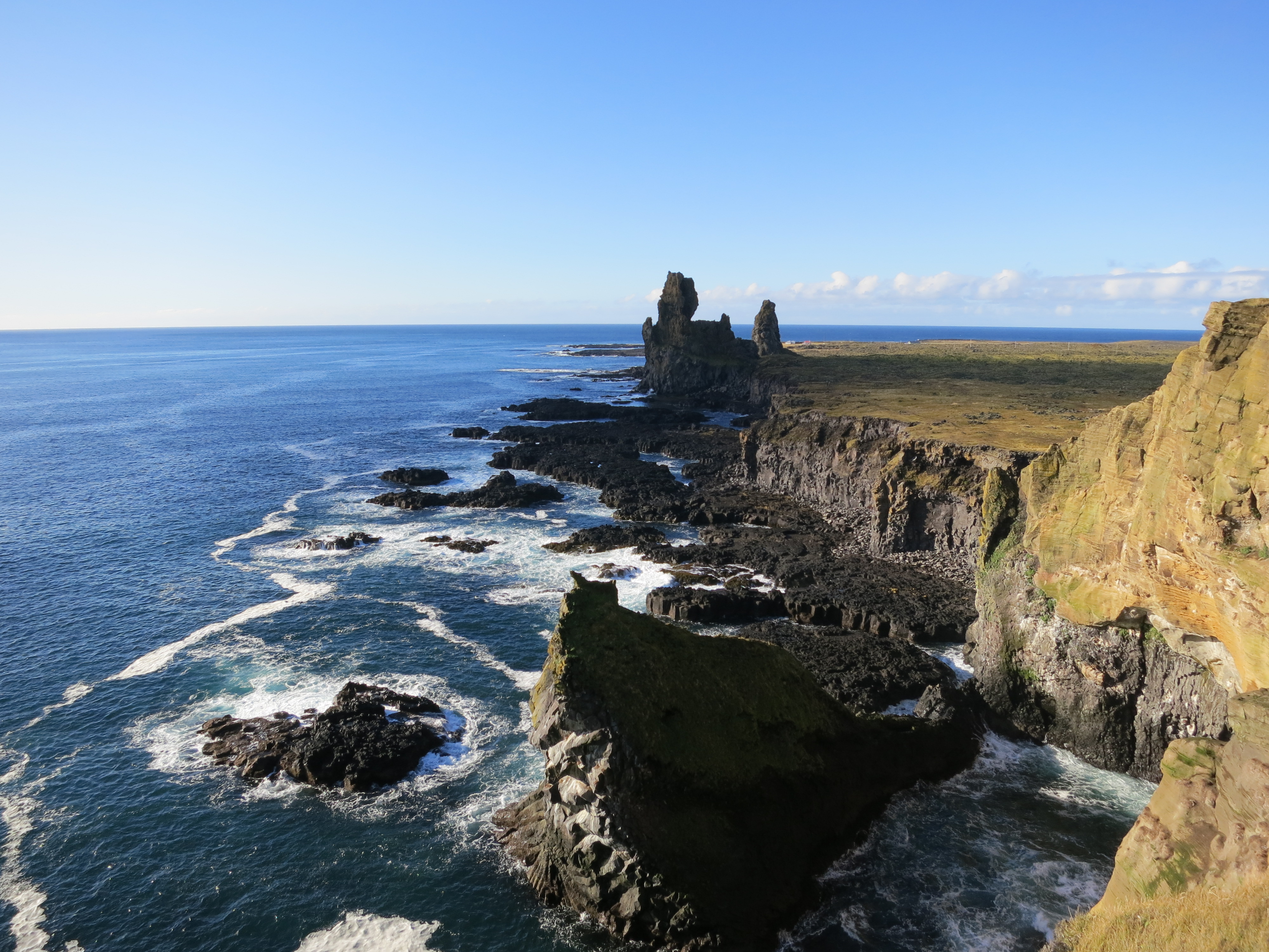
We started driving north along the coast of the peninsula, and arrived our the next stop, Lóndrangar. After getting out of the car, we could clearly see a pair of rock pinnacles rising out of the cliffs facing the ocean. We walked for about 15 minutes, down a staircase embedded into the side of a hill, in order to reach the base of the first tower. We took some photos, then scrambled down the cliff to reach the beach and took some more photos. We hiked back to the parking lot, and then out to a viewpoint located on the cliffs of the ocean, to get a different perspective on the coast, before returning to the car and continuing on.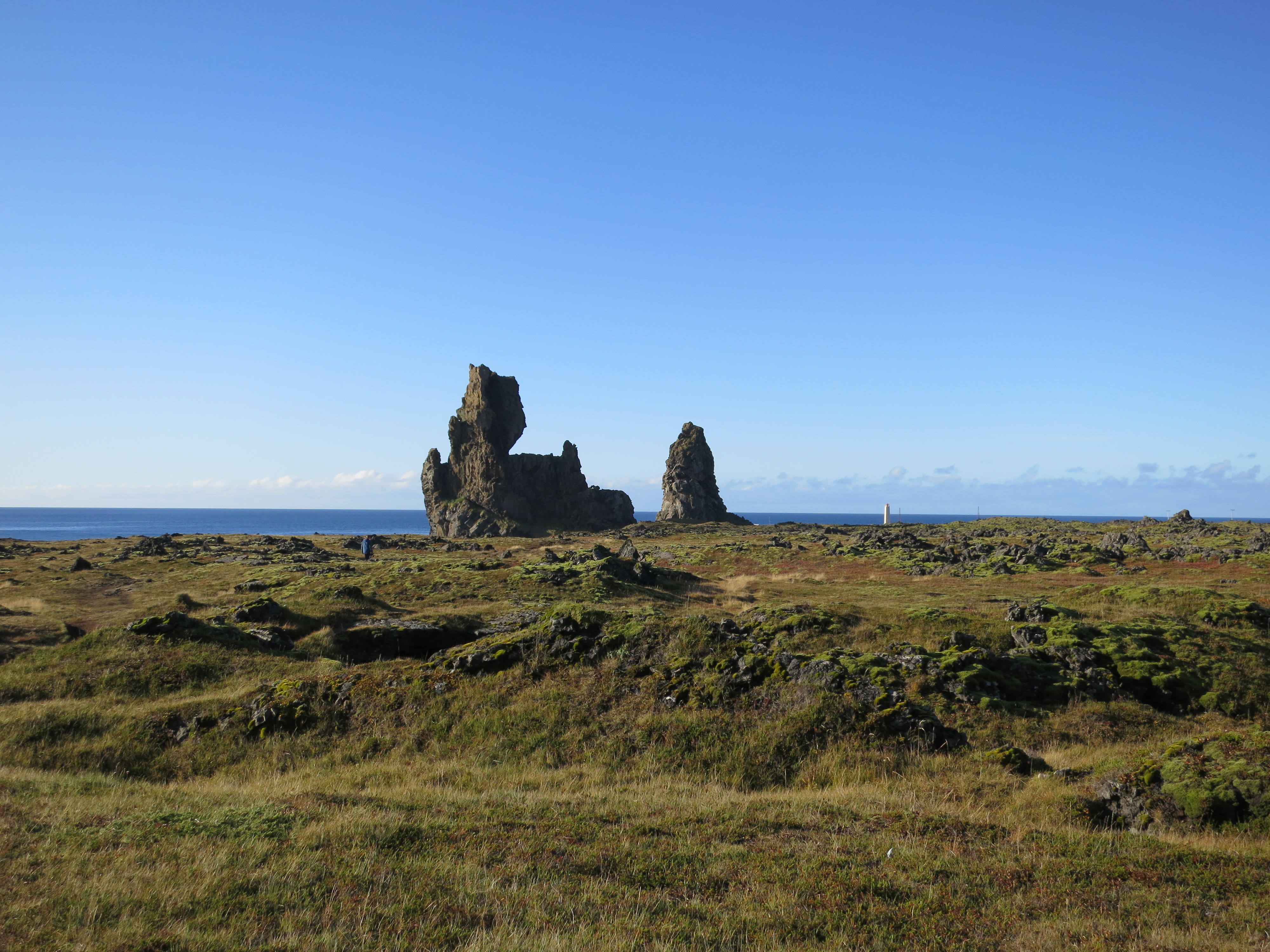
The volcanic towers of Lóndrangar
Lóndrangar
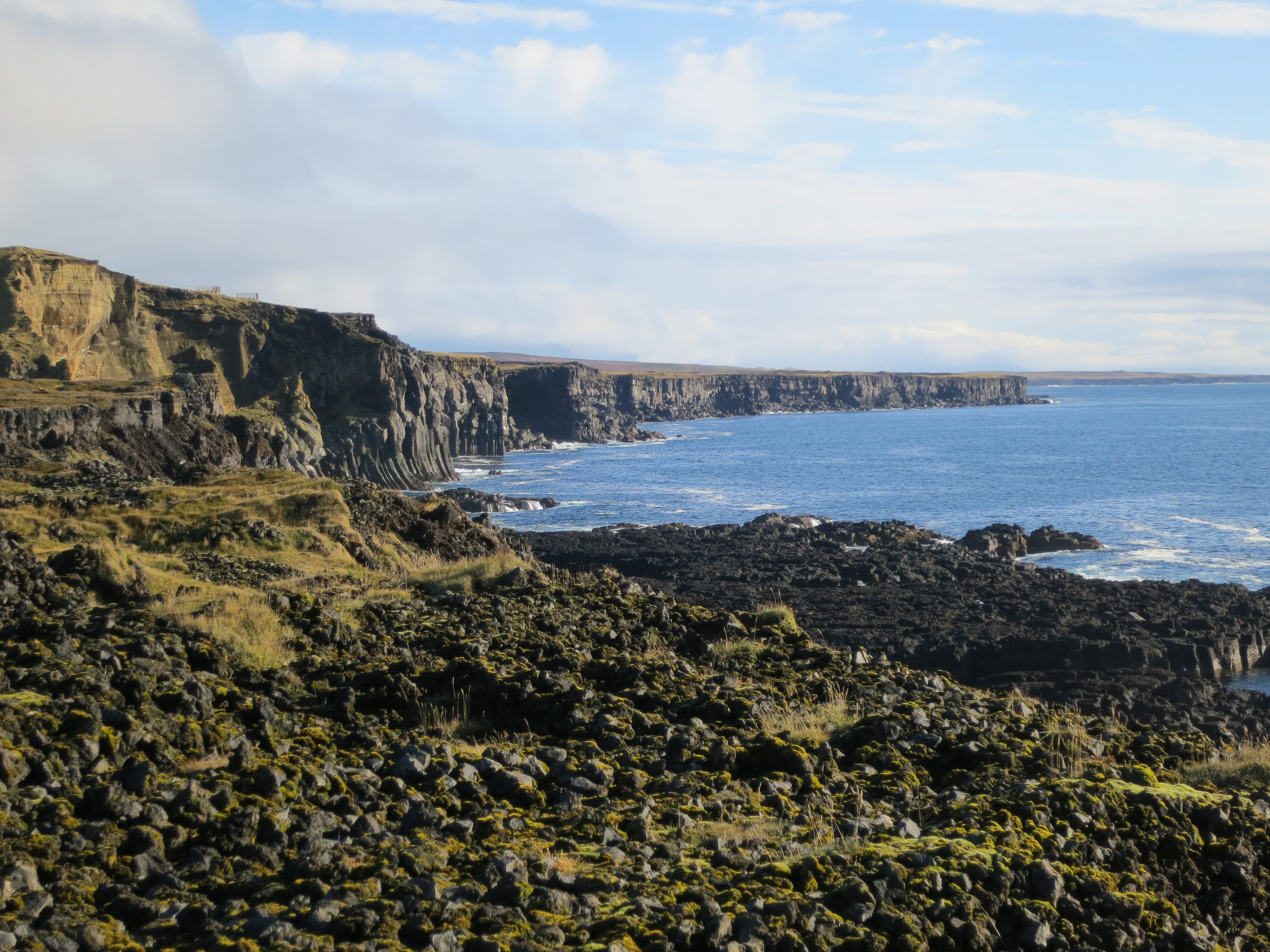
The Icelandic coast
Lóndrangar
The ocean meets the shore
Looking back at Snæfellsjökull
The path we took to get to Lóndrangar, visible as a narrow path at the far left
Lóndrangar from a different angle
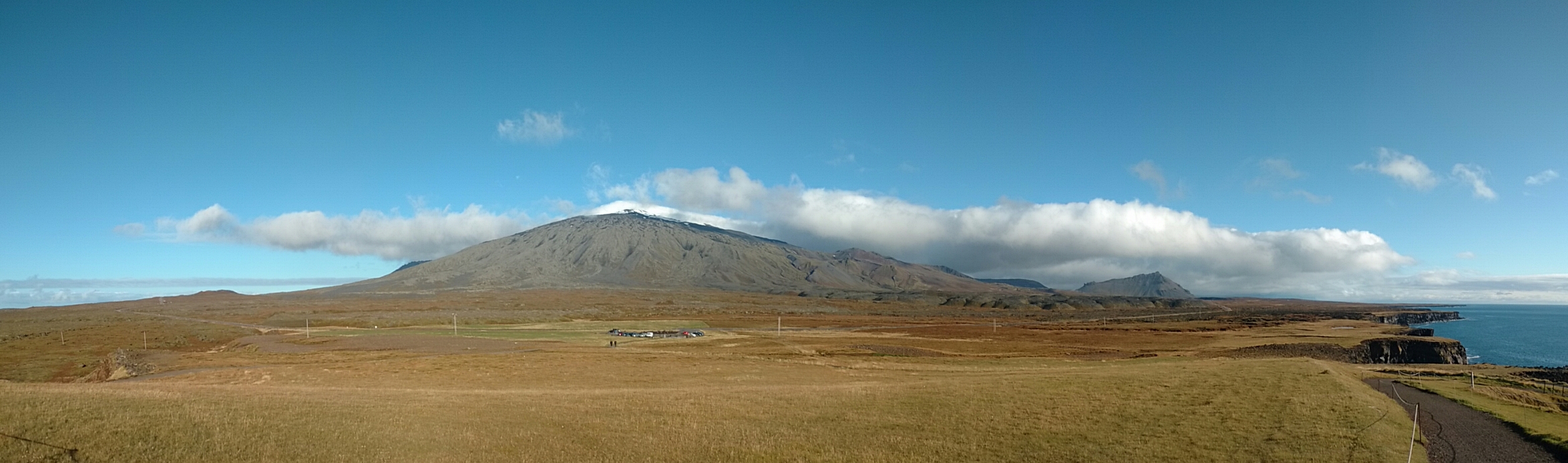
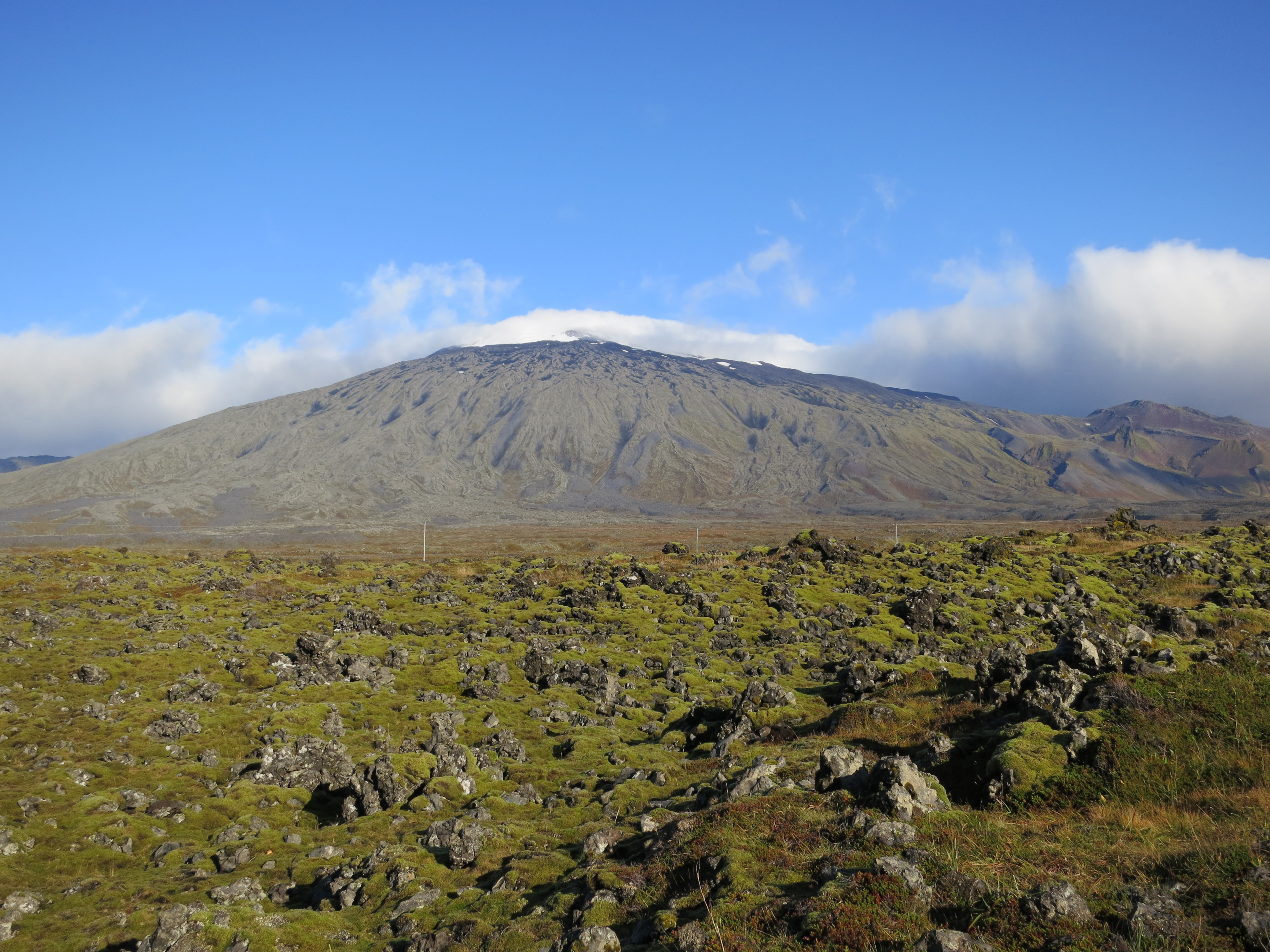
A panorama view of Snæfellsjökull
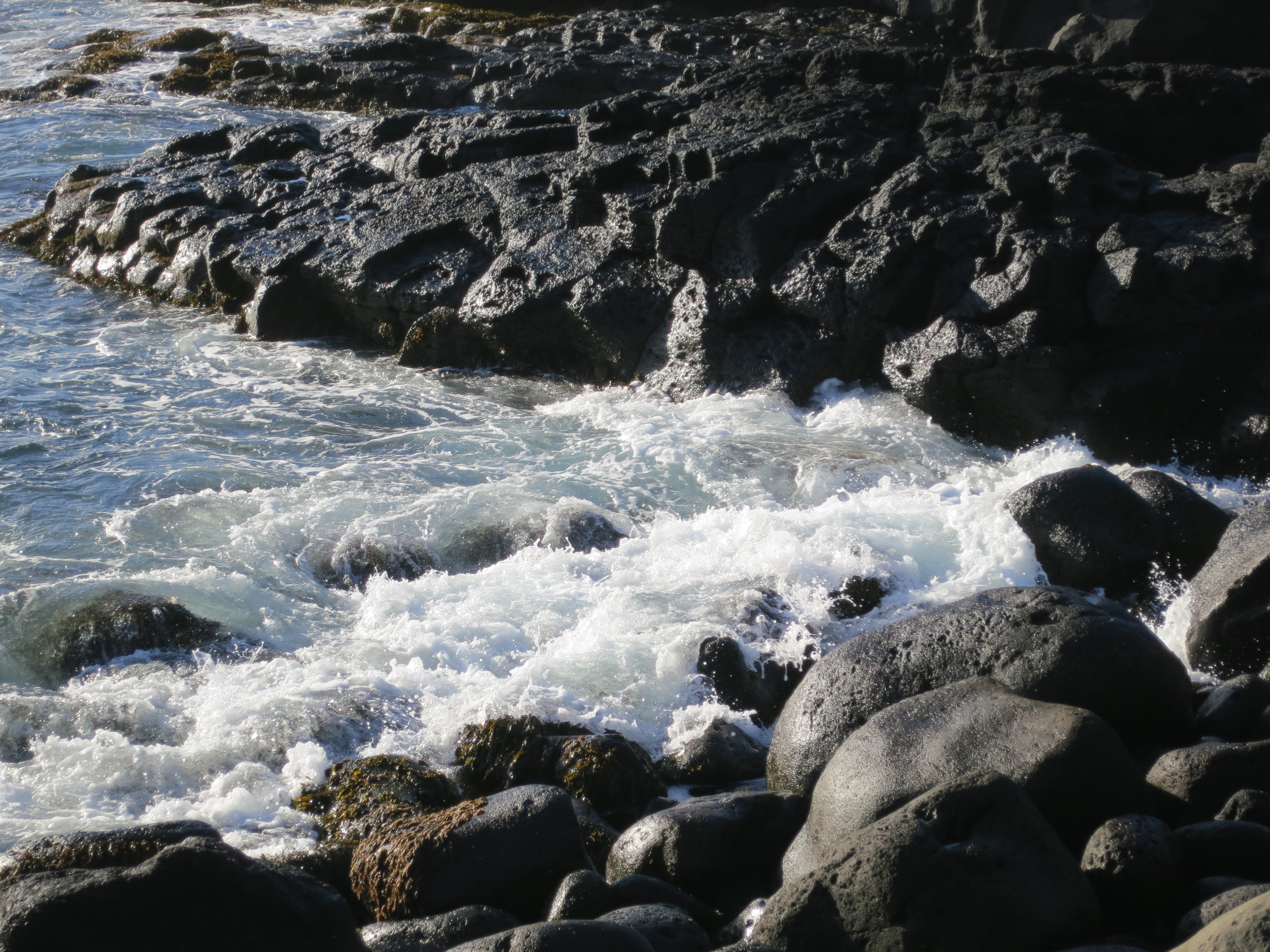
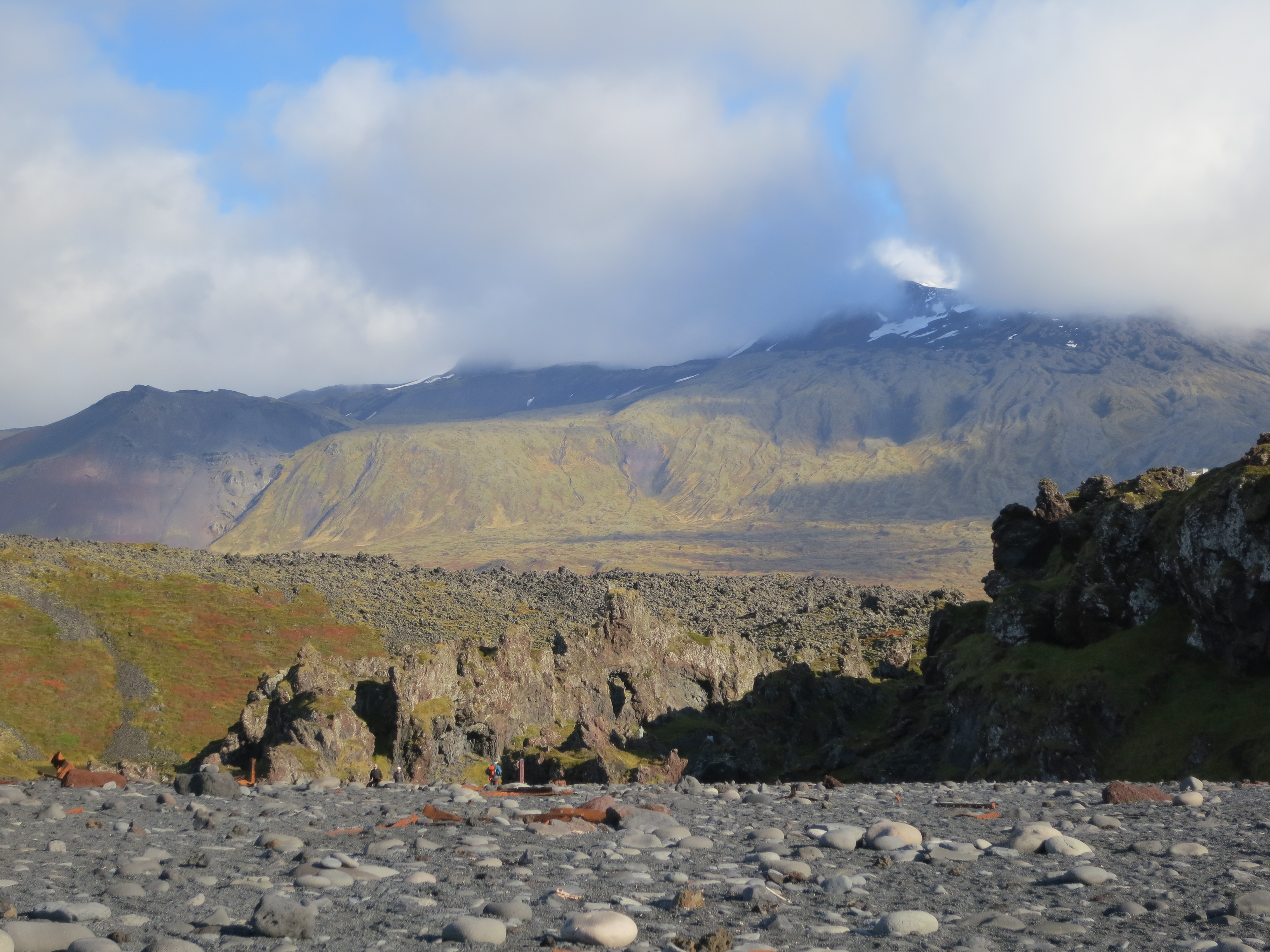
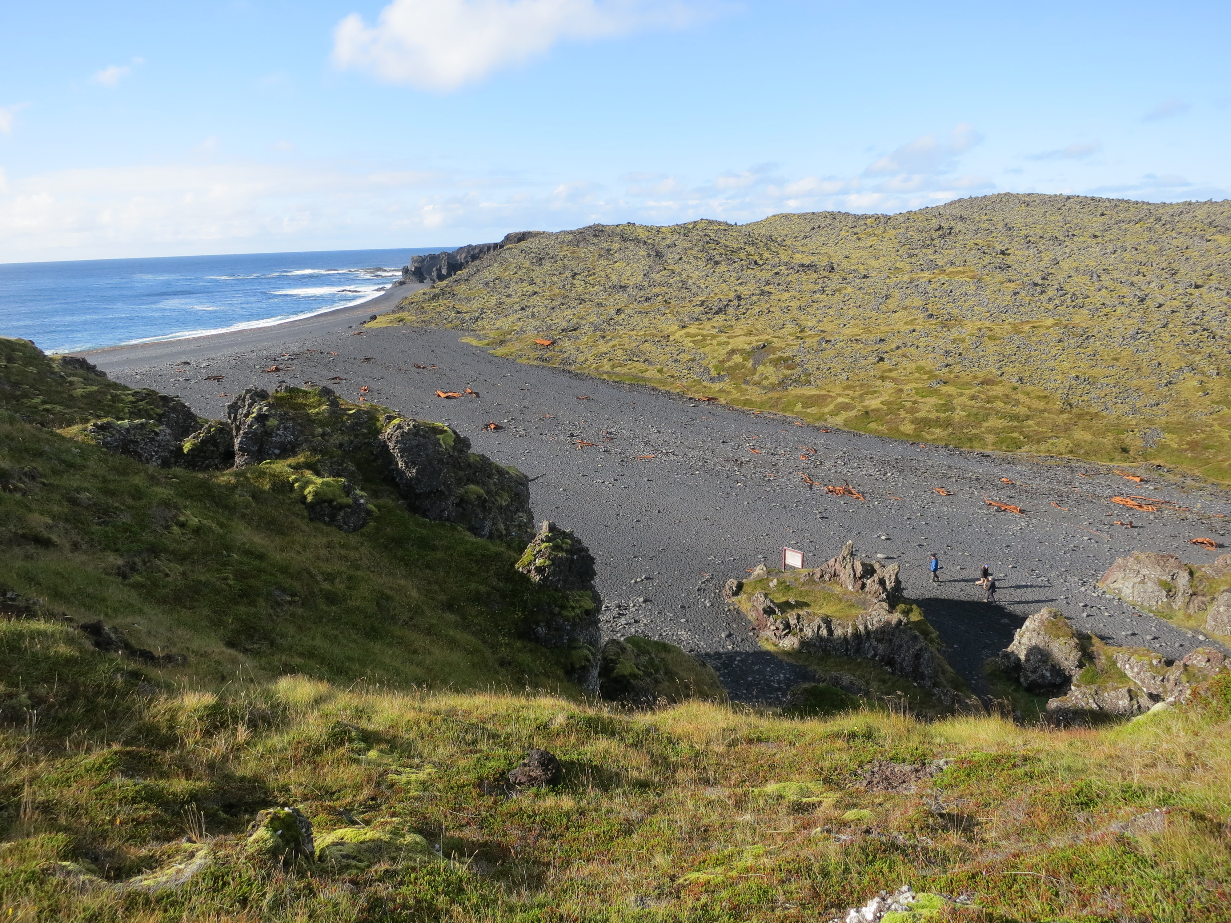
The next stop was only a few kilometres further along the coast, the Djúpalónssandur beach. We parked and walked down to the beach, taking photos of the coast as we went. This beach used to be used by fishermen, and in order to evaluate whether a man would be able to work a fishing boat the prospective crew member was tested by lifting large rocks on this beach. We saw these rocks at the beginning of the beach, however we didn’t end up trying to lift any of them. We saw other visitors who were struggling with the smaller rocks and decided against it. This beach is also the final resting place of the Epine, a British fishing trawler that was wrecked on the beach during a fierce storm in 1948. The remains of the boat were spread across the beach, and in very small pieces - I had expected the remains to be more recognizable as a boat, but they were mostly small scraps of metal spread across the beach. We got some good photos of the cliffs and the beach, and then returned to the car.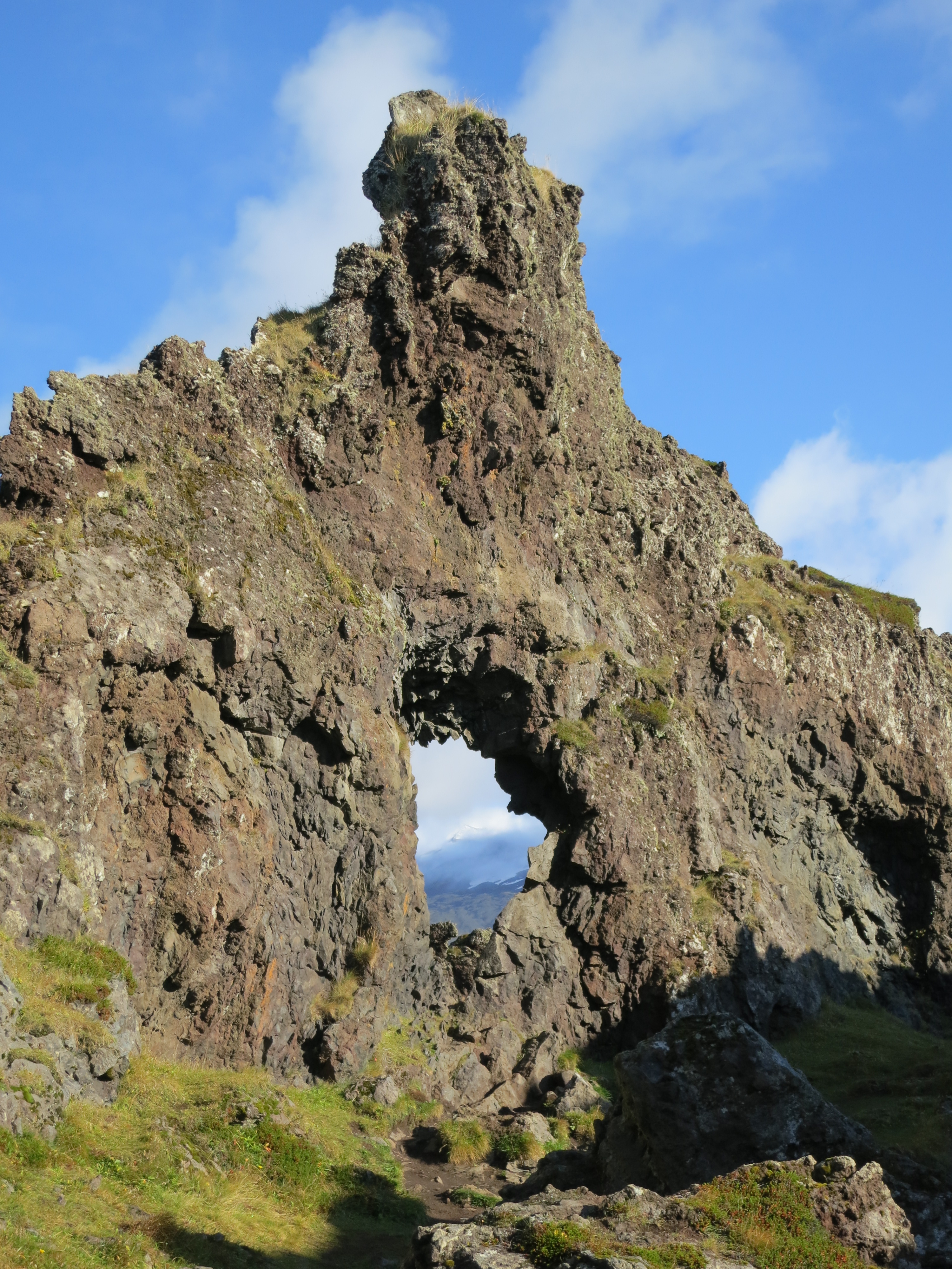
A rock formation on the path to Djúpalónssandur, with Snæfellsjökull visible in the opening
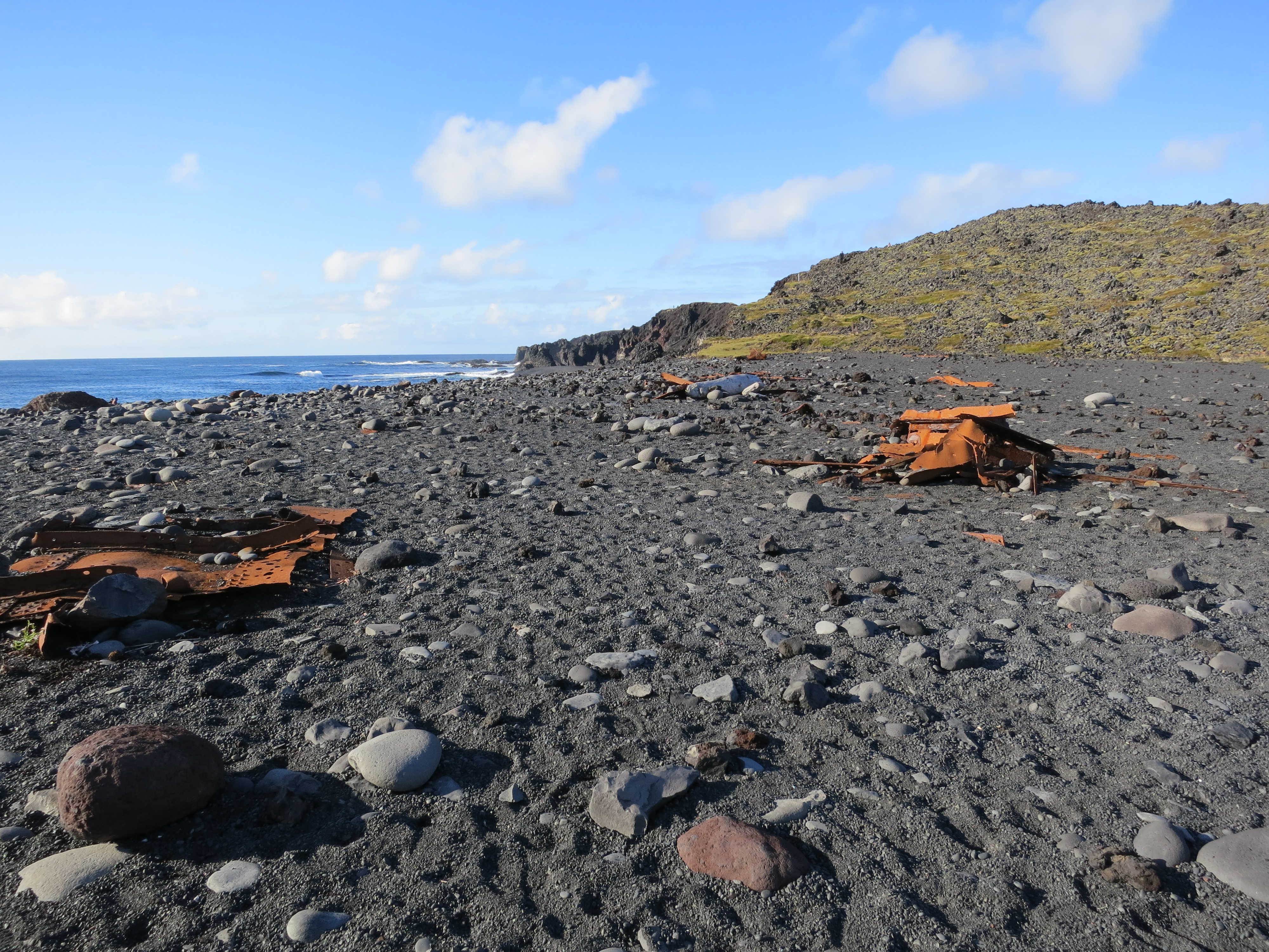
Wreckage of the Epine on Djúpalónssandur
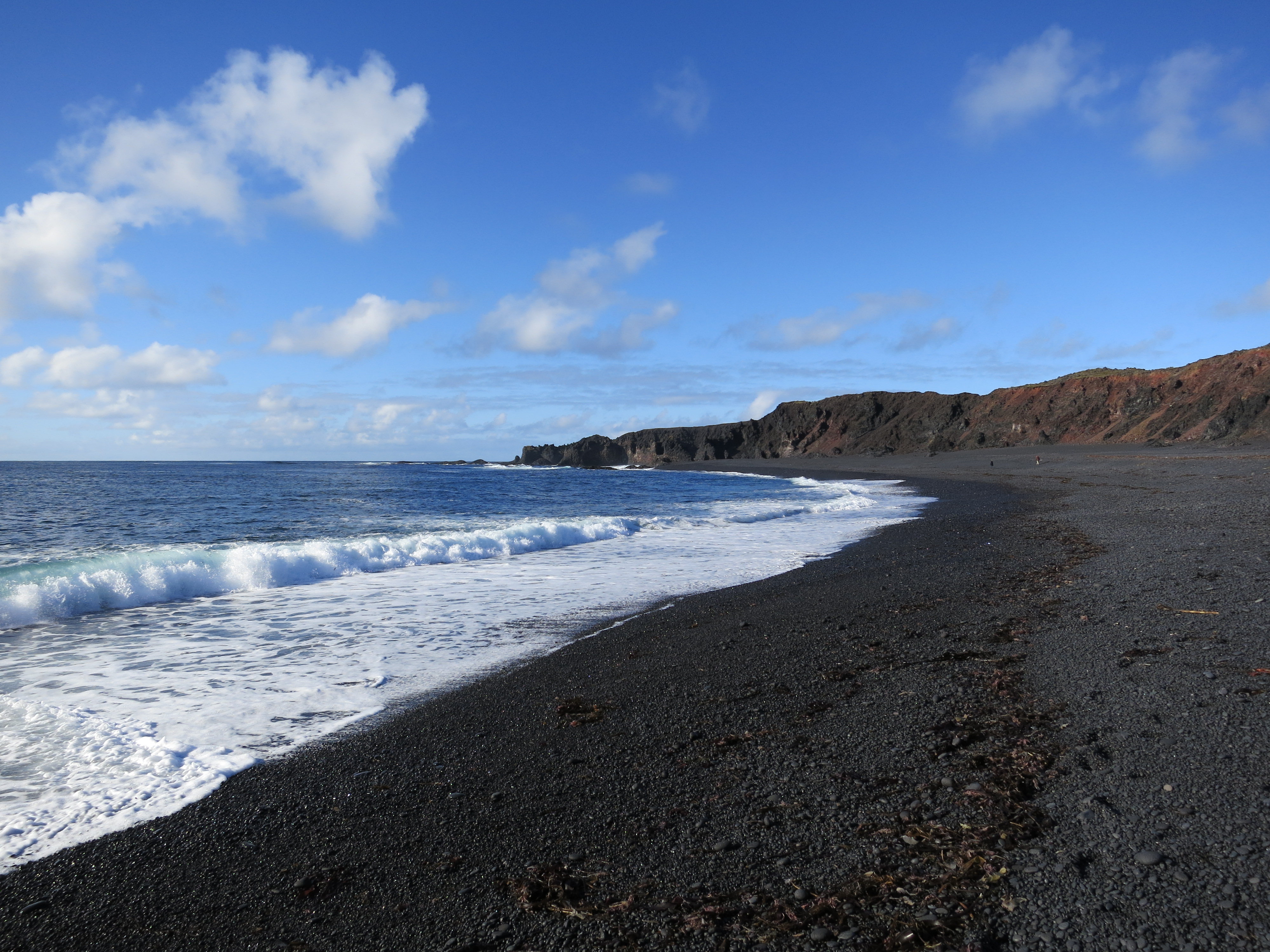
Djúpalónssandur
Djúpalónssandur, with Snæfellsjökull in the background
The wreckage extends a fair distance inland
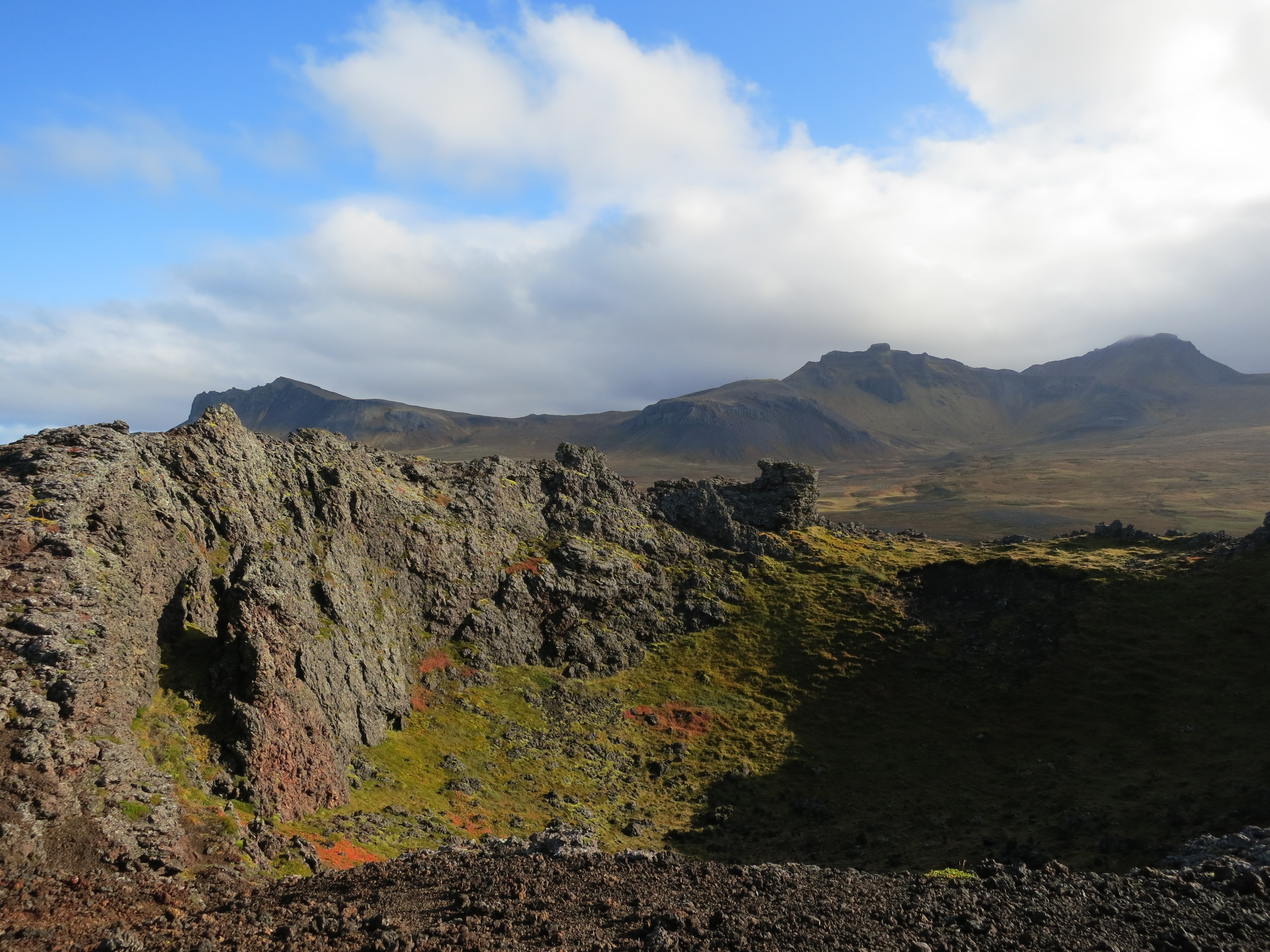
We drove on for another 15 minutes before reaching the Saxhólar crater. This crater had a series of metal steps built into the side of it, winding about 1/3 of the way around, which made it very easy to reach the top. We got some good photos of the crater, and the surrounding landscape, before descending and continuing on. The crater was smaller than most of the other craters we had seen previously, and was slightly deformed due to quarrying that had taken place on one side.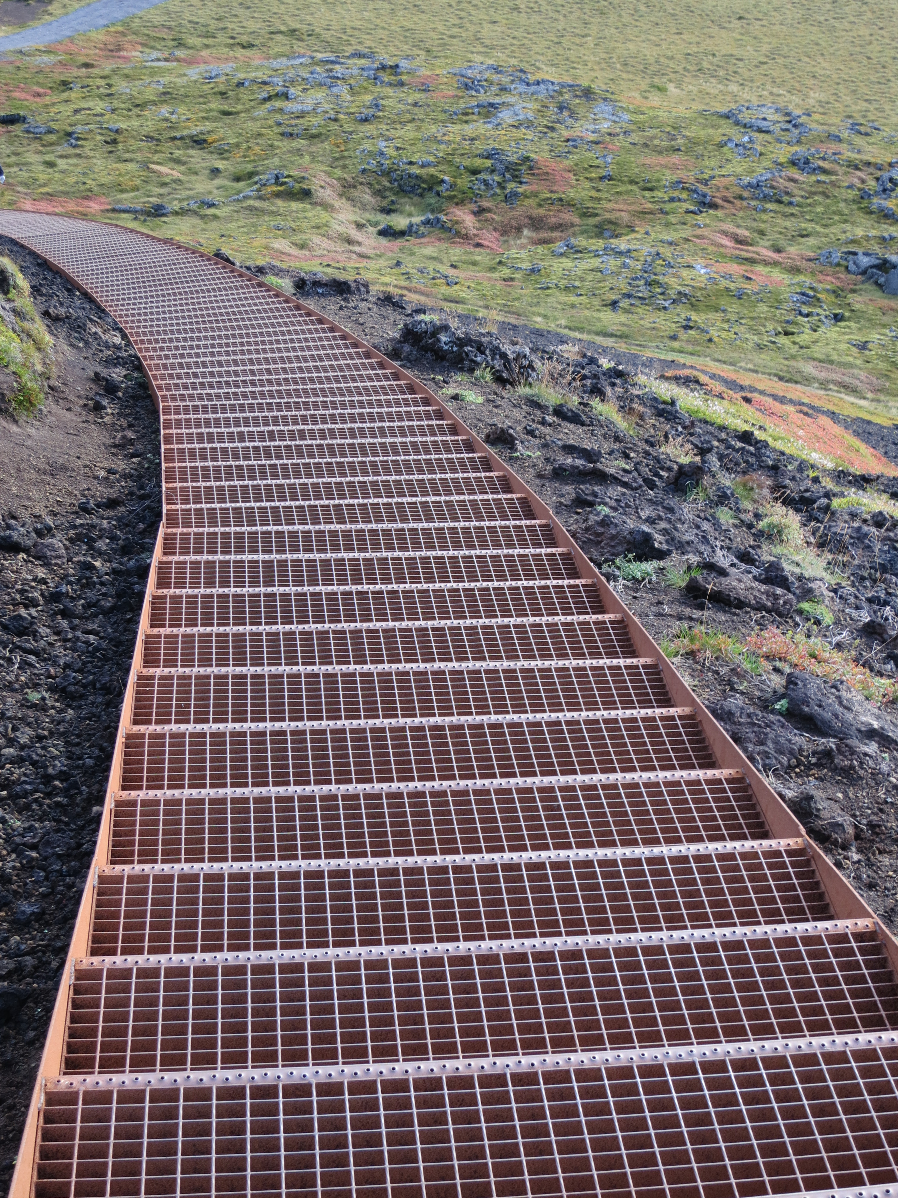
The staircase
The inside of the Saxhólar crater
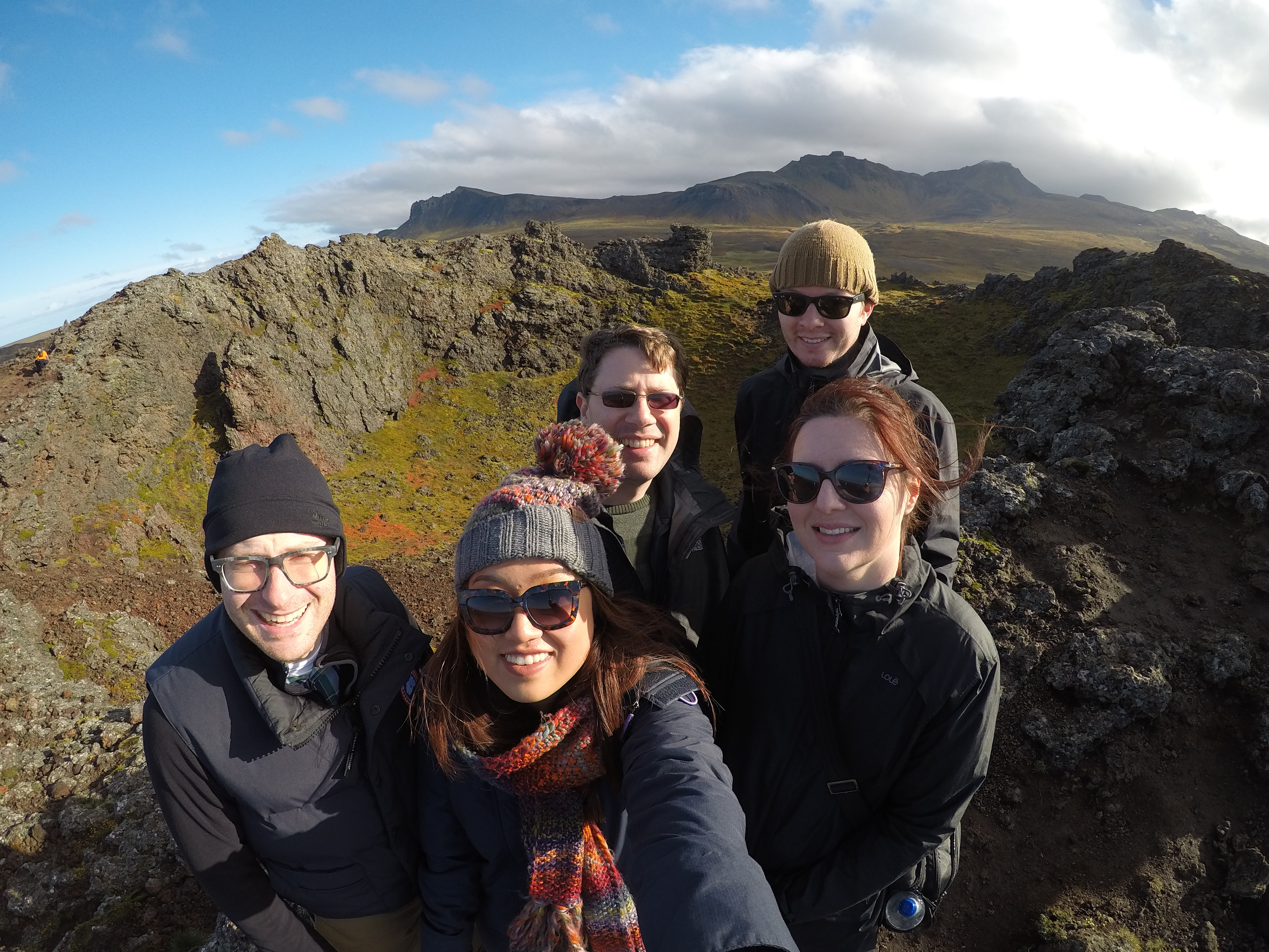
Us at the Saxhólar crater
Looking out from Saxhólar
We continued our drive and left the Snæfellsjökull national park. Shortly after leaving the park we drove past a massive radio antenna, which later research showed to be the Hellissandur radio mast, one of the tallest structures in western Europe. It certainly dwarfed many of the mountains in the area. We continued on to Ólafsvík.
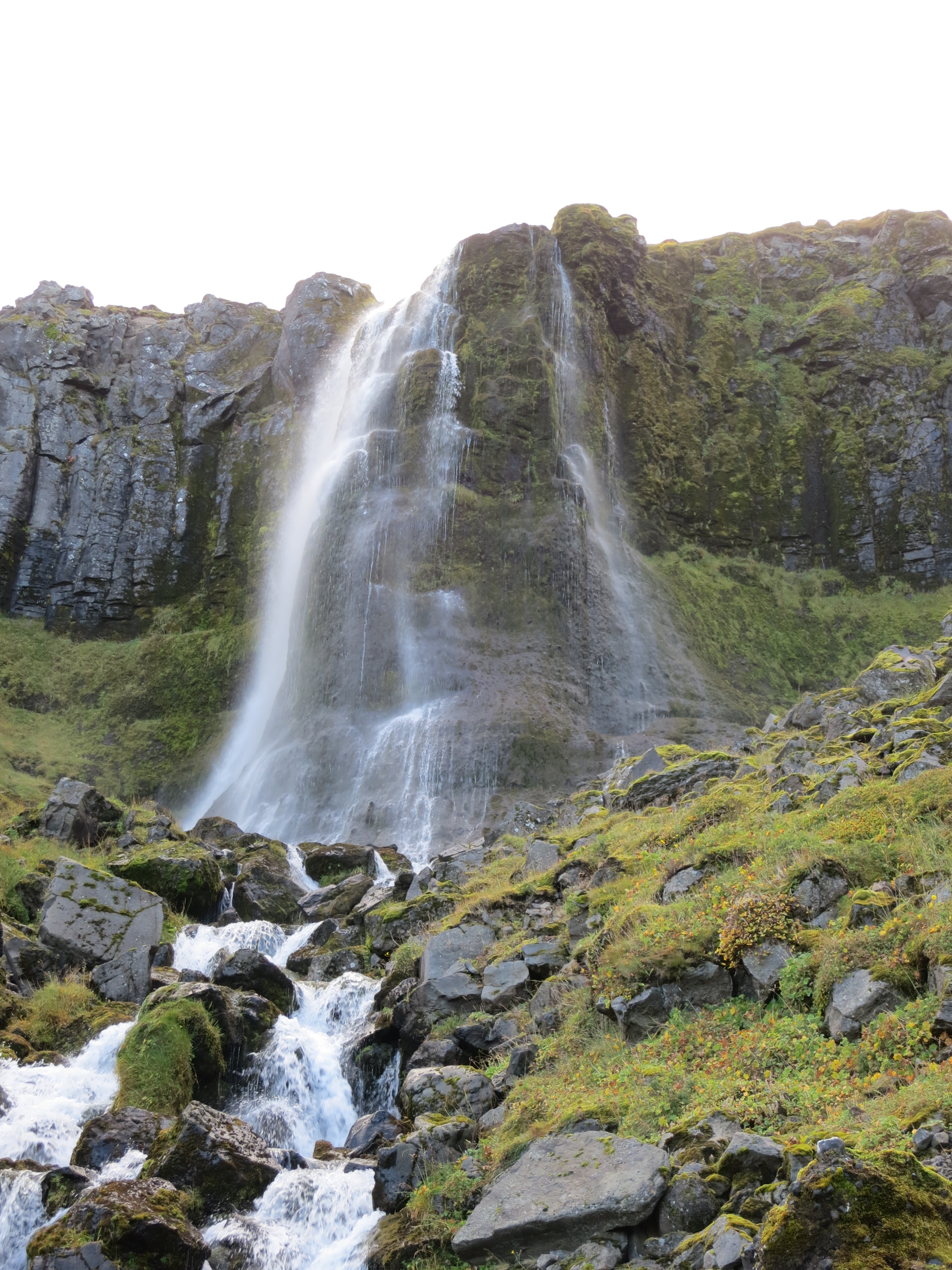
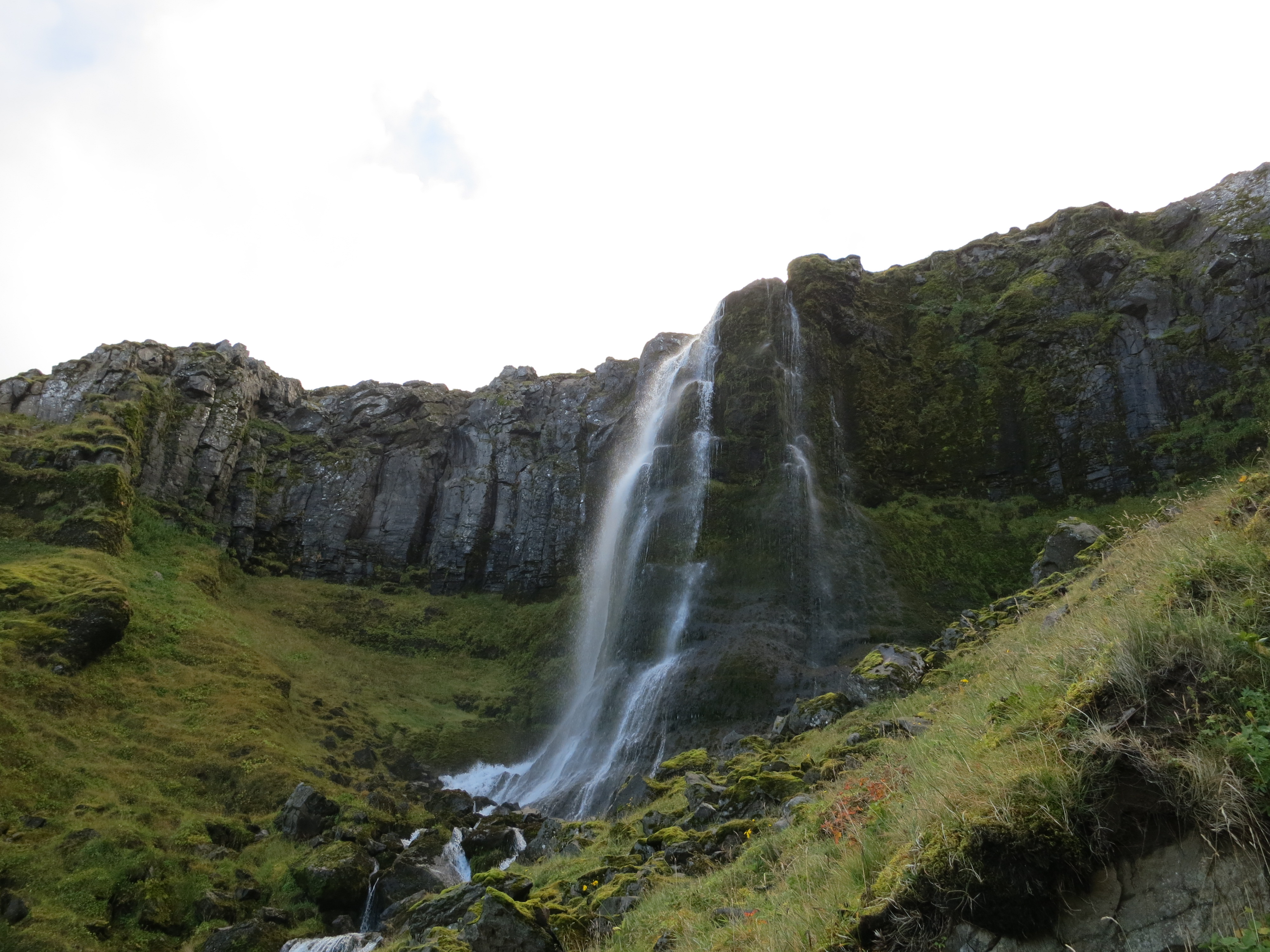
Once we got into Ólafsvík we were starving, so we looked around and decided to have lunch at Matarlist. Here we all had a very tasty meal of fish and chips. After eating we drove over to Bæjarfoss, a waterfall located at the back of the town. Here we walked up to the base of waterfall, through some pretty marshy terrain. We took some photos then returned to the car.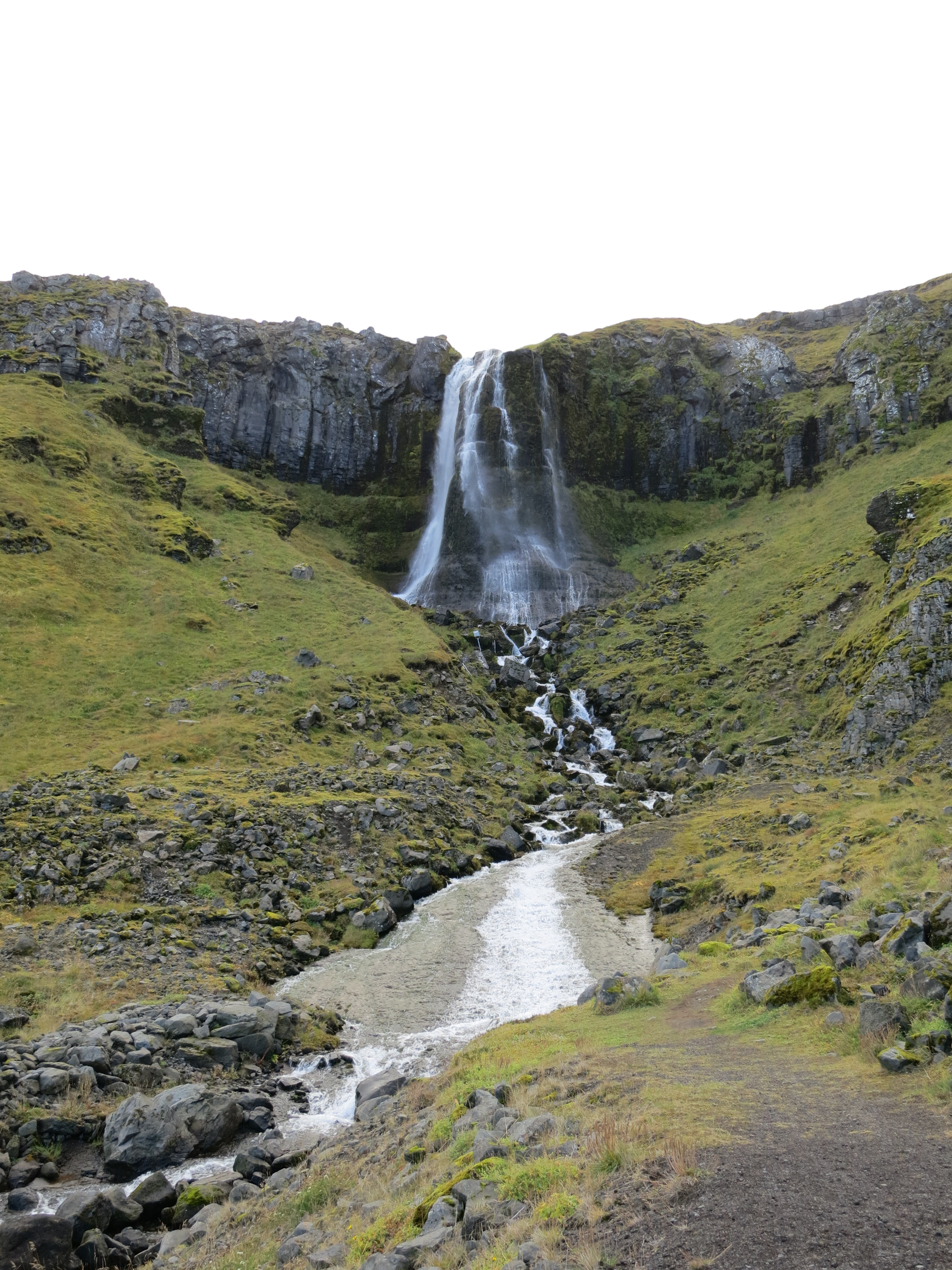
Bæjarfoss
Bæjarfoss
Bæjarfoss
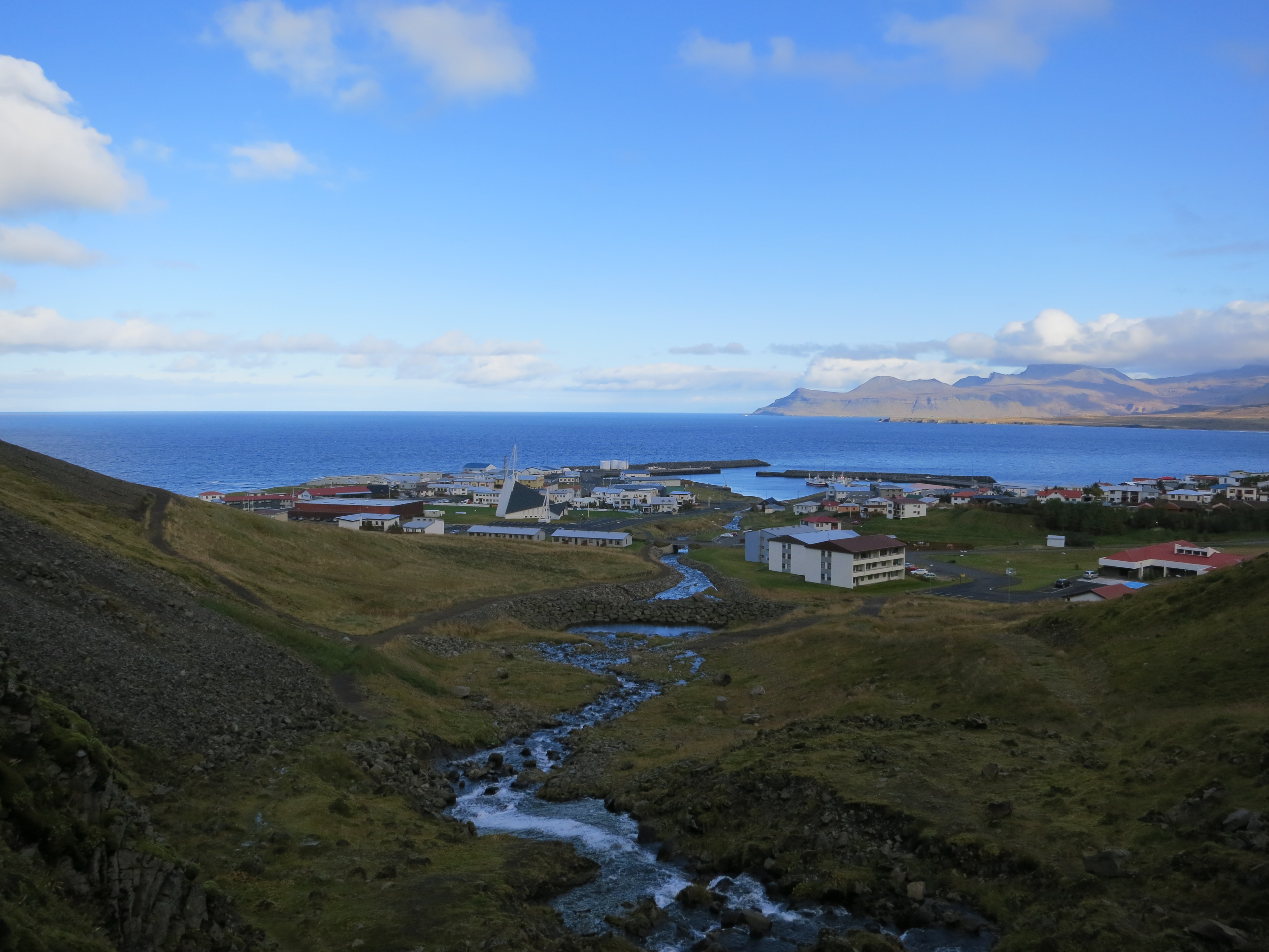
The town of Ólafsvík
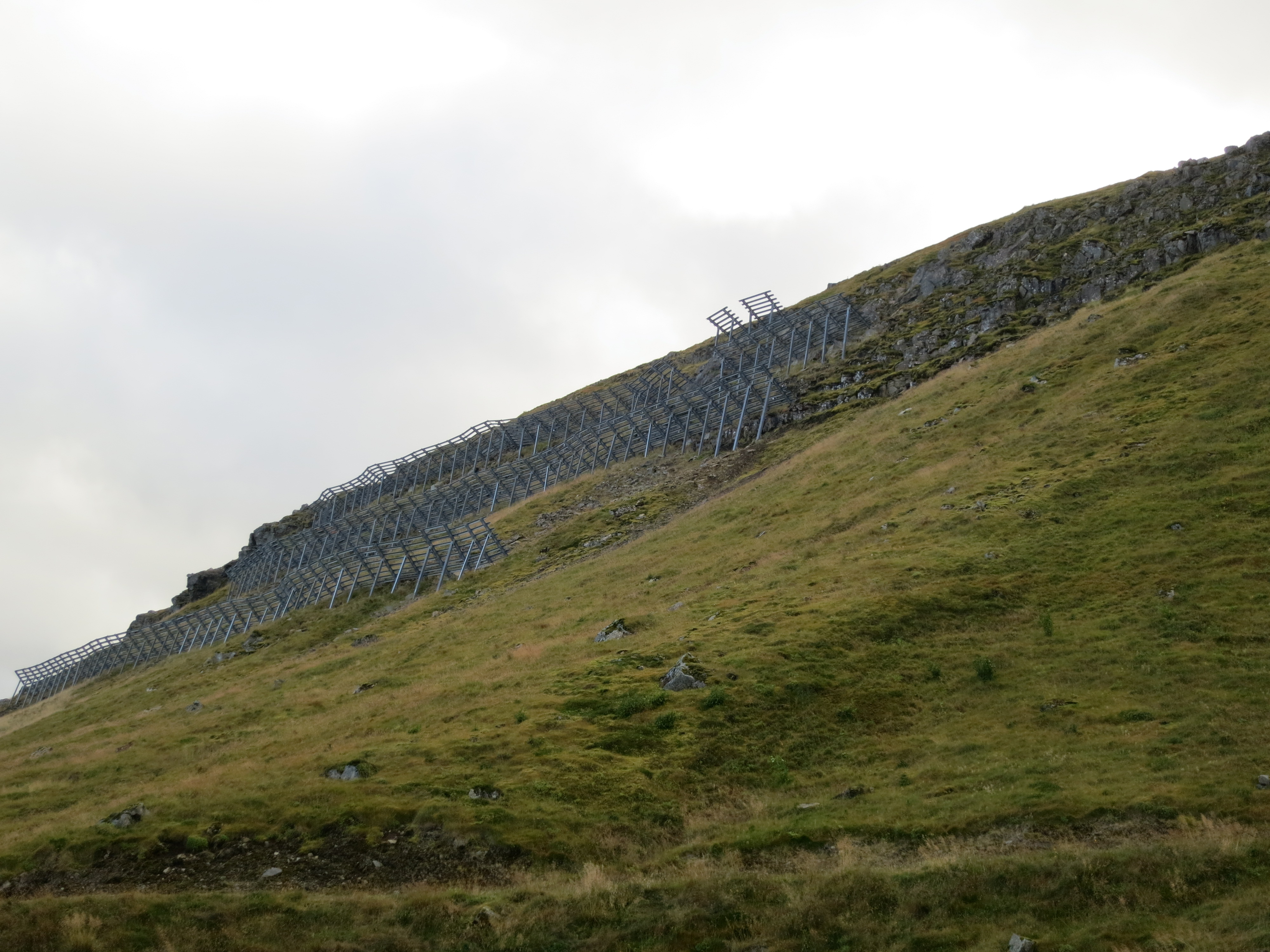
Rock guards preventing landslides at Ólafsvík
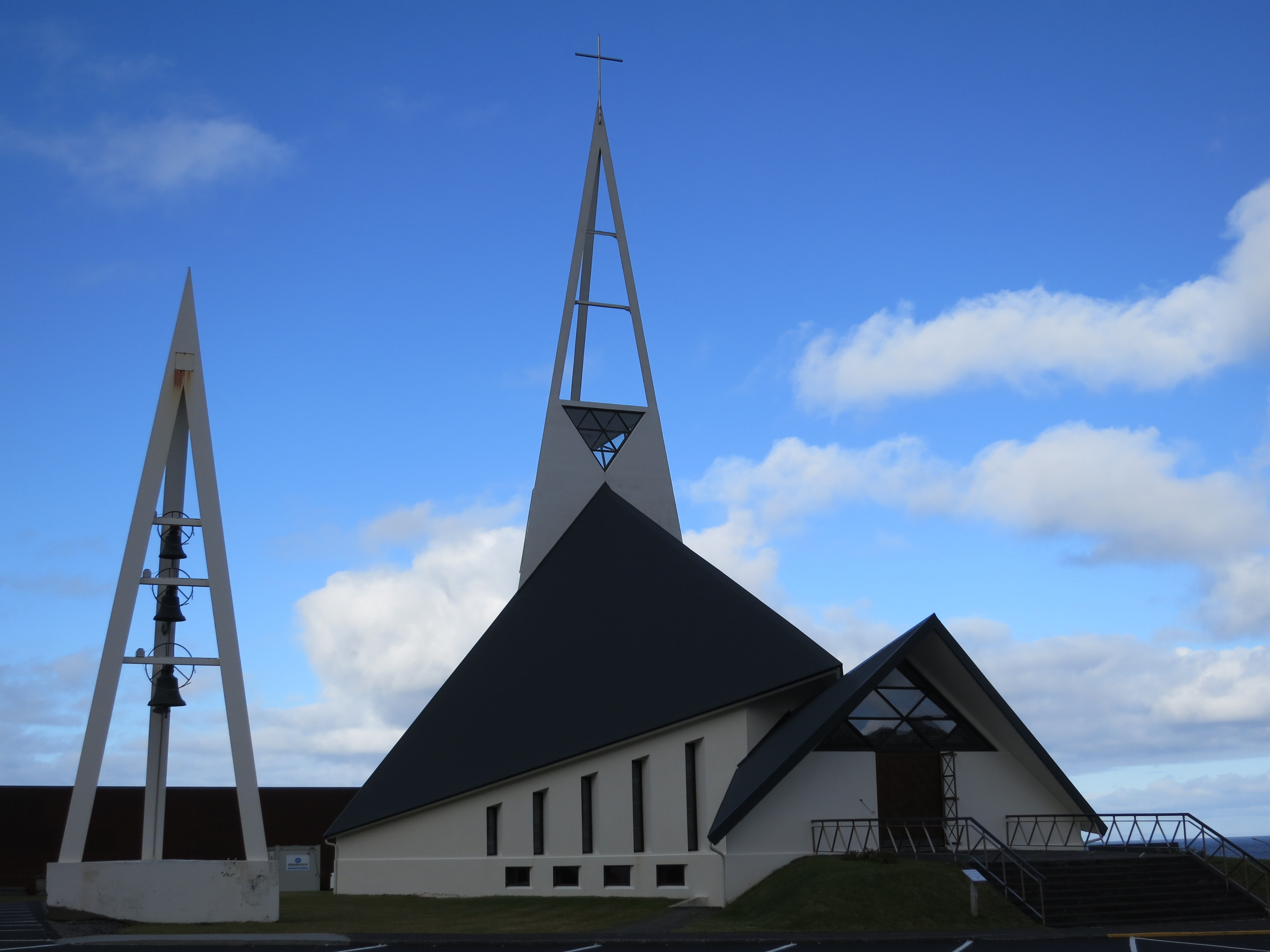
A church in Ólafsvík
Shortly after leaving Ólafsvík we completed the loop of the western peninsula that we had started yesterday afternoon. We turned right down Road 54 for the second time and repeated the drive we took to reach the southern part of the peninsula. Instead of turning right onto Road 574, however, we continued on, this time driving south.
We drove for about an hour and a half before turning off the highway to reach the Gerðuberg Cliffs. These cliffs were just off the road, and rose up out of a farmer’s field that we were able to drive up to. These cliffs were made from basalt columns, very similar to the columns we saw at Svartifoss and Litlanesfoss. We hiked up the left side of the cliffs, then hiked around the tops of the cliffs a bit. The path was pretty slick and steep, but we made it without any falls. We didn’t spend more than 20 minutes here before getting back into the car and continuing on.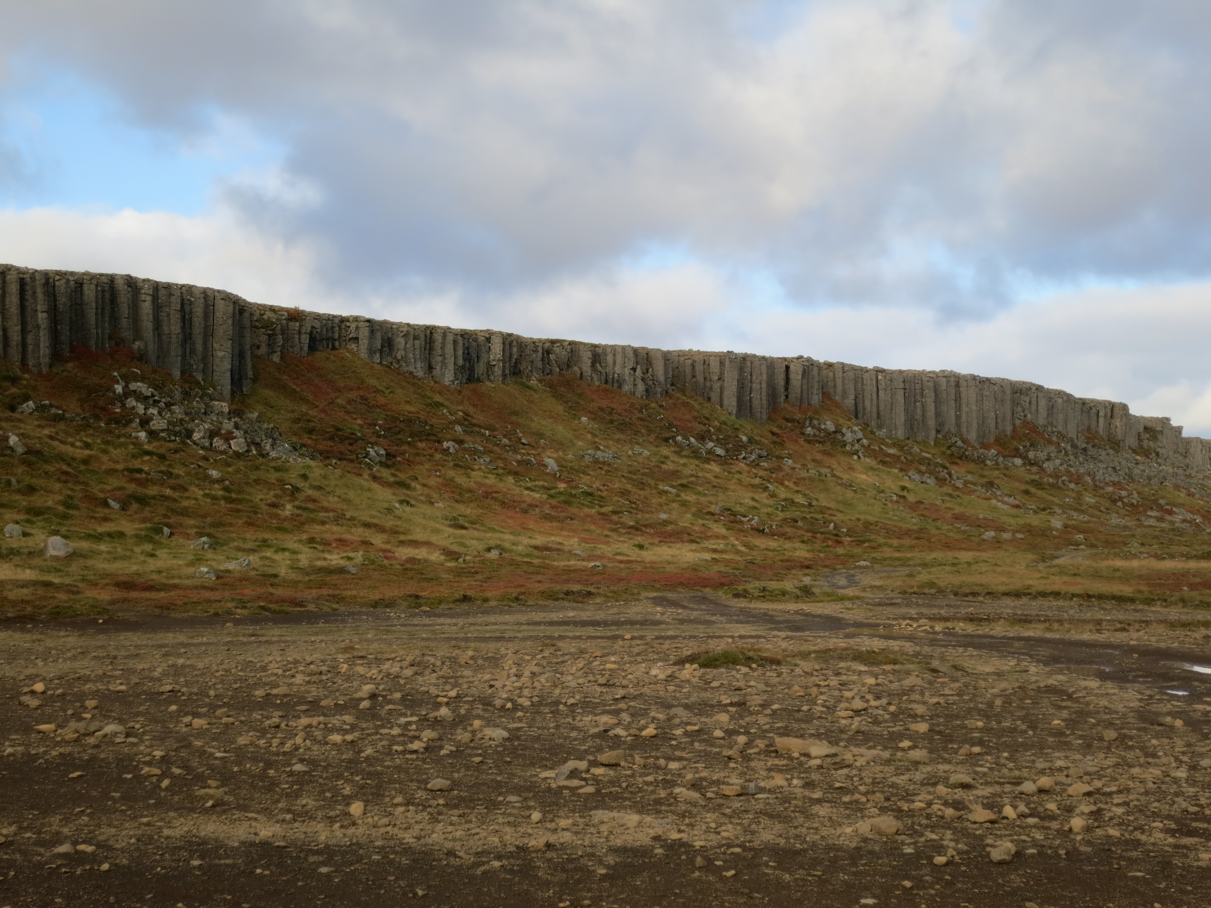
The Gerðuberg cliffs
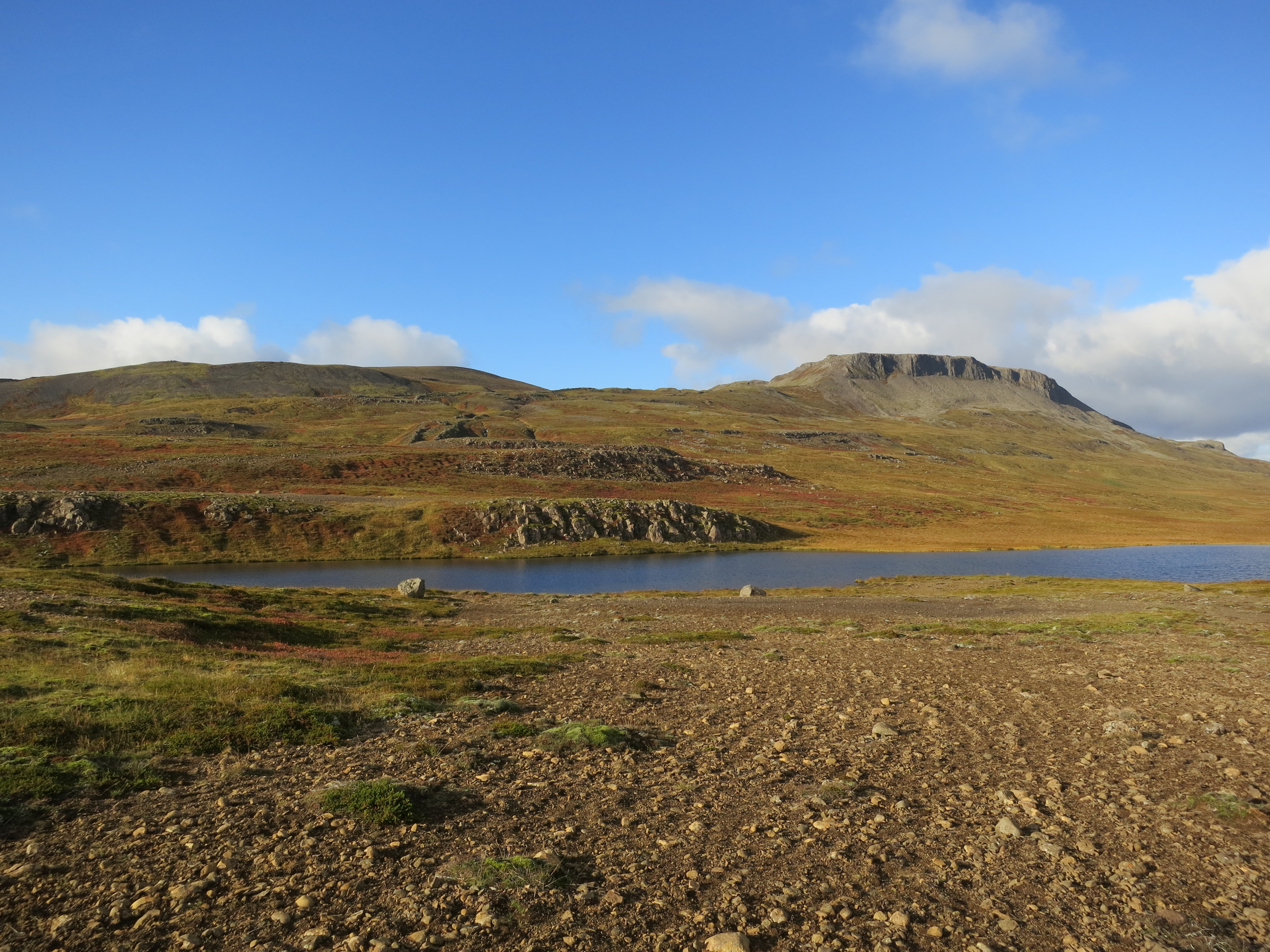
A small lake above the cliffs
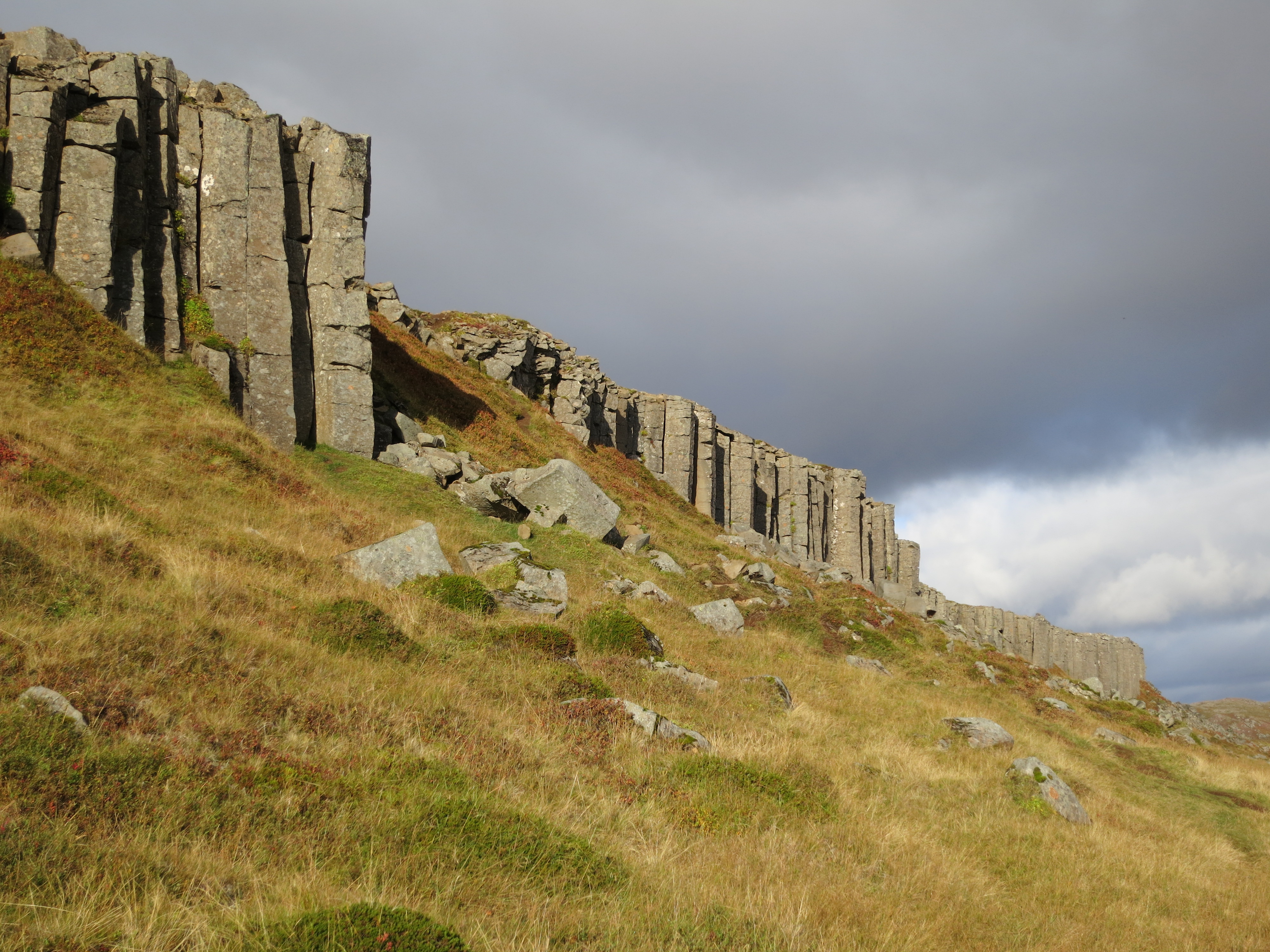
The cliffs are pretty imposing up close
Our hotel for the evening was located in Borgarnes, which was our next stop. It took us about 45 minutes to drive from the cliffs, and we arrived shortly before 5 PM. We checked into the Icelandair Hotel Hamar, dropped off our things, and continued on to the last site of the day, the Settlement Center. This museum was split into two audio tours, each running for approximately 30 minutes. The first audio tour covered the founding history of Iceland, describing the first Viking settlers to arrive and where they settled. The second audio tour covered one of the founding myths of Iceland, Egil’s Saga. Both were very informative, and provided some interesting context to previous sites we had visited.
Once we finished the tour, we had dinner at the attached restaurant. It was well reviewed, and cooked some very good food. I had a delicious lamb steak with root vegetables and a tasty sauce made from dates and rosemary. We drove back to the hotel after dinner, leaving shortly after 8:30 PM.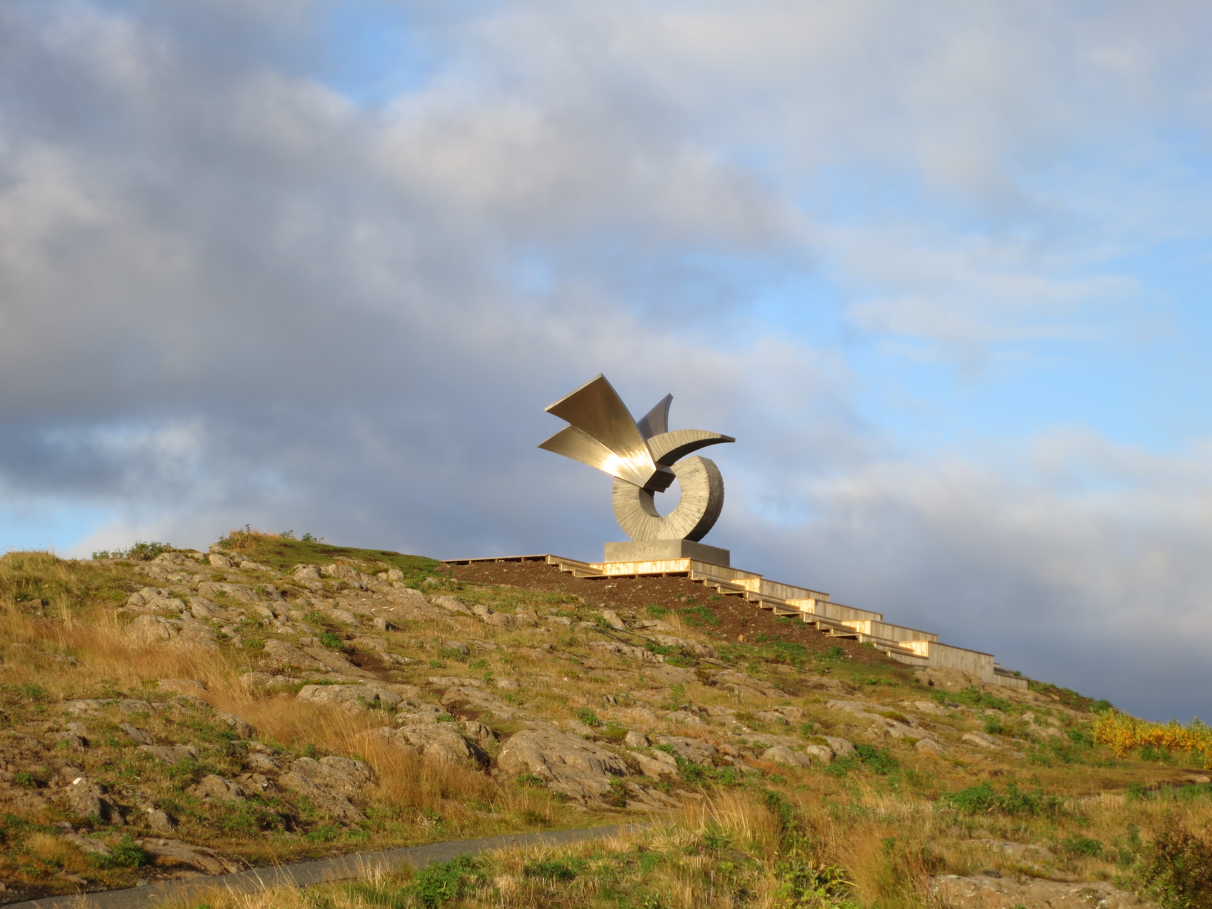
An interesting sculpture by the Settlement Centre
As we drove back to the hotel the sun had set, and we saw some light streaks that we thought might be the northern lights. Just as we pulled into the parking lot, the light streaks went from being a faint streak in the sky into full-blown northern lights, with the greens and pinks being very visible. For about ten minutes the lights danced in the sky, prompting people to come running out of the hotel to see the lights. It was without a doubt the most impressive display of the northern lights I had seen. The lights faded out as quickly as they appeared; and we went into the hotel. Kate and Susan decided to go into the hot tub, while Chris, Dave and I had a few drinks in our hotel room. About 30 minutes after the ladies left Susan came back and let us know that the northern lights had returned, so we all went outside and watched the northern lights in the sky. The show lasted for about ten minutes again, and afterwards we went back inside and went to bed shortly afterwards.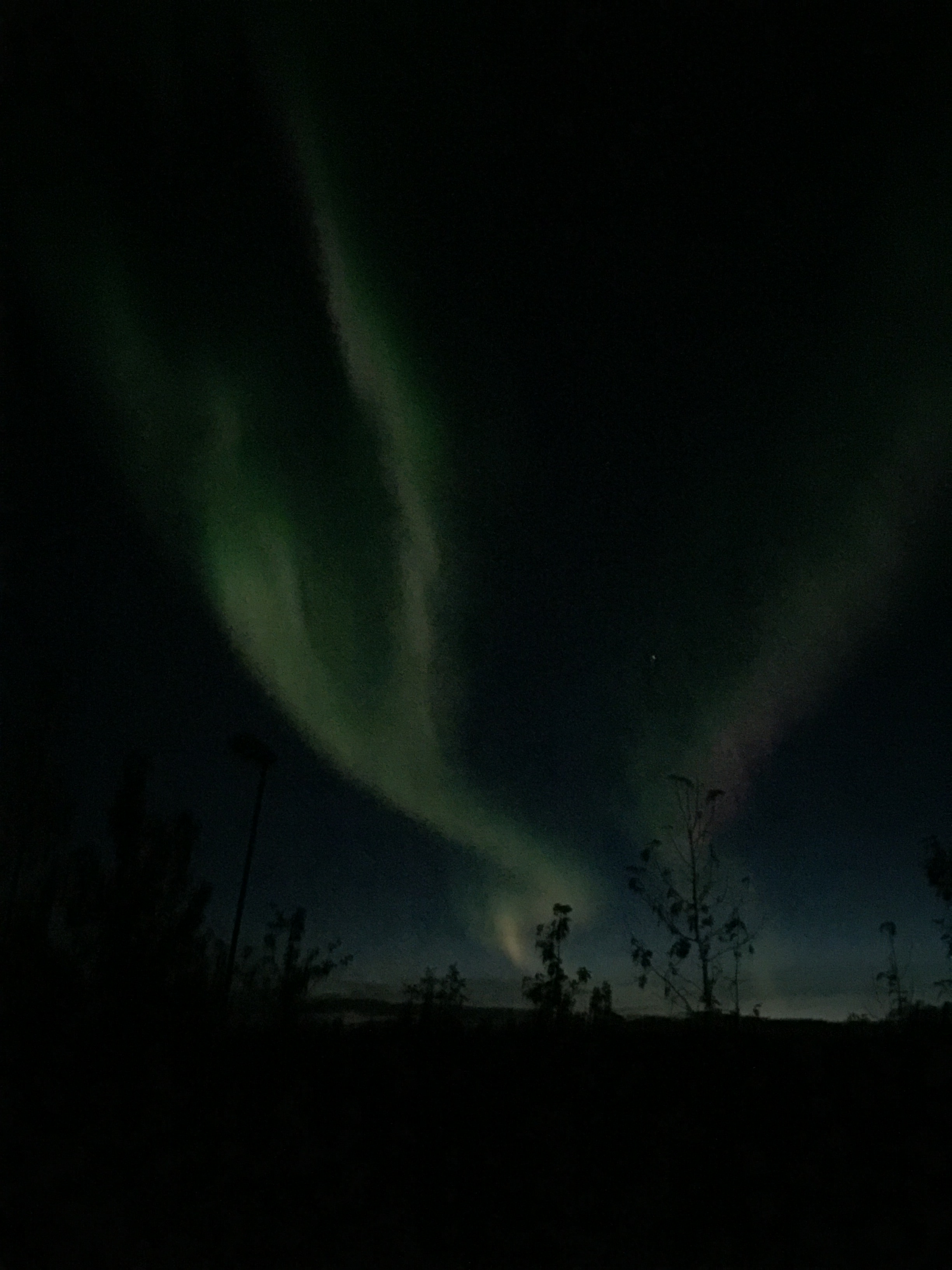
The northern lights were bright enough to capture with a normal camera