Today was a first - driving on the left side of the road! I had booked a rental car for the day so that we could drive south of Cairns and visit Wooroonooran National Park. We woke up early, got ready, and then took an Uber to the Cairns Central grocery store. Here we picked up supplies for lunch and some snacks for the day, then walked over to the Budget car rental office (located across the street from the Cairns Aquarium). I had booked a sedan, however they did not have any available so we were upgraded to a Mitsubishi Outlander. The pickup was easy, and shortly 9:00 we were pulling out of the parking lot. We stopped by a McDonald’s on the way out of town so I could get a coffee, then started our drive south. Driving on the left side of the road initially took some mental effort, but before we left Cairns it was already starting to feel natural.
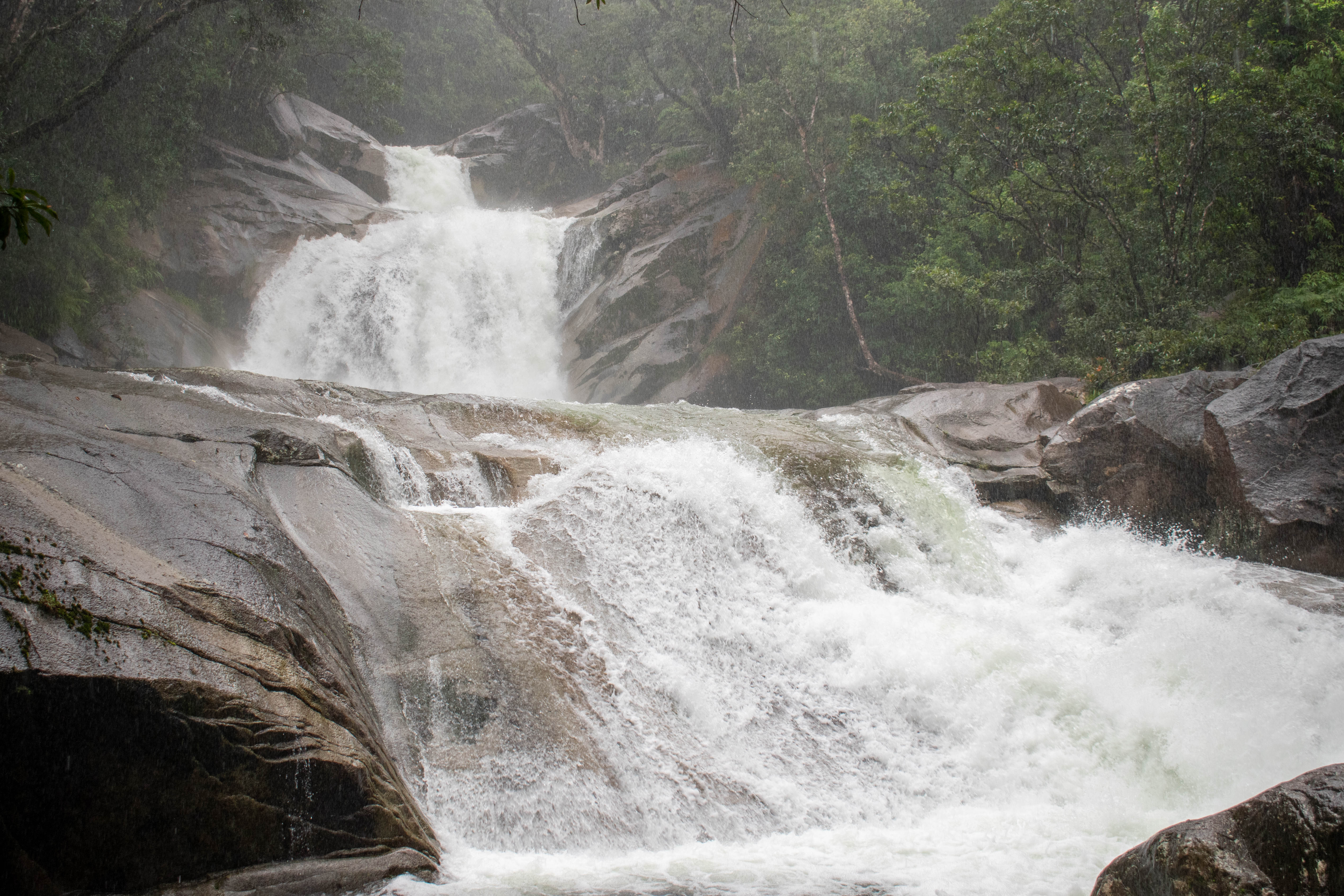
The first stop of the day was at Clamshell Falls, and it was about a 50 minute drive from Cairns. The sun was out as we left Cairns and we had a gorgeous drive south on the Bruce Highway. The falls require hiking in about 3 km from the parking lot, so once we parked we packed up a bag and began the walk. The hike traverses some fairly hilly terrain, luckily the path was paved so it wasn’t too difficult. The sun was out and the temperature was in the high 20’s so we were feeling pretty warm by the time we reached the falls. We scrambled down from the path to the river, the path didn’t take you down to the riverbank but there was a trail we could follow to reach the water. Once on the riverbank we enjoyed a cooling breeze coming from the falls, and then took a few photos. The falls were nice to look at, but they didn’t have a substantial drop so it wasn’t exactly what we were expecting. It was nice to cool off beside the river, however. After a short break we turned around and returned to the car. In total we spent about 2 hours at Clamshell falls.
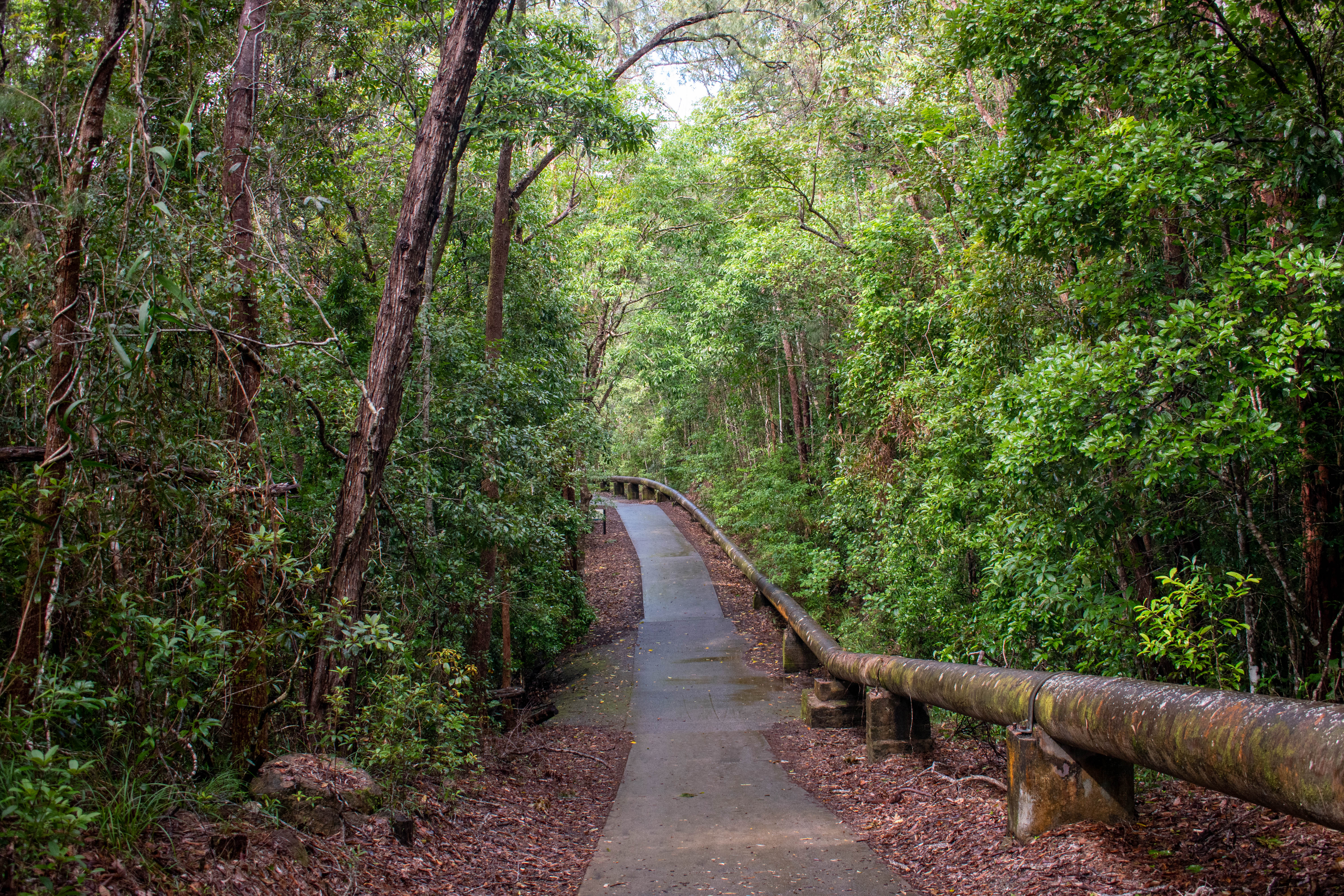
The trail follows a pipe that supplies drinking water to Cairns
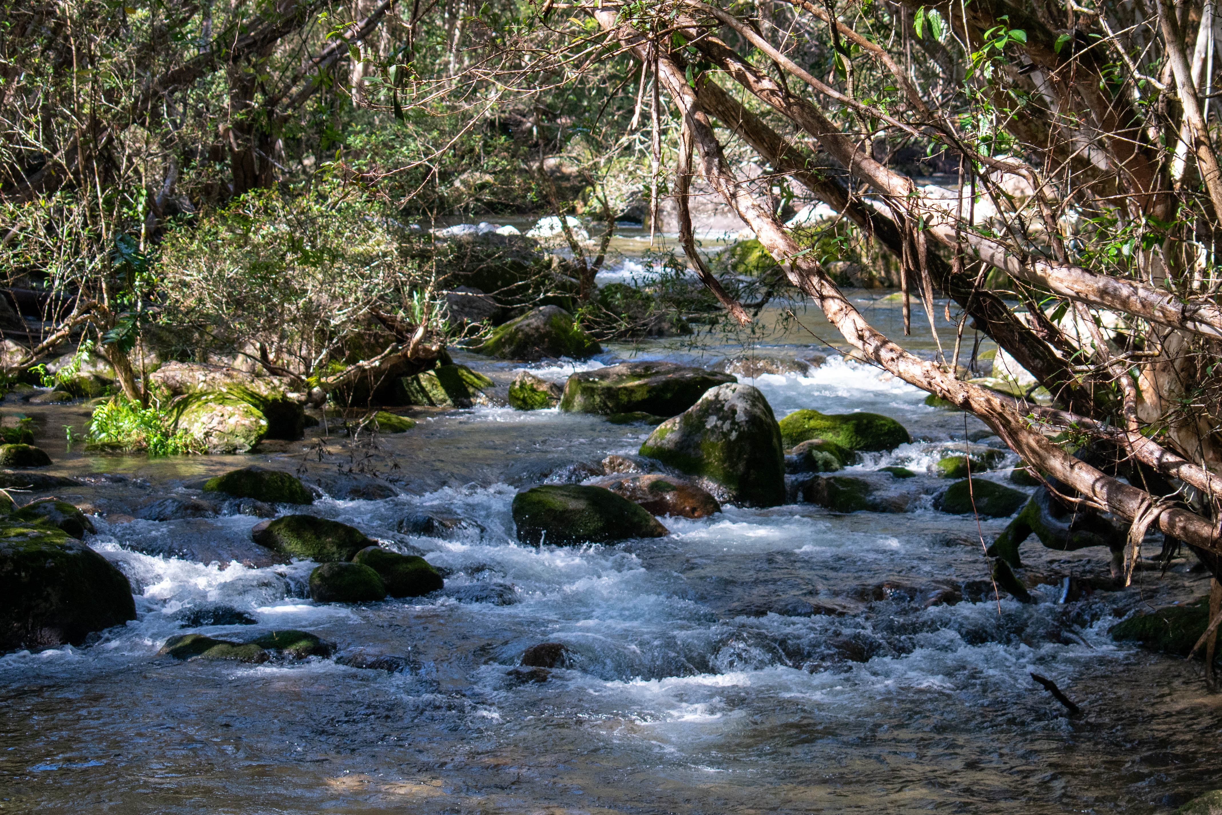
A small river follows the trail up to the waterfall
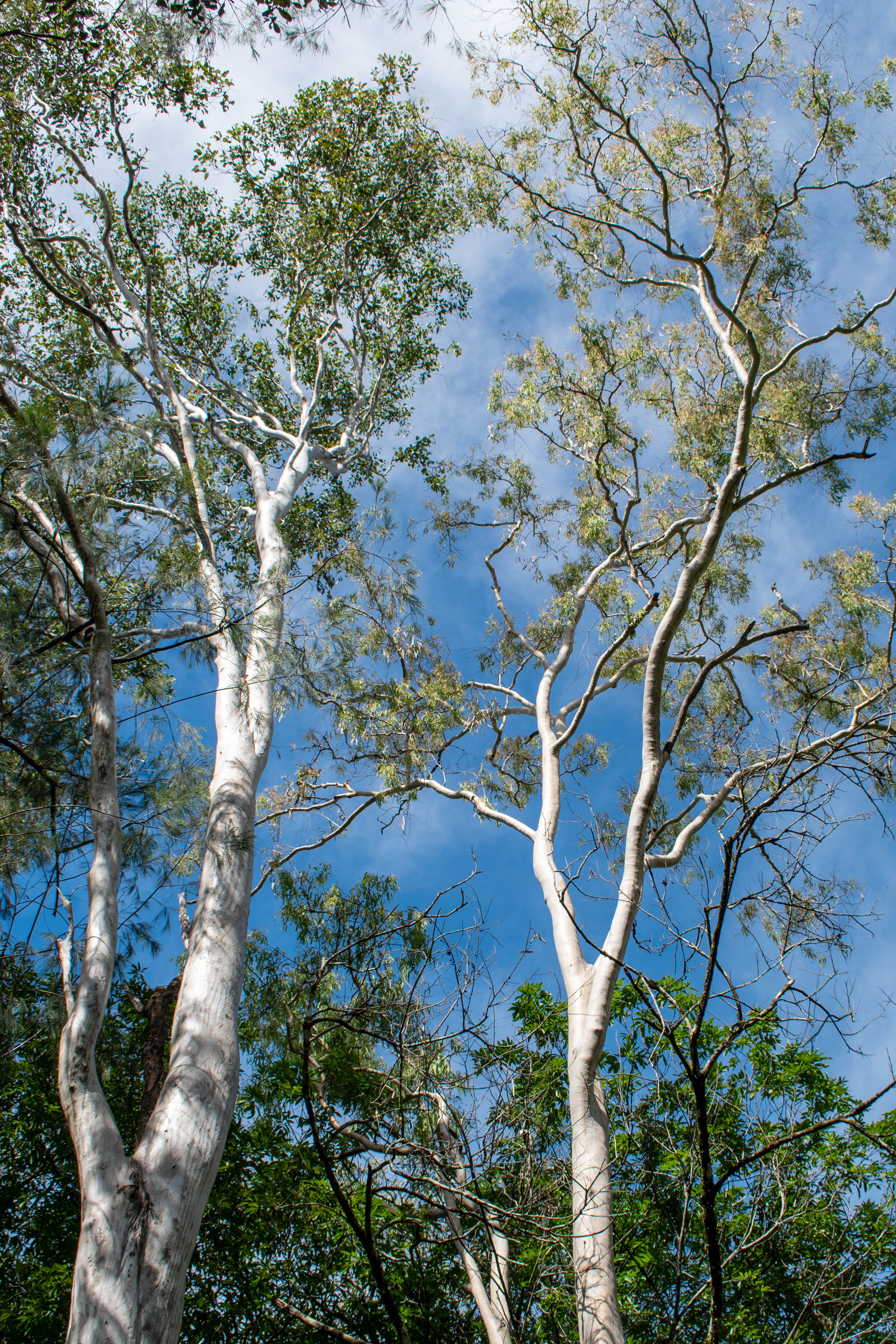
There were some pretty trees with very white bark on the path
Clamshell Falls is a series of small waterfalls going from stream to pond to stream
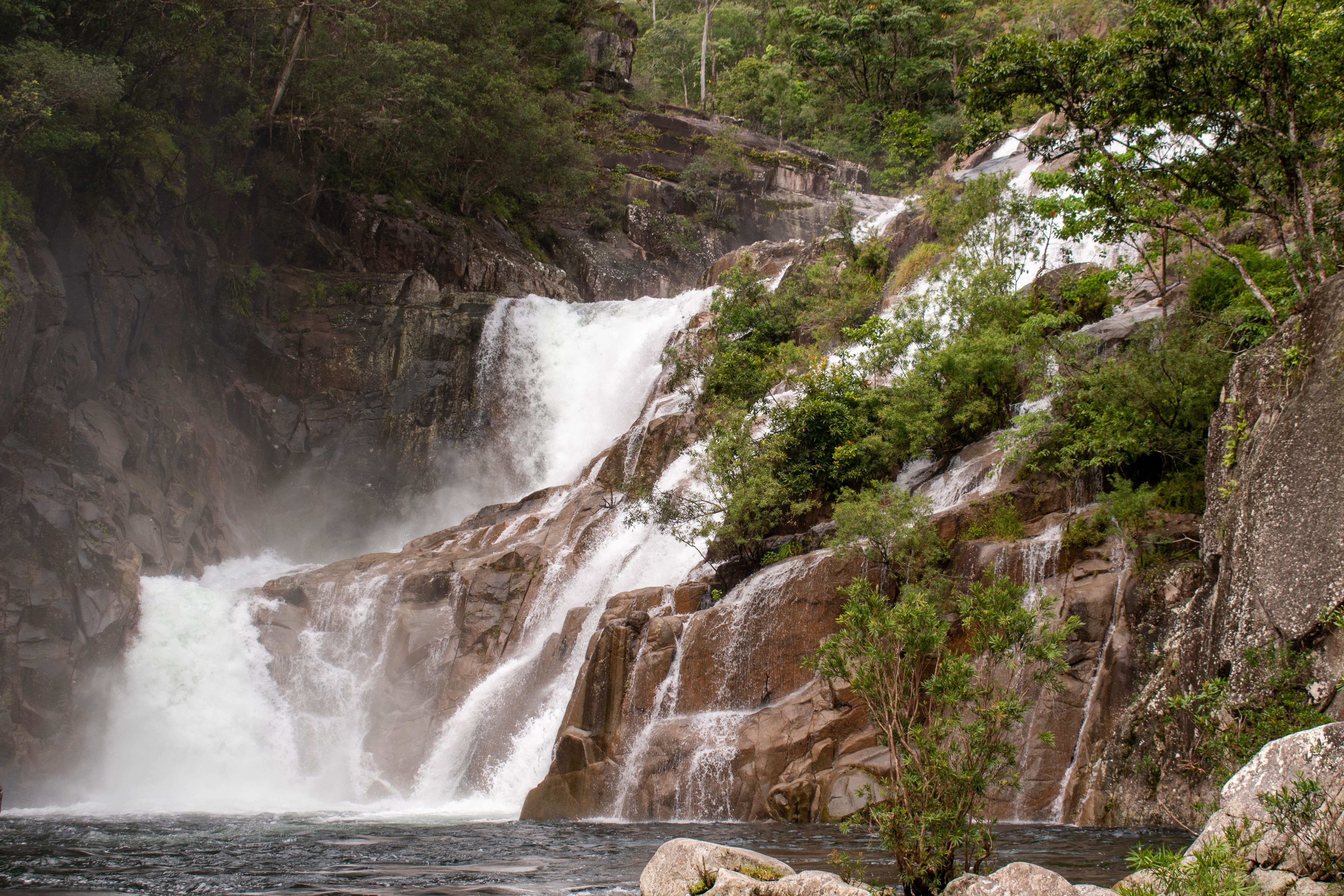
The first chute at Clamshell Falls
The parking lot was pretty full as we got into the car and started back down towards the Bruce Highway - getting there early in the day was a wise choice! Once we reached the highway we turned right and continued to our next destination, Babinda Boulders. The sun we had on the earlier in the morning disappeared shortly after we started driving back on the Bruce highway and we didn’t see it again until we arrived at the Babinda Boulders parking lot. It didn’t take us long to reach this next site - we drove for about 50 minutes after leaving the parking lot for Clamshell Falls. This site is a popular swimming destination, and after the hike up to Clamshell Falls we were happy to have a place to cool off. We had a quick lunch of sandwiches and snacks in a picnic area just beside the swimming area. There were signs warning us against feeding any wandering cassowaries, however we weren’t interrupted by wildlife while eating. After lunch we grabbed our swim trunks from the car, quickly changed in change rooms located right beside the parking lot, and then went for a dip in the cool water. It felt super refreshing, and while the first steps into the water were uncomfortable it quickly became relaxing as we acclimatized to the water. The swimming area exists at the intersection of a couple of rivers, and so there was a surprisingly strong current in the water. We had a busy day planned so we didn’t spend more than ten minutes swimming before we got out and dried off. Our timing worked out well - just as we were getting back to the car after drying off and changing the rain started up again. We were back in the car shortly before 13:00, and headed off to our next destination.
The namesake boulders in the swimming area
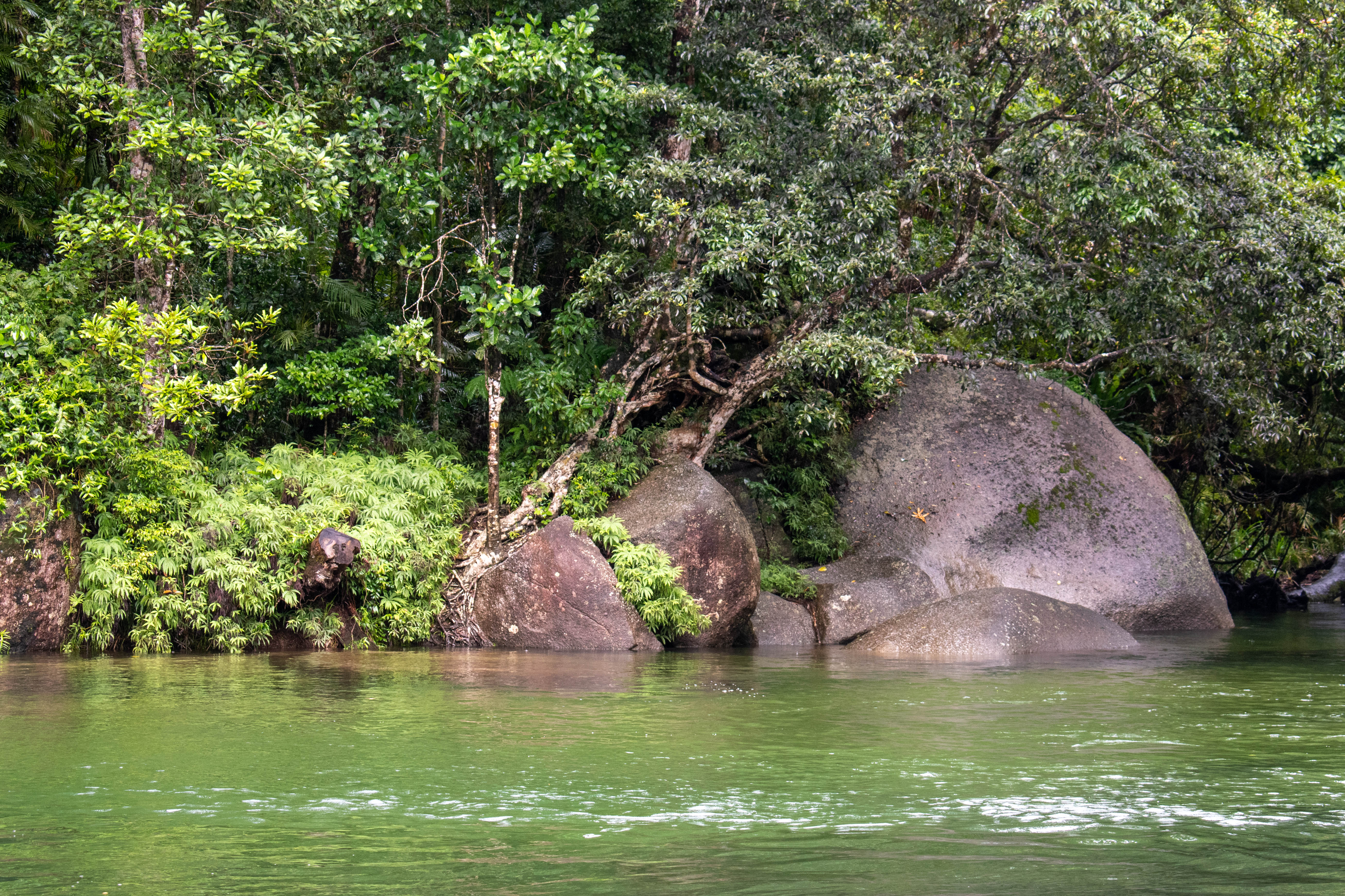
A tree growing on the bank of one of the source rivers
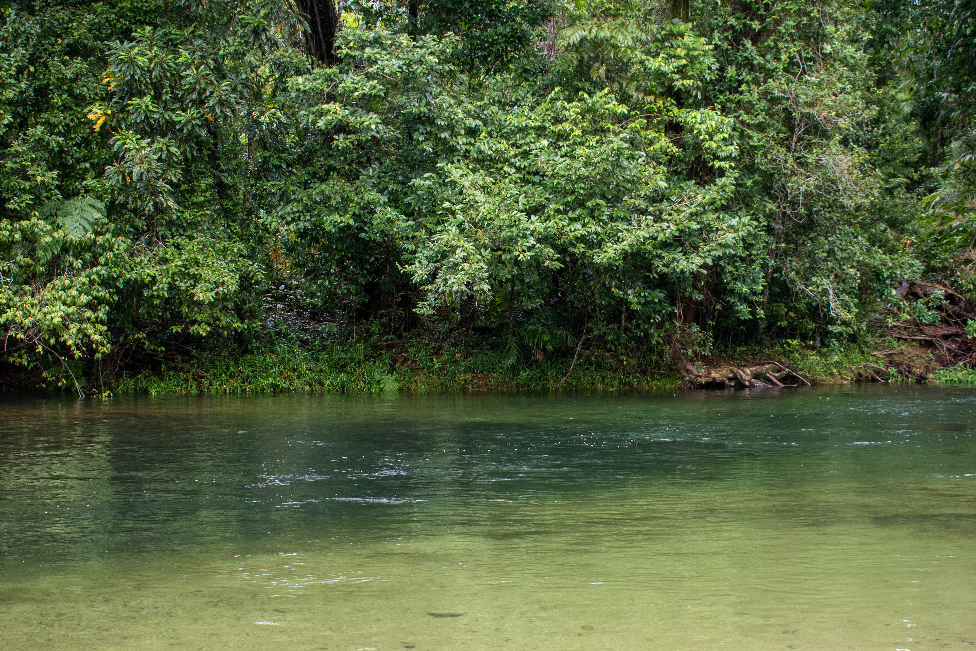
The colours of the river were gorgeous
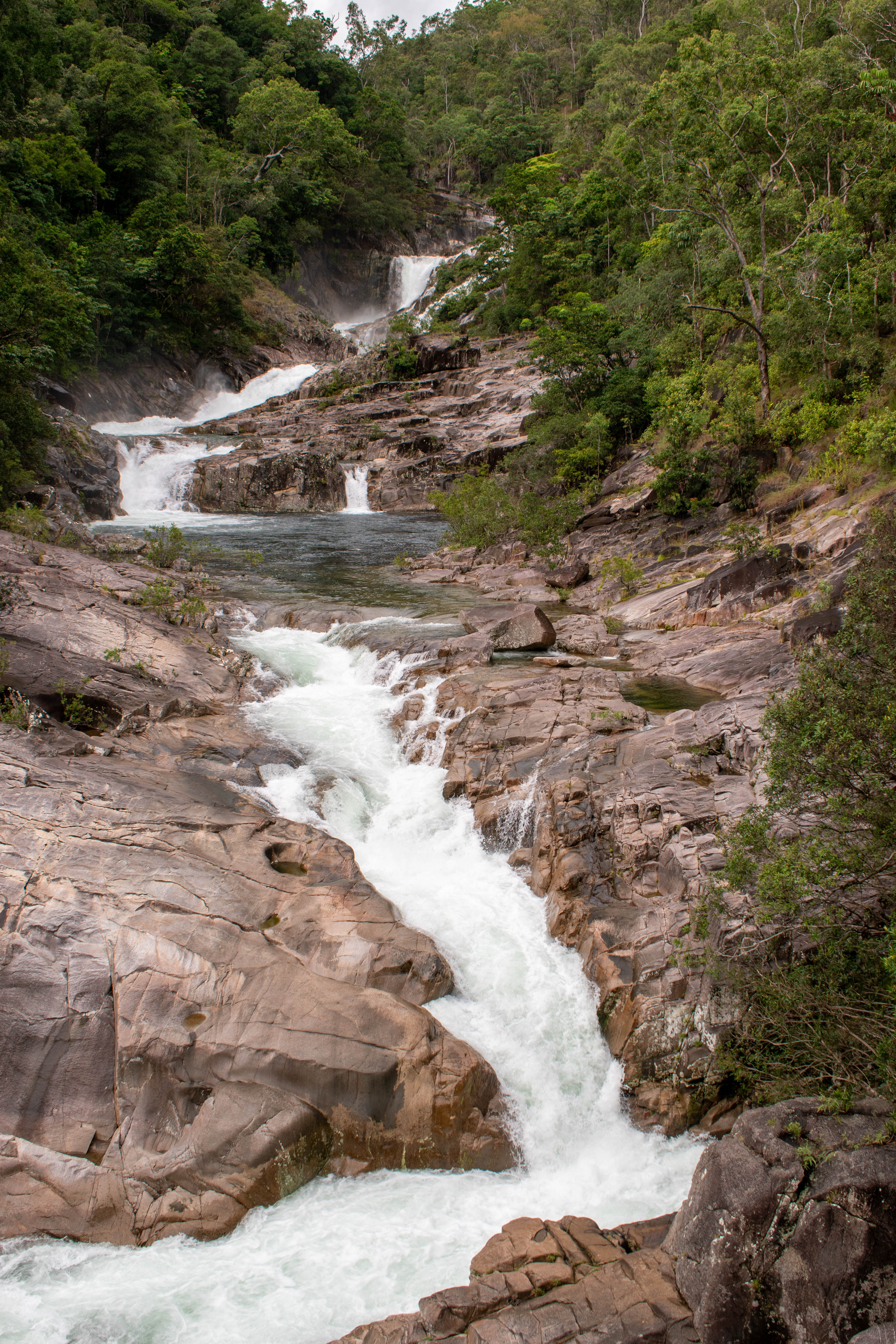
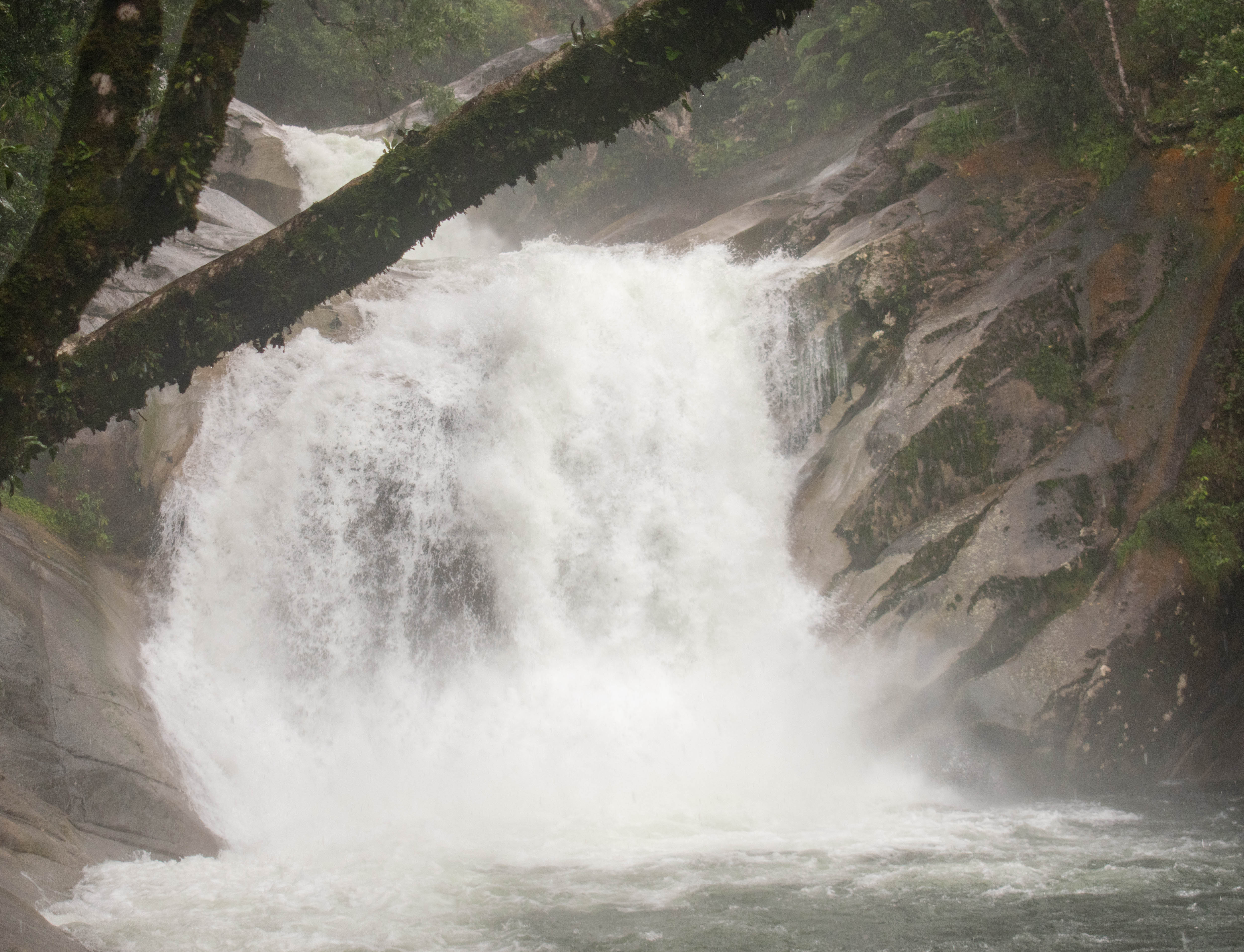
We arrived at the parking lot of Josephine Falls about twenty minutes after leaving Babinda Boulders. The drive to Josephine Falls took us through intermittent rain and sun, yet it was sunny when we pulled into the parking lot. The falls were a short 700 m walk from the parking lot, so with my trusty camera in hand we headed up. The pathway here was also paved and pretty easy to navigate, and when we reached the viewing area at the lower part of the falls there was a viewing platform made from metal grating that gave us a better view of the falls. Unfortunately the weather began to turn as we stepped onto the lower falls viewing platform, and it began raining with a vengeance. We quickly ran up to the top viewing platform and were able to take a few photos, however by this point we were completely soaked. As we walked back down to the car the rain let up slightly, but it didn’t really matter as we were already drenched. When we reached the car we dried off as best we could with the towel we had, then drove off as the sun started to peek through the clouds.
Josephine Falls; you can see the rain in the background
The upper chute of Josephine Falls
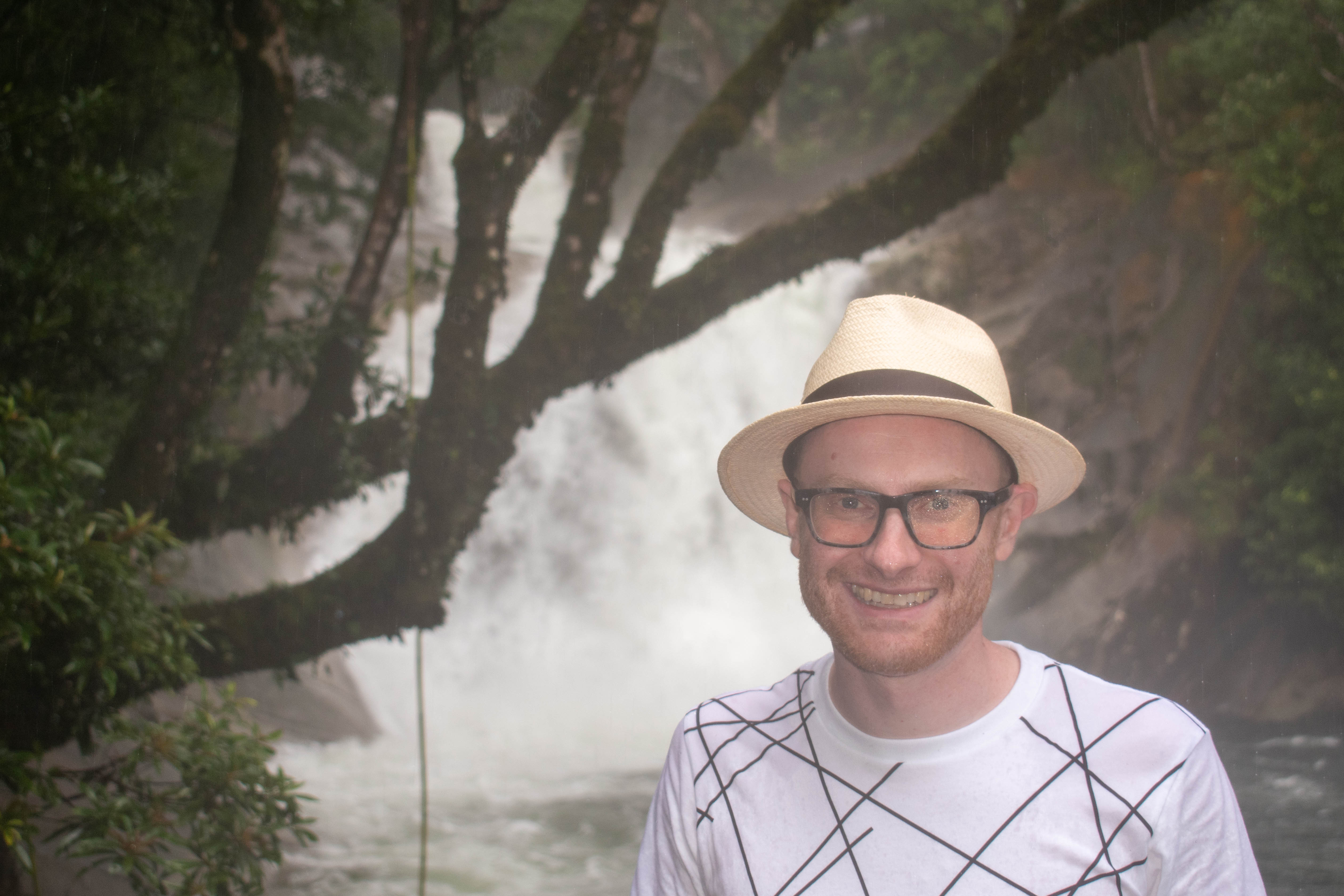
I was pretty wet at this point
As an aside, one of the things that made today special were the snacks we had. When we were at the grocery store I had picked up some double chocolate chip cookies and some Tim Tam’s to snack on during the drive. I had heard about Tim Tam’s from friends of ours who had visited Australia before, and once we opened the package we couldn’t stop ourselves from enjoying their chocolatey goodness. A much endorsed Australian snack!
We continued our day by leaving Josephine Falls and continued along Highway A1 until we encountered the exit for Highway 25, where we turned. This route was designed to allow us to loop back to Cairns without needed to backtrack; we were going to take Highway 25 up to Highway 52 which connected back to Highway A1 just outside Cairns. A short way along Highway 25 we turned off at the parking lot for the Mamu Tropical Skywalk. The sky walk is a series of elevated pathways that let you explore the different levels of the rainforest canopy, while also providing scenic views of the surrounding landscape. Unfortunately, it wasn’t really designed for visitors to enjoy during heavy rains, so as we pulled in to the parking lot we decided that this was one site we were going to have to skip, as it was still raining and the views weren’t going to be anything special.
A small waterfall we passed on Highway 25
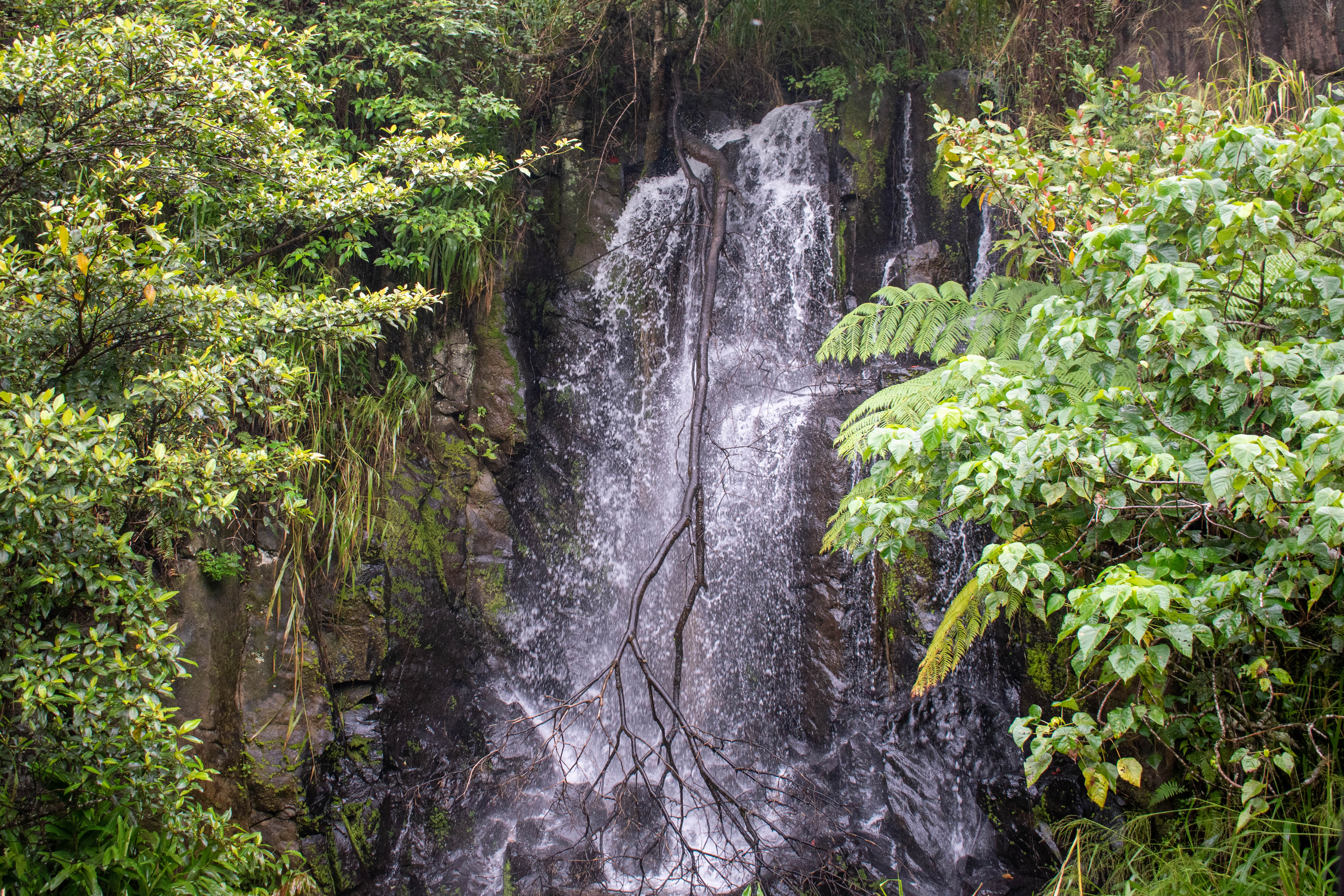
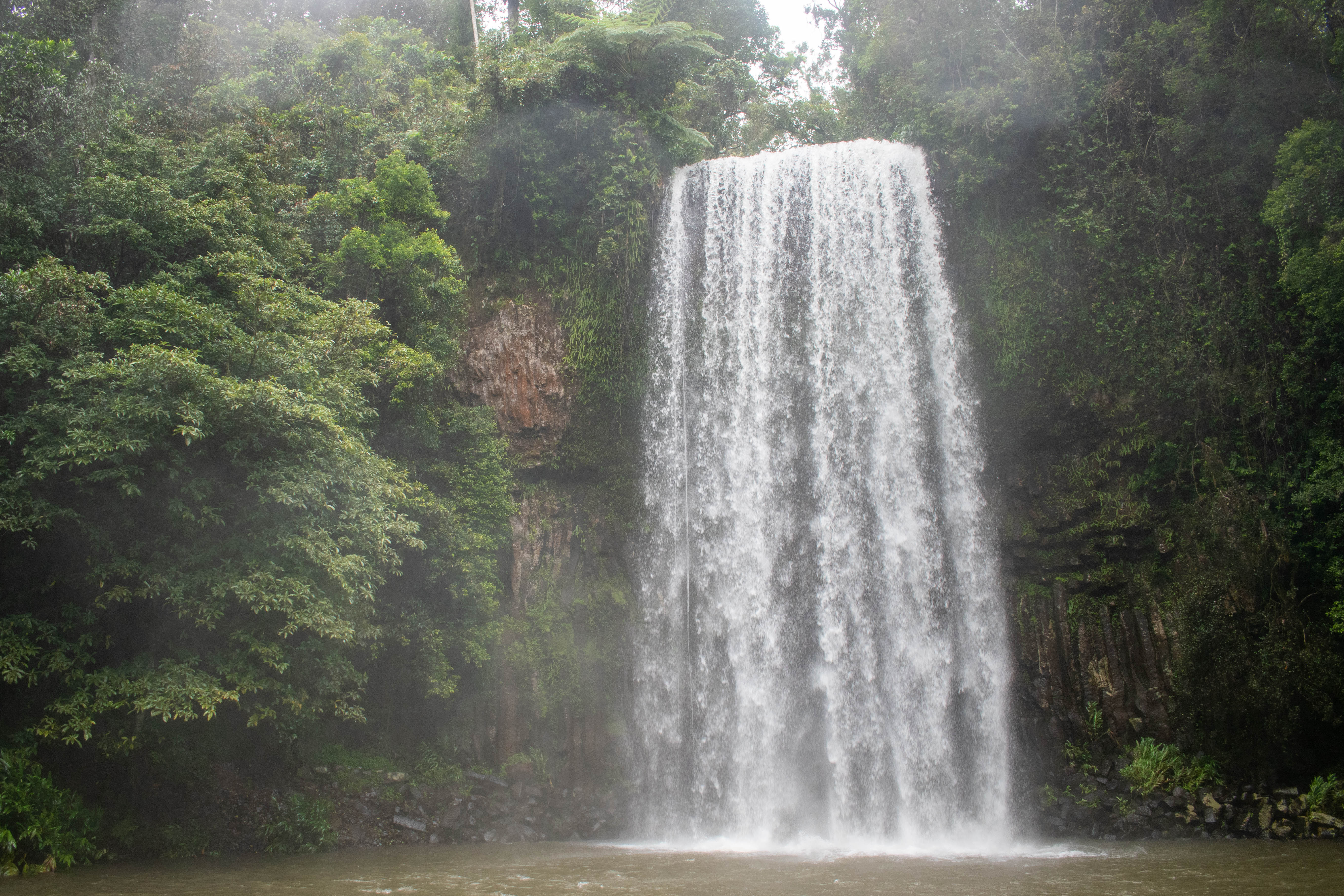
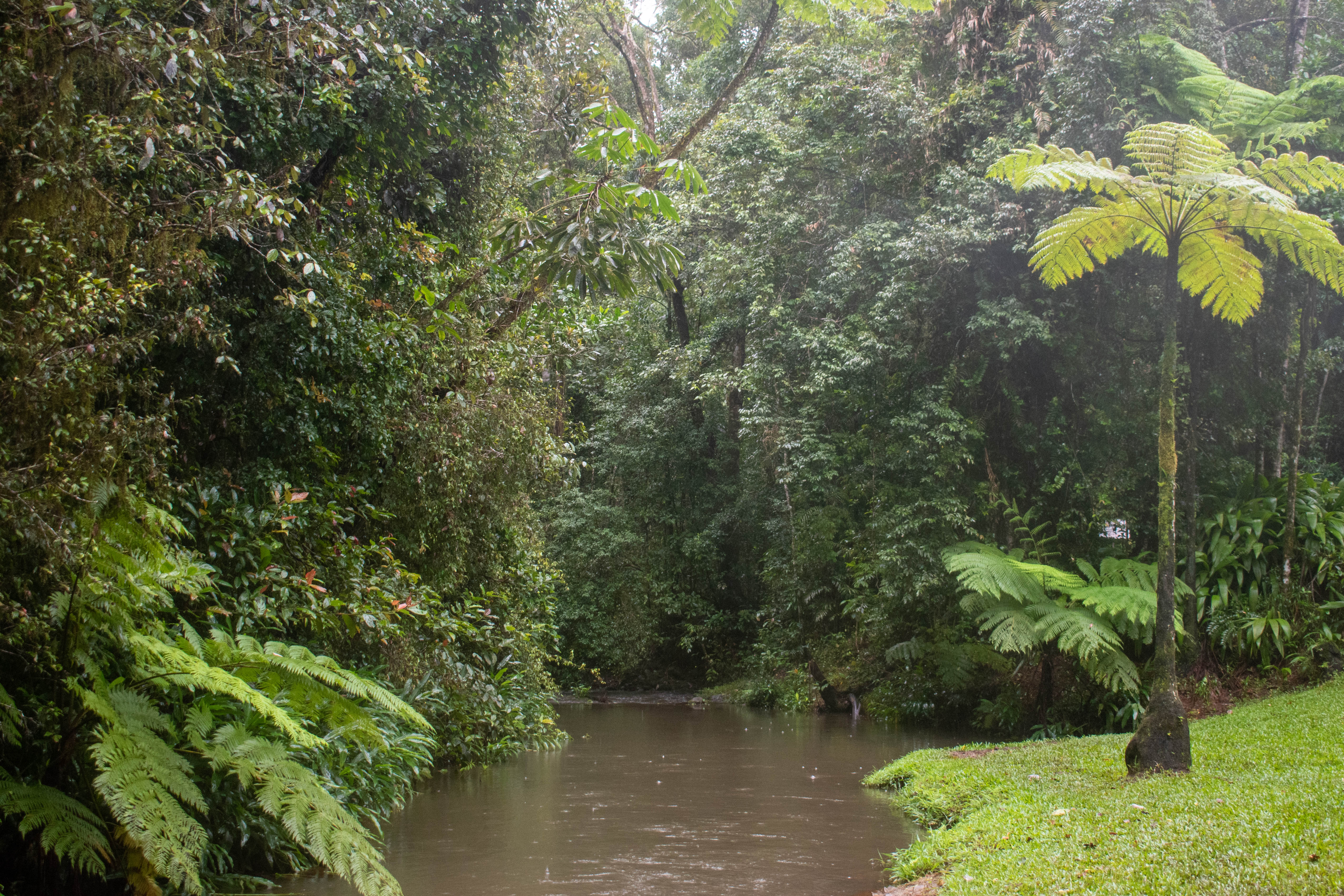
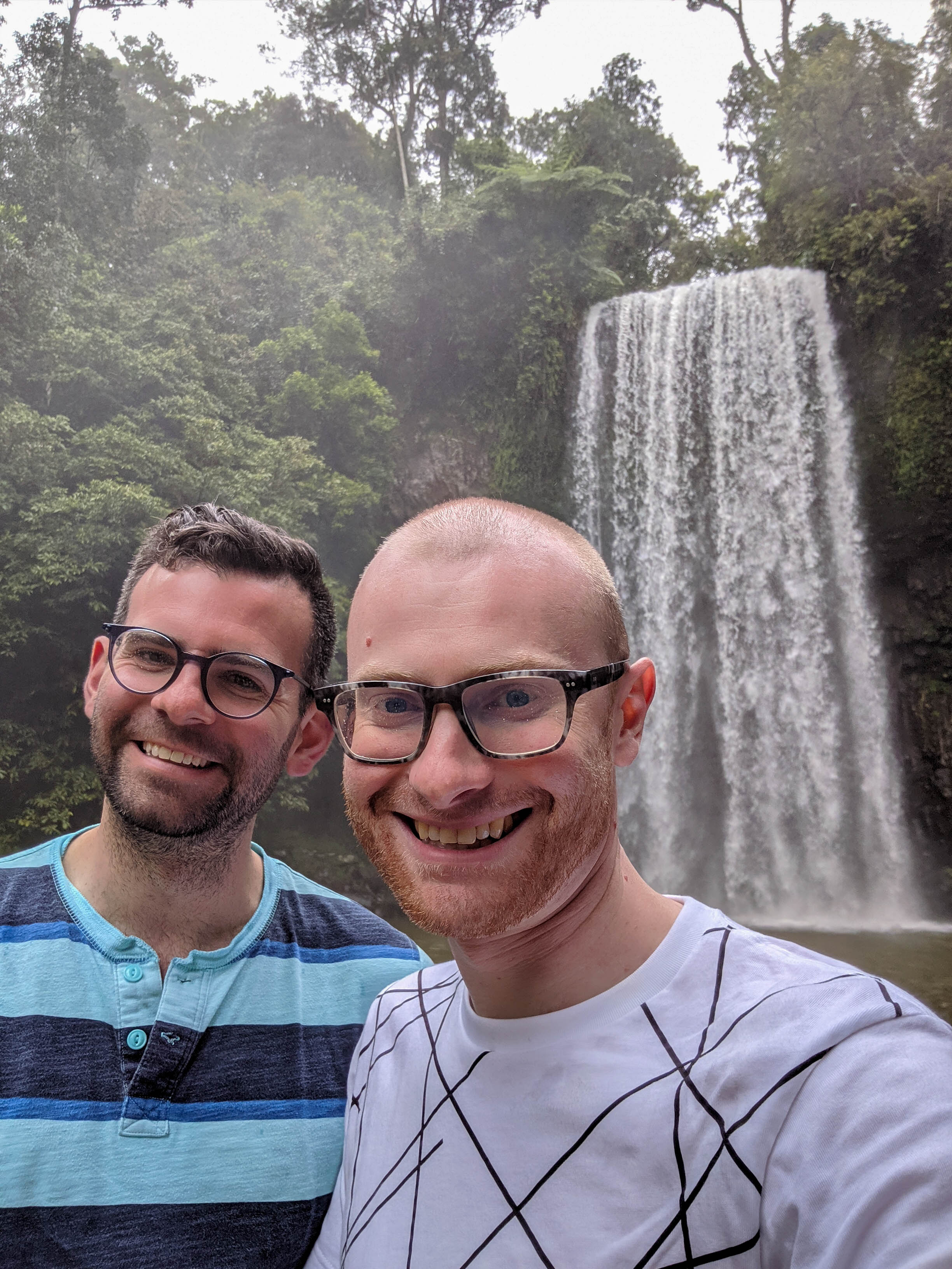
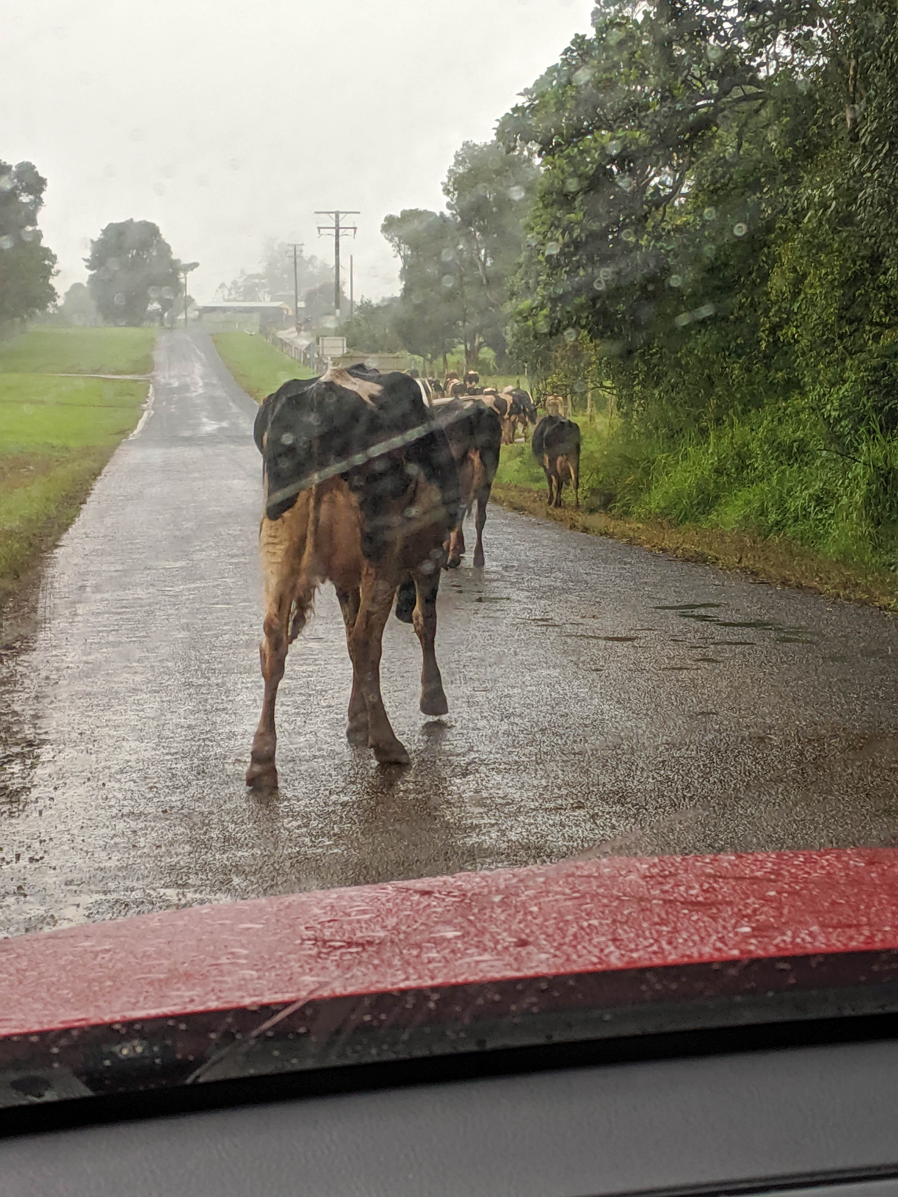
The next stop on our trip was going to be Mungalli Falls, however we lost cell service before reaching the Mamu Skywalk and so didn’t have GPS navigating us. We continued along Highway 25, hoping to see the turnoff, but we did not see the sign through the rain. We did, however, see the sign for our following stop, the Millaa Millaa Waterfall and so we pulled off onto a narrow road that led us past a farmer’s pasture and to the parking lot of the falls. This waterfall is mildly noteworthy as it was the site of an Herbal Essences shampoo commercial. It was still raining, thankfully only lightly, when we arrived at the parking lot for the falls. There was a short walk down to the viewing platform of the falls, where we were able to take a few photos. We decided against going for another swim, though it looked like it would have been a nice place to cool off if the day had been drier. After appreciating the falls for a few more minutes, we returned to the car. As we were driving back to Highway 25 we got caught behind a herd of cows that was crossing the access road, and had to slowly inch our way into the herd in order to get past them. That was a bit of an unexpected roadblock!
Millaa Millaa Falls
The river leading away from the falls
Us in front of the falls
There was some traffic on the road leaving the parking lot
Once we made our way through the herd and turned back onto Highway 25, we were able to continue on to our next destination, the Curtain Fig Tree. This site was about a 30 minute drive from Millaa Millaa falls, and we arrived shortly after 16:00. This site is home to a strangler fig, whose host tree fell into another tree, leading to a set of aerial roots that form a wall (or curtain) in the forest. The strangler fig is notable as it has long roots that reach down from the support tree into the soil, and as it grows it can often envelop and kill off the tree it was originally growing on. The Curtain Fig Tree experienced this, however at some point in development the host tree fell into another tree, which led to the strangler fig growing onto the other tree and forming the distinct shape it has today. It is estimated to be over 500 years old, and seeing it up close is spectacular. There was a short boardwalk around the tree that we explored, took some photos, then continued on.
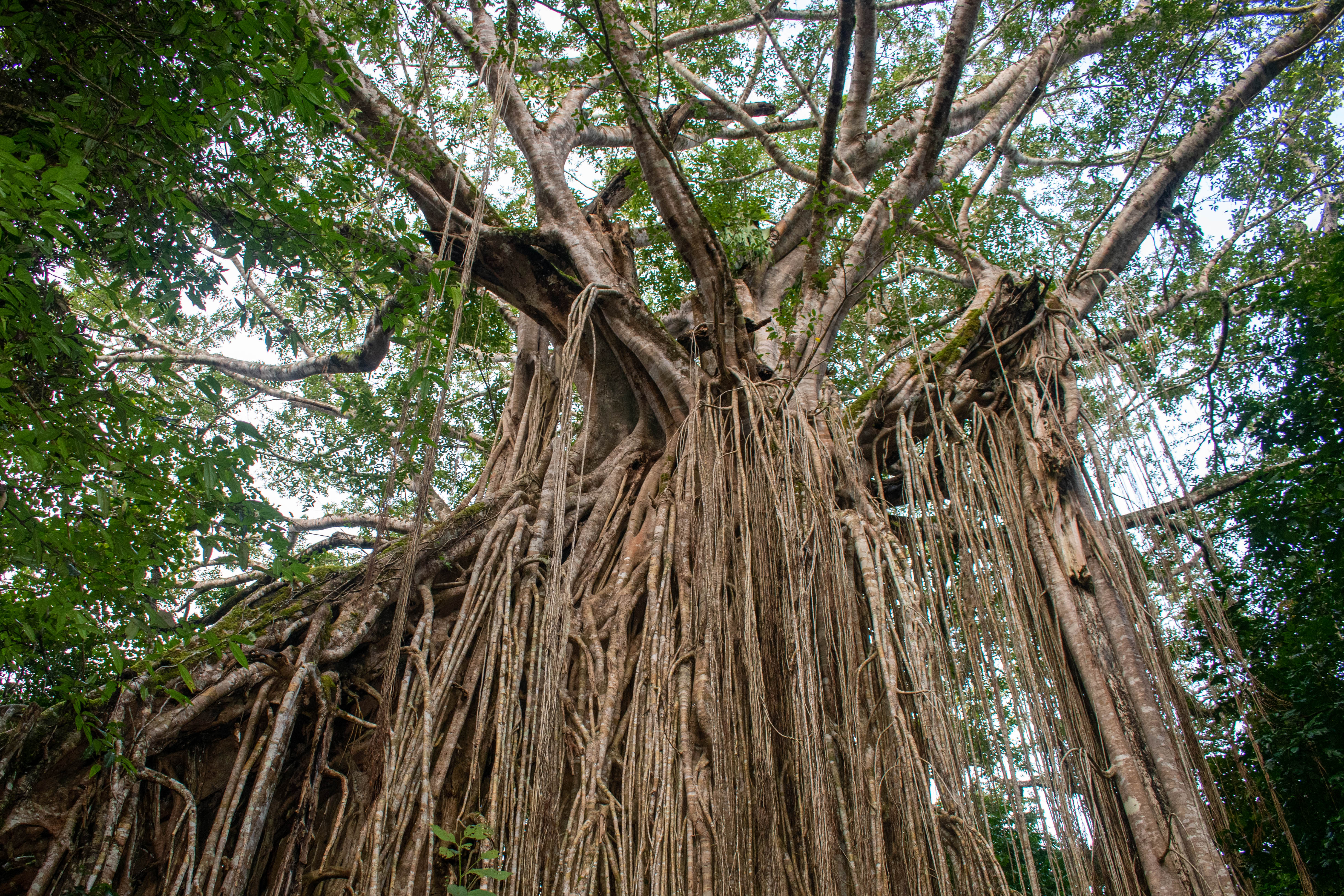
The curtain fig tree
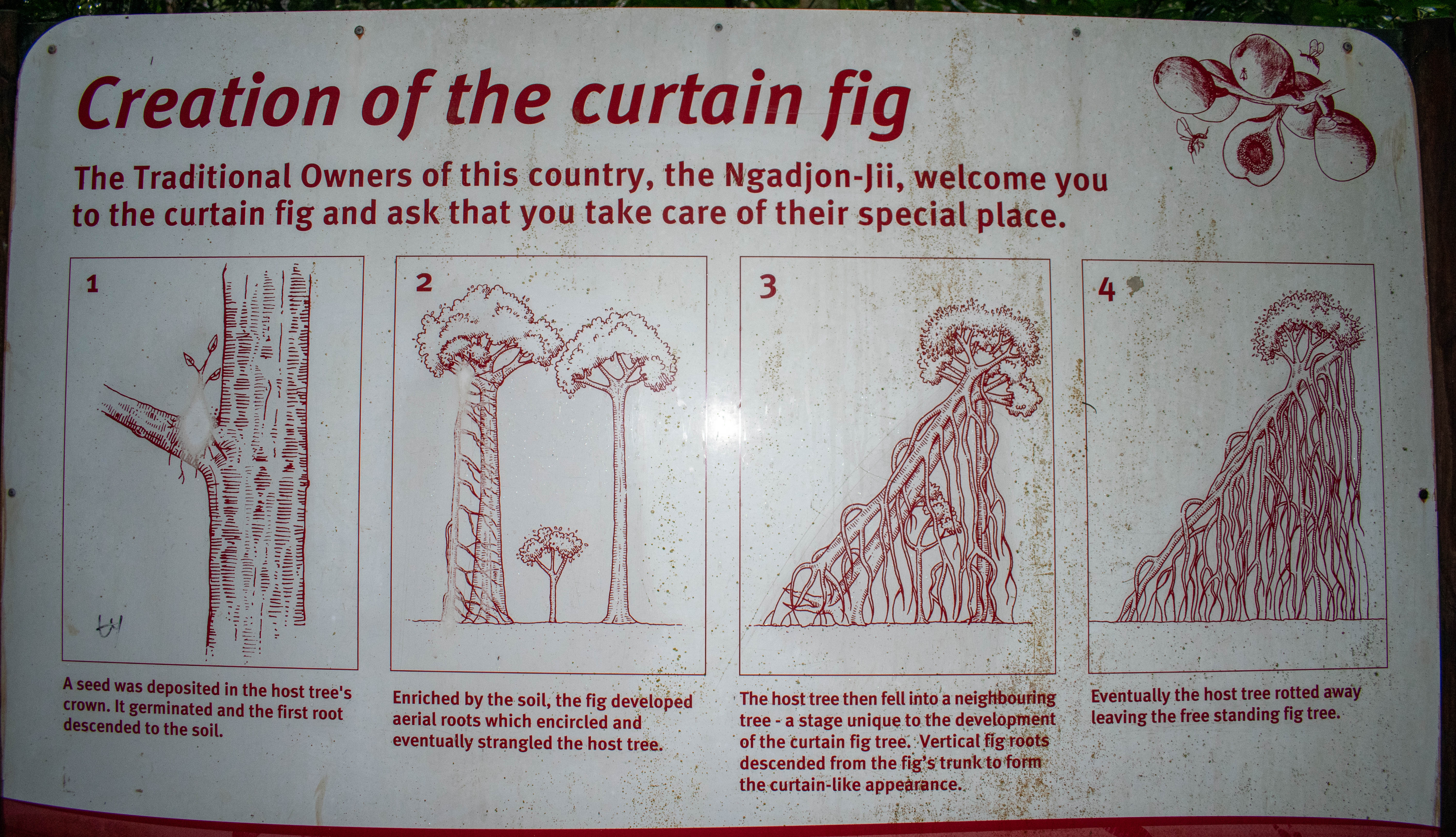
A handy infographic showing the way this tree was formed
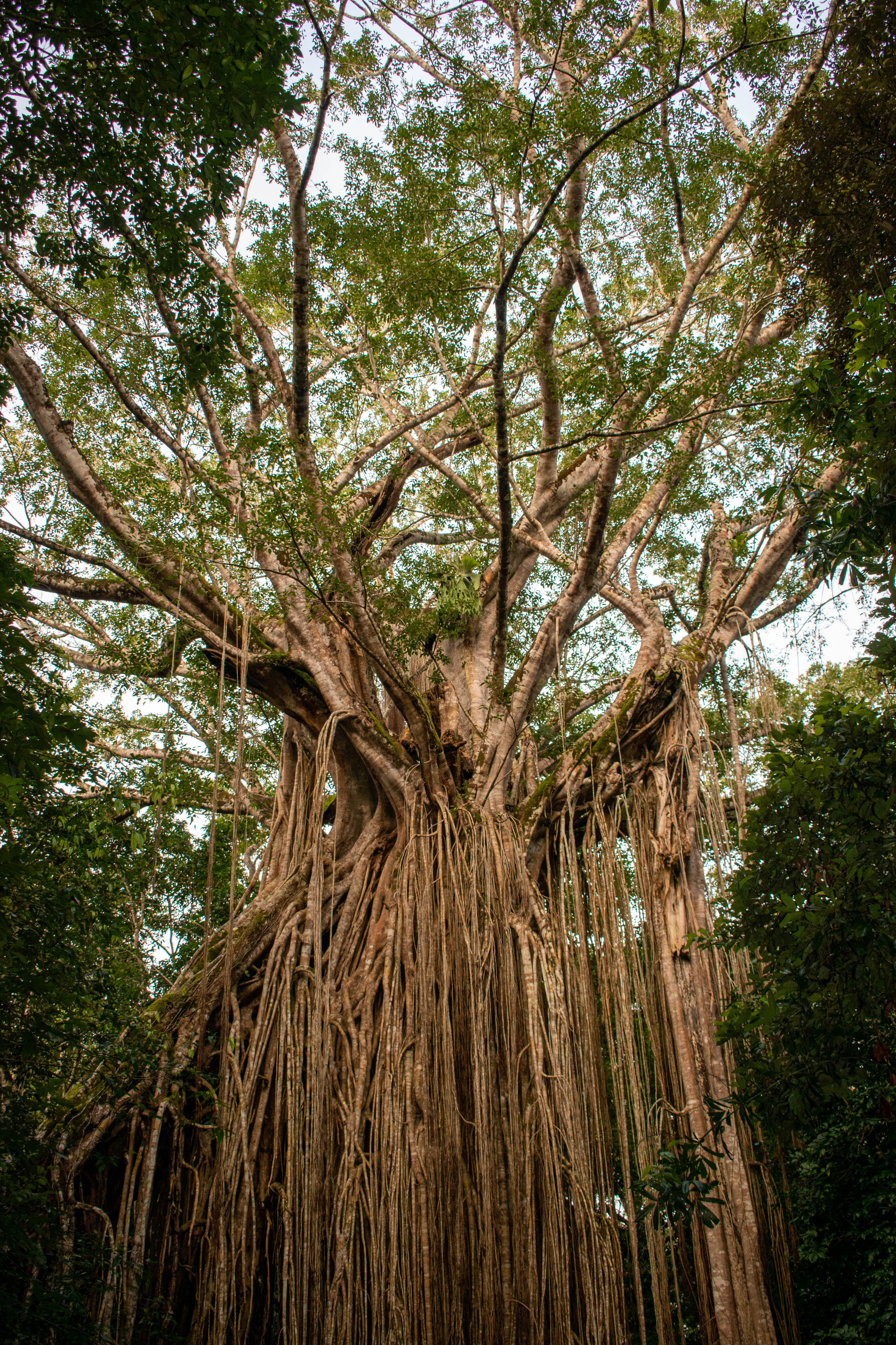
The tree from a different angle

A final angle of the tree
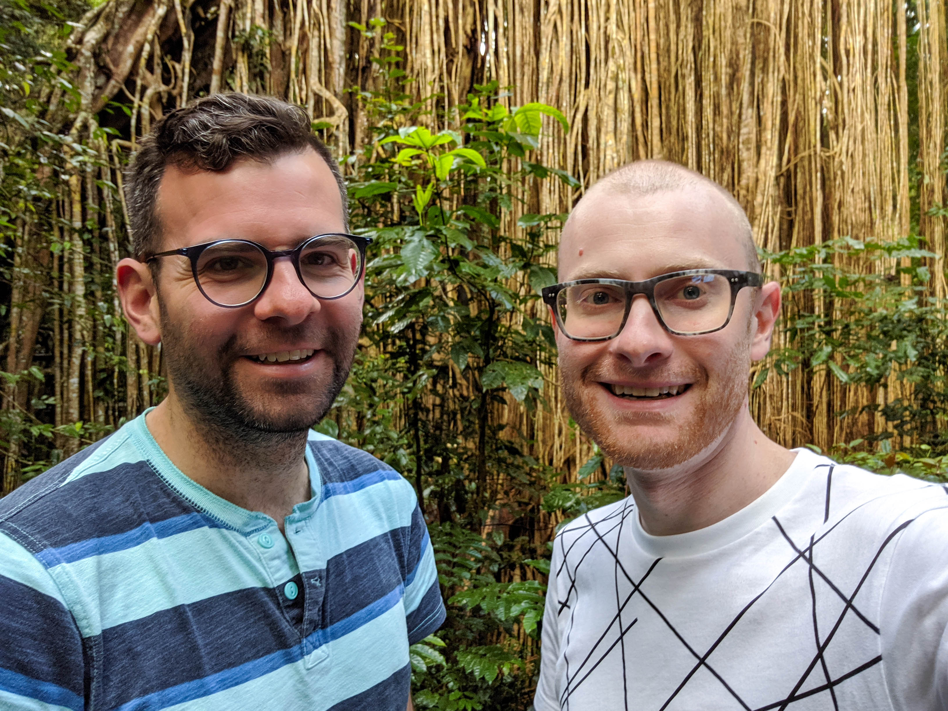
Us in front of the tree
Our final site of the day was a platypus viewing area, a short 15 minute drive from the Curtain Fig tree. This site, located in Yungaburra, is home to several platypuses, and while we spent a good thirty minutes waiting on the riverbed just before dusk we didn’t get a glimpse of these fascinating creatures. We did get to see a few turtles, however, which was a nice consolation prize. We arrived shortly after 16:45, and left just after 17:15. After leaving the platypus viewing area we began the return drive to Cairns.
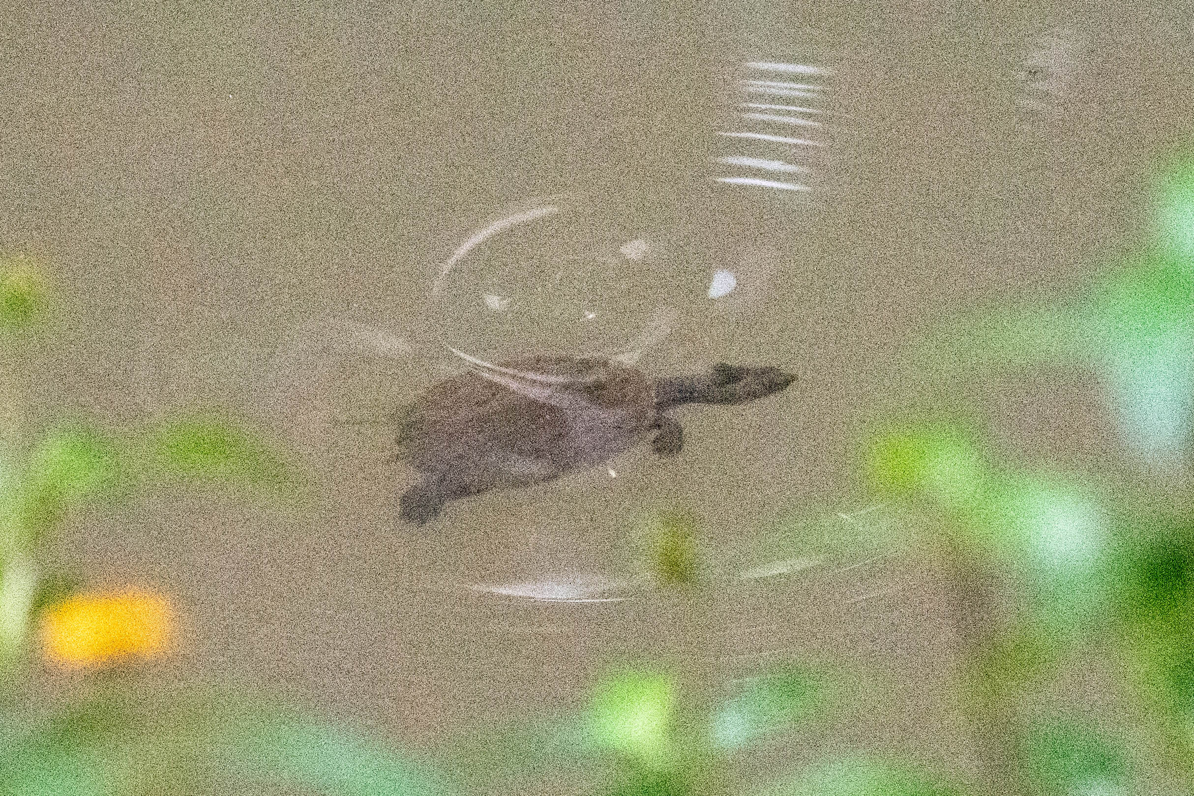
A small turtle we saw swimming in the river
The route back to Cairns took us along the Gillies Highway, which is notable for being incredibly windy having some very steep sections. When we were driving it almost felt like being in a video game, as the road is always turning like in Mario Cart. I wasn’t able to look at the fantastic views as the road took my full attention, but luckily Todd was able to enjoy the vistas. We stopped at Heales Lookout, partway down Gillies Highway, to take a few photos of the canyon below as the sun was going down. This gave me a chance to see a bit of the scenery in the area before continuing the drive. It was lucky that there were no cars behind us, as I was taking the corners pretty carefully, which made the drive go fairly slow. We made it through the highway safely which was what mattered most. We returned to Cairns at around 18:45, and it was pitch black by the time we returned. The sun had set during the last bit of the Gillies Highway drive, which was pretty well timed. I wouldn’t have wanted to drive the highway in the dark. I was also glad that the rain had stopped ahead of our descent, as I wouldn’t want to do that drive in slippery conditions!
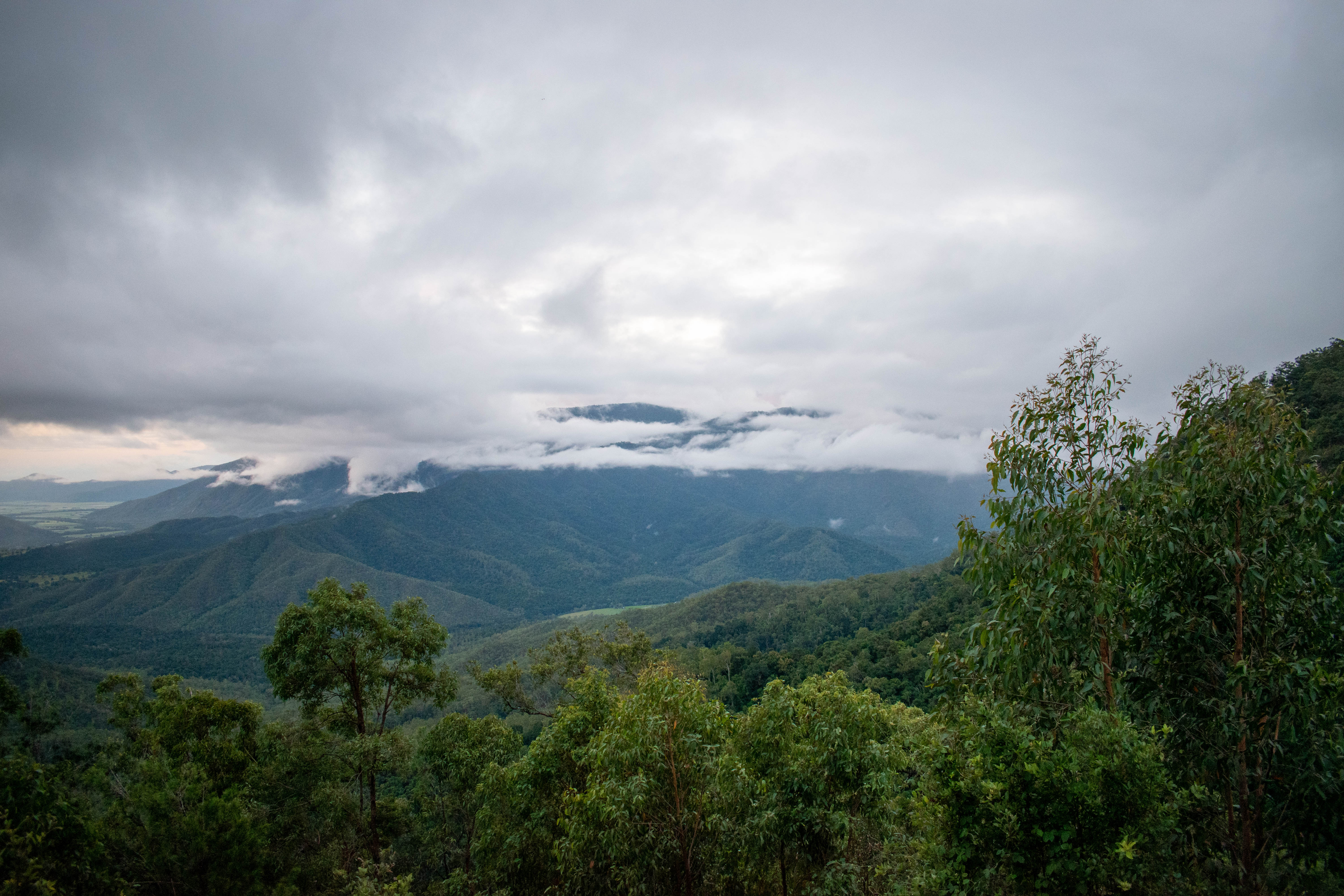
The view from Heales Lookout
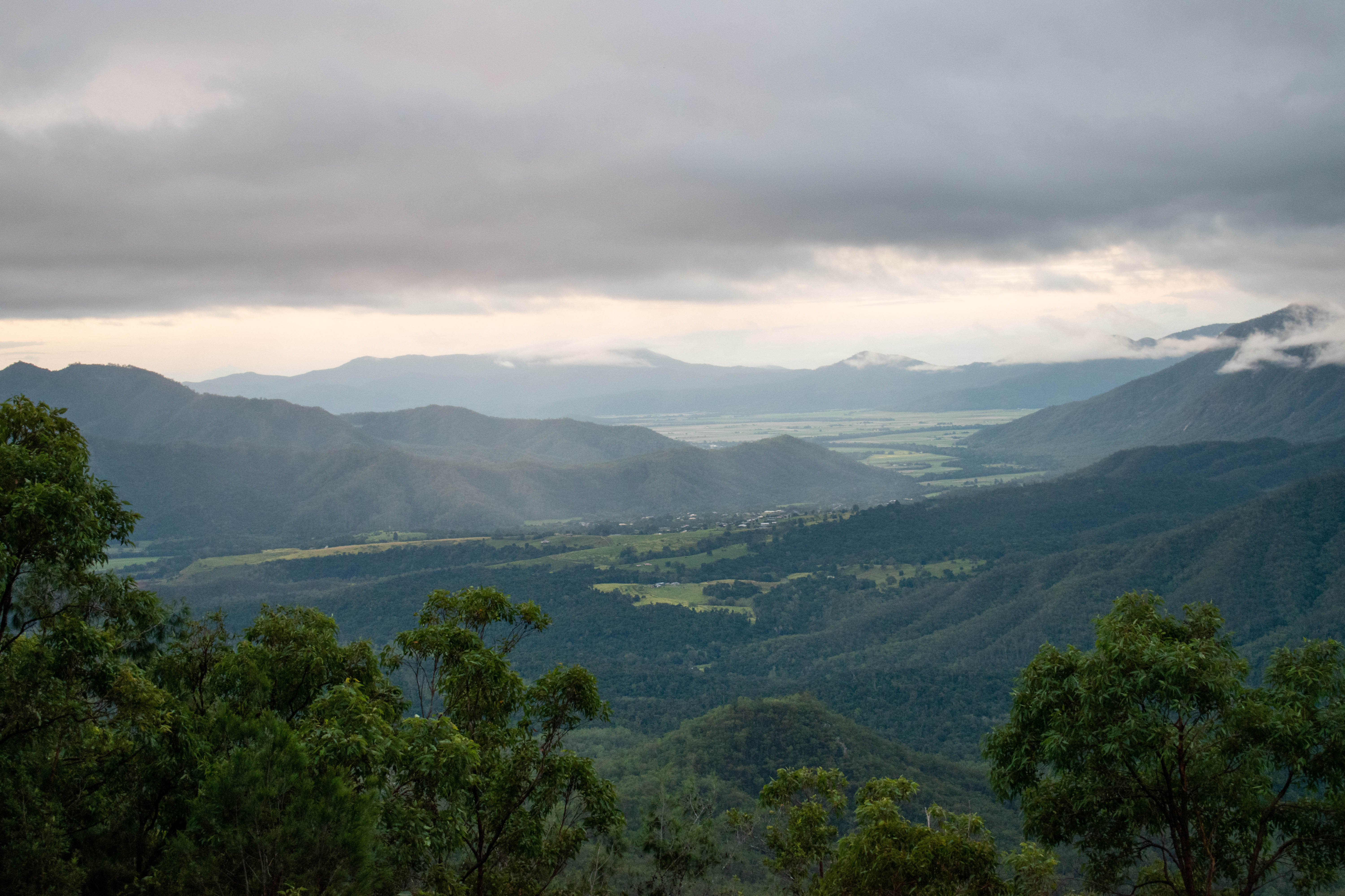
Looking down the valley at Heales Lookout
We returned to the AirBnB after our day of driving, and after dropping off our bags we walked to another restaurant just minutes from our place. We chose Ozmosis for dinner, and enjoyed some tasty Italian food on their patio. I had their carbonara, while Todd had a prosciutto pizza. Both meals were well done and enjoyable. We returned to the AirBnB for some relaxing before heading to bed.